Wasson Bluff
More than 100,000 bones lie embedded in these cliffs. That number alone would make Wasson Bluff remarkable, but what sets this mile-long stretch of rock face apart is timing: the fossils record the precise boundary between the Triassic and Jurassic periods, roughly 200 million years ago, when a mass extinction reshuffled life on Earth and handed dominance to the dinosaurs. Paleontologist Paul E. Olsen, who spent years excavating here, put it simply: "Every time I stand before these cliffs, I feel dwarfed by the immensity of time."
When Pangea Broke Apart
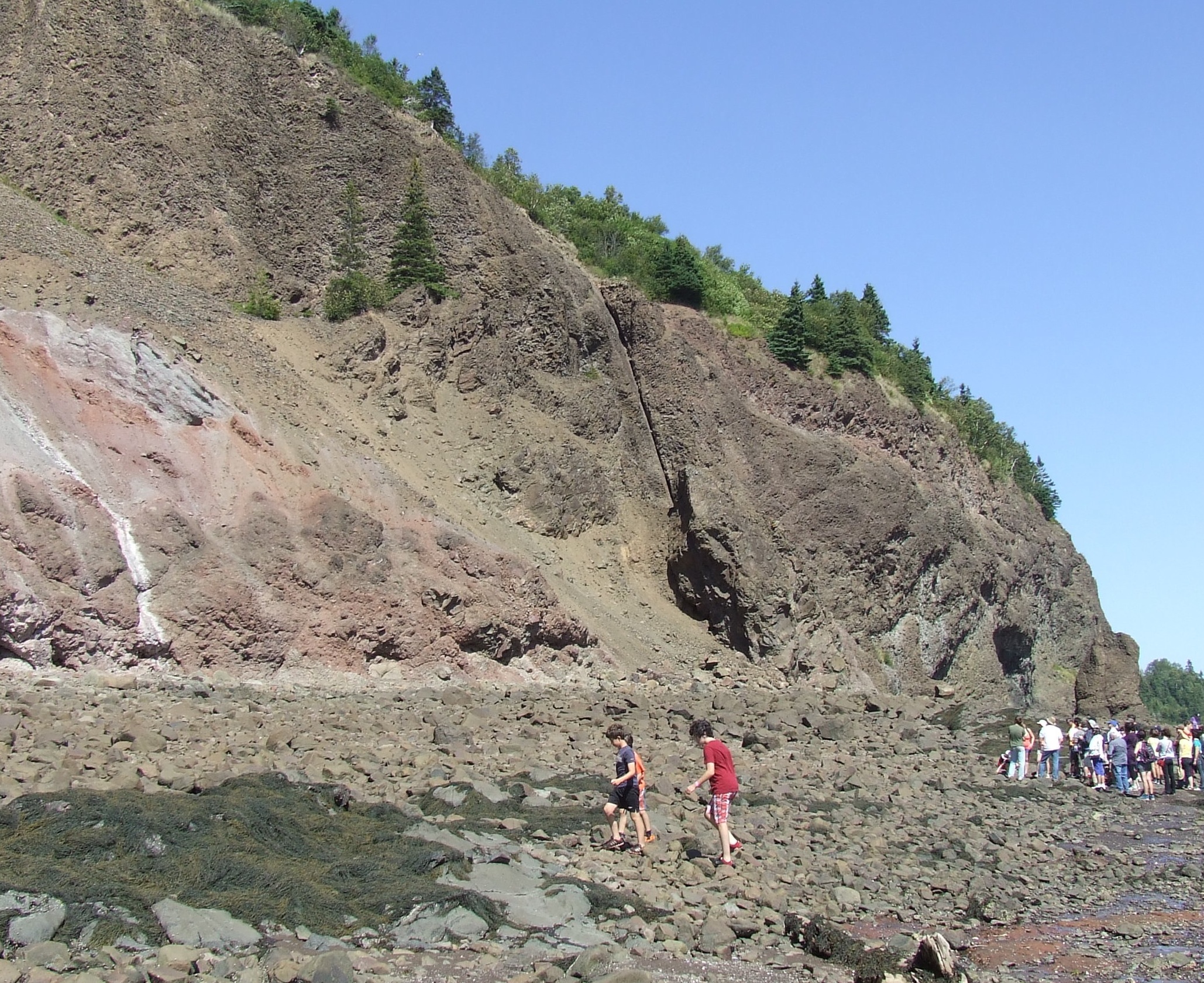
The orange and red sandstones visible along Wasson Bluff tell a story written in sediment. Rivers swollen by intense rains carried coarse debris from nearby highlands into the Fundy Basin, layering it with wind-blown dune sand and the fine deposits of shallow, ephemeral lakes. Then the supercontinent Pangea began to fracture. Magma surged upward through deep fissures in the crust, erupting as massive lava flows that cooled into the greenish-grey basalt columns and grey-black blocks now standing alongside the older sandstone. The result is a geological layer cake: ancient riverbeds, desert dunes, lake bottoms, and volcanic basalt, all stacked together in cliffs that stretch from Wasson Brook in the east to Swan Creek in the west, about five miles east of the town of Parrsboro on Nova Scotia's north shore.
The Bones in the Rock
In January 1986, American paleontologists Paul Olsen and Neil Shubin announced a find that reverberated through their field: hundreds of thousands of bones recovered from Wasson Bluff, the largest fossil assemblage in North America dating from the Triassic-Jurassic boundary. The cliffs had preserved creatures from both sides of the extinction event -- animals that lived before the catastrophe and those that emerged afterward. Among the discoveries were Canada's oldest known dinosaurs and the smallest dinosaur tracks ever found, footprints so tiny they could fit on a coin. But the site's significance extends beyond dinosaurs. Fish, crocodiles, frogs, and early mammals all left their traces here, representatives of vertebrate lineages whose descendants are still alive today. Wasson Bluff offers a rare window into the moment when the modern animal world began to take shape.
A Landscape Shaped by Catastrophe
The mass extinction that marks the Triassic-Jurassic boundary was driven in part by the very volcanism visible in these cliffs. As Pangea rifted apart, eruptions across what is now Atlantic Canada released enormous volumes of lava and gas, triggering climate disruptions that wiped out many species and cleared ecological space for dinosaurs to diversify. The rocks at Wasson Bluff record this transition with unusual clarity because the Fundy Basin was actively accumulating sediment throughout the period, capturing snapshots of changing environments and shifting animal communities over thousands of years. Few places on Earth preserve the boundary this completely.
Protected Ground
Today, Wasson Bluff is protected under Nova Scotia's Special Places Protection Act, and a special permit is required before anyone can collect fossils or use rock hammers at the site. The law recognizes the cliffs' importance not just to paleontology but to understanding the environmental and geological forces that shaped eastern North America. The Minas Basin's extreme tides continue to erode the cliff face, occasionally exposing new material, but the site remains one where careful, permitted excavation takes priority over casual collecting. For visitors, the cliffs offer something that no museum can replicate: the chance to stand where two geological ages meet and to see, in layered stone, the evidence of a world that ended and another that began.
From the Air
Located at 45.39°N, 64.24°W on the north shore of the Minas Basin, about 5 miles east of Parrsboro, Nova Scotia. The cliffs are visible along the coastline at low to moderate altitudes. Nearest airport is Debert (CYDB) approximately 35 nm east. The Minas Basin and Bay of Fundy coastline provide strong visual reference. Best viewed at 2,000-4,000 feet AGL for cliff detail; the red-orange sandstone contrasts sharply with the grey basalt and green surroundings.