Waterton-Glacier: The World's First International Peace Park
The border between Canada and the United States cuts through the most spectacular mountains in either country, and in 1932, someone decided that was stupid. Waterton-Glacier International Peace Park was the world's first - a formal declaration that the arbitrary line on maps shouldn't interrupt the ecosystem that spans it. Grizzly bears don't show passports; rivers don't recognize sovereignty; the same geological forces created both parks. The Rotary Clubs of Alberta and Montana proposed the idea; both nations agreed; the designation became a model for transboundary conservation worldwide. The parks are still managed separately, but the principle holds: some things are more important than borders.
The Border
The 49th parallel became the U.S.-Canada boundary in 1846, drawn on maps by diplomats who'd never seen the terrain. The line cut through lakes, across rivers, and directly through the Rocky Mountains, dividing ecosystems that had functioned as one for millions of years. Glacier National Park was established in 1910; Waterton Lakes National Park in 1895. Both protected spectacular mountain scenery; both managed the same wildlife populations; neither could function fully without the other. The boundary that separated them was political, not ecological.
The Peace
Rotarians from Alberta and Montana proposed the International Peace Park in 1931, during a period when U.S.-Canada relations were excellent and international cooperation seemed possible. The Canadian Parliament designated Waterton-Glacier International Peace Park in 1932; the U.S. Congress followed. The designation was symbolic - no new agency was created, no new authority granted - but it established a precedent: protected areas could transcend national boundaries when ecosystems required it. UNESCO later designated the combined parks a World Heritage Site (1995) and International Biosphere Reserve.
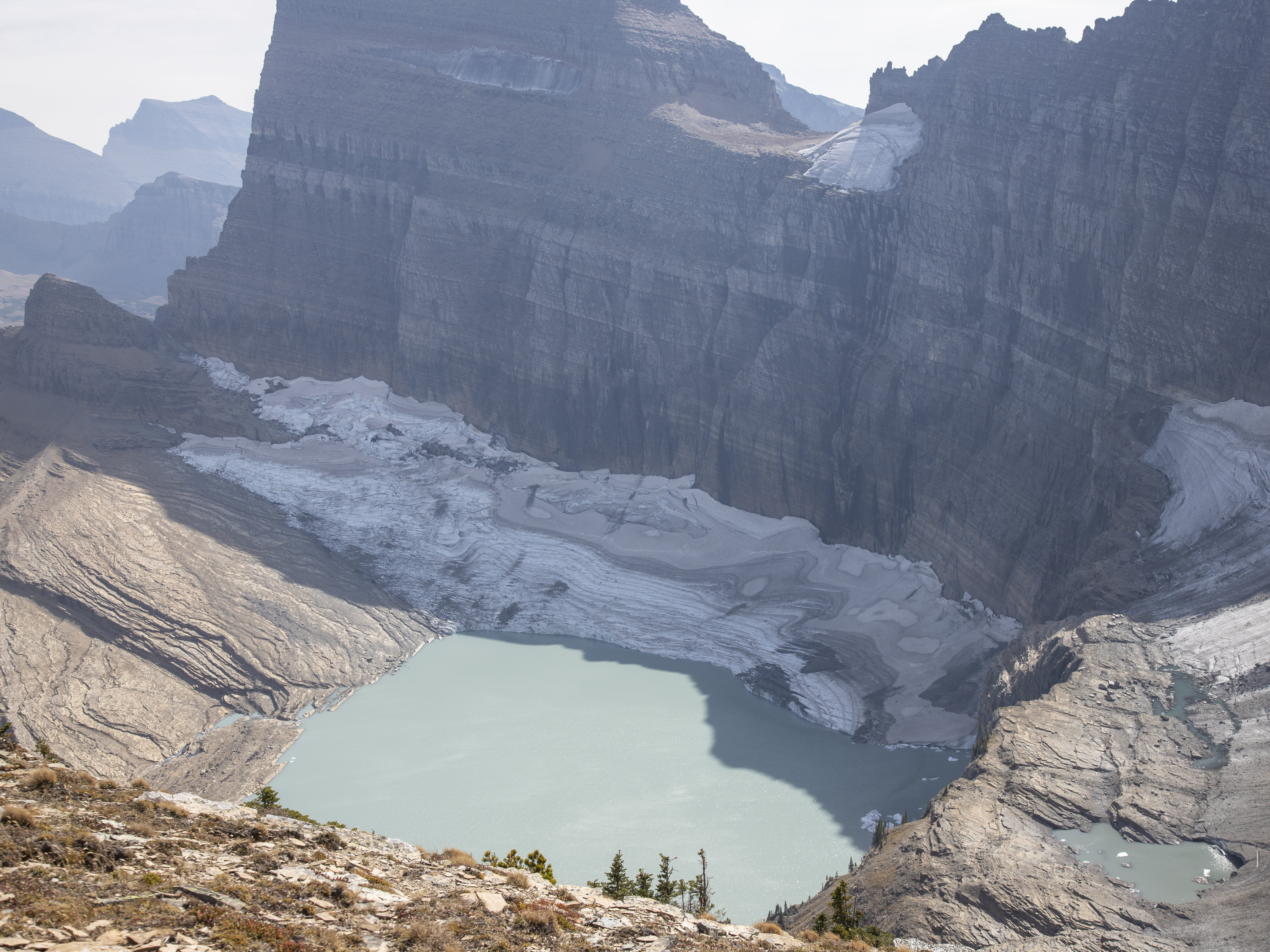
The Ecosystem
The Crown of the Continent ecosystem spans 10 million acres, with Waterton-Glacier at its heart. Grizzly bears, gray wolves, mountain lions, and other wide-ranging species move freely across the international boundary - though development outside the parks increasingly constrains these movements. The ecosystem supports over 1,000 plant species, 272 bird species, and 71 mammal species, making it one of the most intact natural systems remaining in the temperate world. The parks protect crucial core habitat; the surrounding landscapes determine whether species can move between them.
The Parks
Waterton (Canada) and Glacier (U.S.) remain separately managed despite the international designation. Border crossing requires going through customs - passports, declarations, inspections. Hiking trails connect the two parks; several cross the boundary, requiring visitors to carry documentation. The crossing experience has tightened since 9/11; what was once casual became bureaucratic. The peace park designation never meant open borders - just recognition that the mountains deserved unified protection. The practical reality involves two visitor centers, two fee structures, and two sets of regulations for one ecosystem.
Visiting Waterton-Glacier
Glacier National Park (Montana) is accessed via Highway 2 from east or west; Going-to-the-Sun Road crosses the park spectacularly. Many Glacier and Lake McDonald are primary visitor areas. Waterton Lakes National Park (Alberta) is accessed via Highway 5 from Pincher Creek. The Prince of Wales Hotel overlooks Waterton Lake. Border crossing is possible via Chief Mountain Highway (seasonal) or by hiking trails (passport required). Both parks require entry fees; passes aren't interchangeable. The Going-to-the-Sun Road typically opens late June; exact dates depend on snow conditions. Summer is crowded; fall offers color and relative solitude. Wildlife is visible in both parks; respect distance requirements.
From the Air
Located at 49.00°N, 113.92°W on the U.S.-Canada border. From altitude, the parks display classic Rocky Mountain scenery - glacially carved valleys, alpine lakes, and rugged peaks. The international boundary is invisible in the terrain but visible on maps; it cuts through Upper Waterton Lake and crosses mountain ridges without regard for geography. Waterton townsite is visible at the lake's north end; Many Glacier valley is visible to the south. The Going-to-the-Sun Road is visible as a thin line crossing Glacier's interior. The parks are clearly contiguous - one ecosystem divided by one arbitrary line.