Wawona Tunnel
Nobody remembers the tunnel. They remember what comes after. You enter at the western portal on Wawona Road, and for 4,233 feet - nearly four-fifths of a mile - you drive through the inside of a granite mountain. The light is amber and flat. The walls are close. The air smells of exhaust and damp stone. Then the eastern portal opens, and Yosemite Valley detonates into view: El Capitan on the left, Bridalveil Fall on the right, Half Dome floating in the distance. It is arguably the most famous scenic reveal in the United States, and it was entirely intentional. The engineers who designed the Wawona Tunnel in the early 1930s understood that the best way to present a masterpiece is to first make the audience sit in the dark.
Owl Song and Origin
The tunnel takes its name from the community of Wawona, a few miles to the south, though the word's origin is uncertain. One popular account claims Wawona was the Miwok word for "big tree," appropriate for a region surrounded by giant sequoias. Another tradition holds that it mimics the call of the owl - waw-o-nah - because the Miwok considered the owl the spiritual guardian of the sequoia groves. Neither etymology has been definitively confirmed, but both feel right for a place where the trees are large enough to drive through and the forests are old enough to need guardians. The community of Wawona predates the tunnel by decades, established as a stagecoach stop on the original southern route into Yosemite Valley. The 1933 tunnel would bypass much of that old route, replacing switchbacks and slow grades with a straight shot through granite, but the name carried forward - a Miwok word riding on twentieth-century engineering.
Boring Through Bedrock
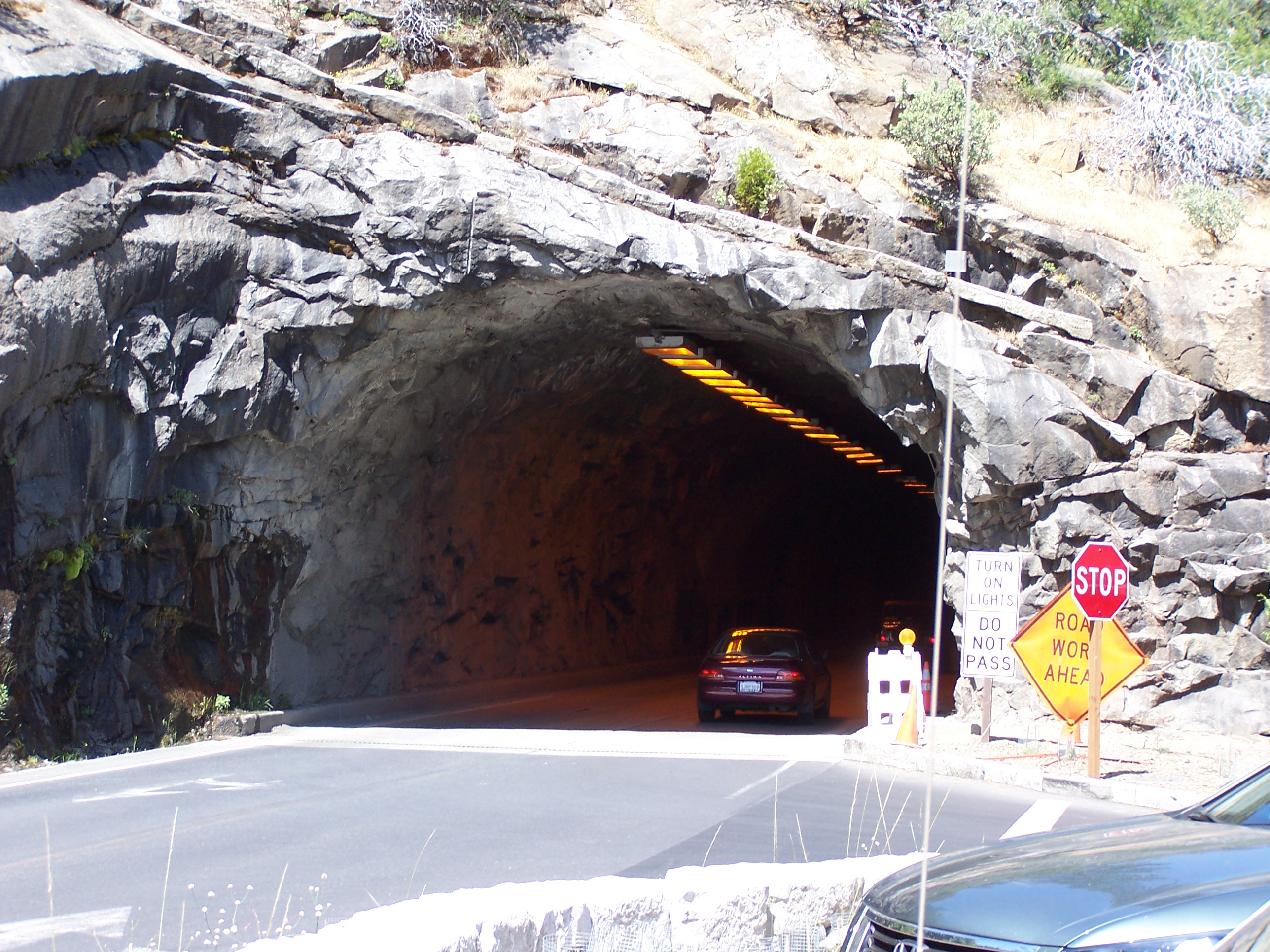
When the Wawona Tunnel opened on June 10, 1933, it was the longest automobile tunnel in the world. Workers had bored through solid granite bedrock on the south side of the Merced River, creating a passage that carried Wawona Road through a mountain rather than over it. The tunnel was part of a much larger road project that transformed access to Yosemite from the south. The old Wawona Road had been a narrow, steep, 12-foot-wide stagecoach road with sharp curves and punishing grades. The new road expanded to 26 feet wide, reduced the maximum incline to a gentle 5 percent, and softened the curves for automobile speeds. The project rerouted the road away from old relay stations like Fort Monroe that had served the stagecoach era. Most dramatically, the tunnel shortened the trip from Fresno and Southern California by 40 miles compared to the All-Year Highway from Merced, making Yosemite accessible to a generation of visitors who measured travel in hours rather than days.
Records and Rivals
The Wawona Tunnel held its world record briefly - other nations were boring longer tunnels through softer rock for rail and road - but it remains the longest highway tunnel in California, a title it has held for more than nine decades. The Tom Lantos Tunnels in Pacifica come closest at 4,149 feet, and the Caldecott Tunnel in Oakland stretches 3,771 feet in its longest bore. Neither matches the Wawona's 4,233 feet. A 1936 Department of Agriculture survey plaque inside the tunnel records the length even more precisely: 4,358.91 feet. The discrepancy between the official figure and the survey plaque has never been fully explained, but surveyors measuring from portal to portal may have included approach sections. By 2008, the tunnel's infrastructure was showing its age. A $1.5 million federal contract repaired the ventilation and electrical systems, and a separate project upgraded visitor services at Tunnel View. The granite itself, of course, needed no repair. It had been holding up mountains for a hundred million years before anyone thought to bore a road through it.
The Road That Made the Park
The Wawona Tunnel sits on one of the three main roads into Yosemite Valley, and for visitors arriving from the south - from Fresno, Los Angeles, the Central Valley - it is the road. California State Route 41 becomes Wawona Road at the park boundary and climbs through forest to the tunnel's western portal. After exiting the eastern portal and passing Tunnel View, the road descends into the valley. A junction at Chinquapin connects to Glacier Point Road, which leads to Badger Pass ski area and the dramatic overlook at Glacier Point, 3,200 feet above the valley floor. The elevation at the tunnel itself is roughly 4,000 feet, and in winter the road can be closed by snow. But in every other season, this is the approach that defines Yosemite for millions of visitors. The tunnel is simultaneously invisible and essential - a piece of infrastructure that most people pass through without thinking about, focused entirely on the view that awaits them on the other side. It is engineering at its most selfless: a structure designed not to be noticed, whose sole purpose is to make something else look magnificent.
From the Air
Located at 37.7158°N, 119.686°W on the south side of Yosemite Valley, carrying Wawona Road (California State Route 41) through a granite ridge. The tunnel's eastern portal opens directly onto Tunnel View, the famous overlook of Yosemite Valley. The western portal is visible from the air as a road cut on the forested south rim. Best viewed at 4,000-6,000 ft AGL. The tunnel runs roughly east-west through the ridge separating Yosemite Valley from the Wawona basin. Nearest airports: Fresno Yosemite International (KFAT), 65 miles south; Mariposa-Yosemite Airport (MPI), approximately 30 miles west. Bridalveil Fall is visible less than a mile to the northeast.