West Highland Way
The obelisk stands in a suburban shopping street in Milngavie, six miles from Glasgow's center. This is where it begins. Ahead lies 96 miles of increasingly wild country - golf courses giving way to oak woods, oak woods to the bonnie banks of Loch Lomond, and then the true Highlands: Rannoch Moor's endless bog, the Devil's Staircase climbing to the route's high point, the long descent to Fort William with Ben Nevis looming above. The West Highland Way was Scotland's first designated long-distance path, opened in 1980 and now walked by roughly 80,000 people annually. Some run it in a day. Most take six to nine days, trudging 10-15 miles each day through rain that seems engineered for misery and sunshine that makes every blister worthwhile. By Fort William, they've earned the ceremonial bench called 'Sair Feet' - and the satisfaction of having walked through some of the most spectacular, storied, and occasionally hostile landscape in Britain.
The Gentle Beginning
Nobody would call the first miles wild. The path crosses Milngavie's golf course, threads through Mugdock Woods, emerges into farmland dotted with small lochs. The Campsie Fells rise to the east, but the walking is easy - a warm-up for legs that will need conditioning for what lies ahead. By Drymen, twelve miles in, you're entering Loch Lomond and The Trossachs National Park, and the character changes.
Conic Hill marks the geological boundary of the Highlands - the fault line that runs through the loch's islands. From the 358-meter summit, you can see how the world shifts: gentle lowlands behind, rugged uplands ahead. The descent into Balmaha is steep, and the loch shore beyond begins its surprise assault. What looks on maps like a gentle stroll along the water's edge is actually a scramble over roots and boulders, up and down the rocky banks, with the loch always promising easier going that never quite arrives. Veterans call this section the first real test. Many have failed it.
The Bonnie Banks
Loch Lomond is Britain's largest lake by surface area, 24 miles long, dotted with islands, its eastern shore wild enough that the road ends at Rowardennan. Beyond that point, the only way north is on foot or by water taxi. The WHW follows this roadless shore for twelve increasingly difficult miles, passing through Rob Roy MacGregor's old country - though the cave that bears his name is hardly worth the detour.
In May and June, the oak woods along the bank explode with bluebells, a haze of purple-blue beneath the fresh green canopy. At other times, the terrain demands too much attention for flowers. The path climbs and drops, crosses burns that become torrents after rain, and passes the bothy at Rowchoish where wild campers shelter from the weather that moves through with the frequency of Glasgow buses. By Inverarnan at the loch's north end, walkers have covered nearly 40 miles. Their legs know the difference. The real Highlands haven't even started.
The Military Road
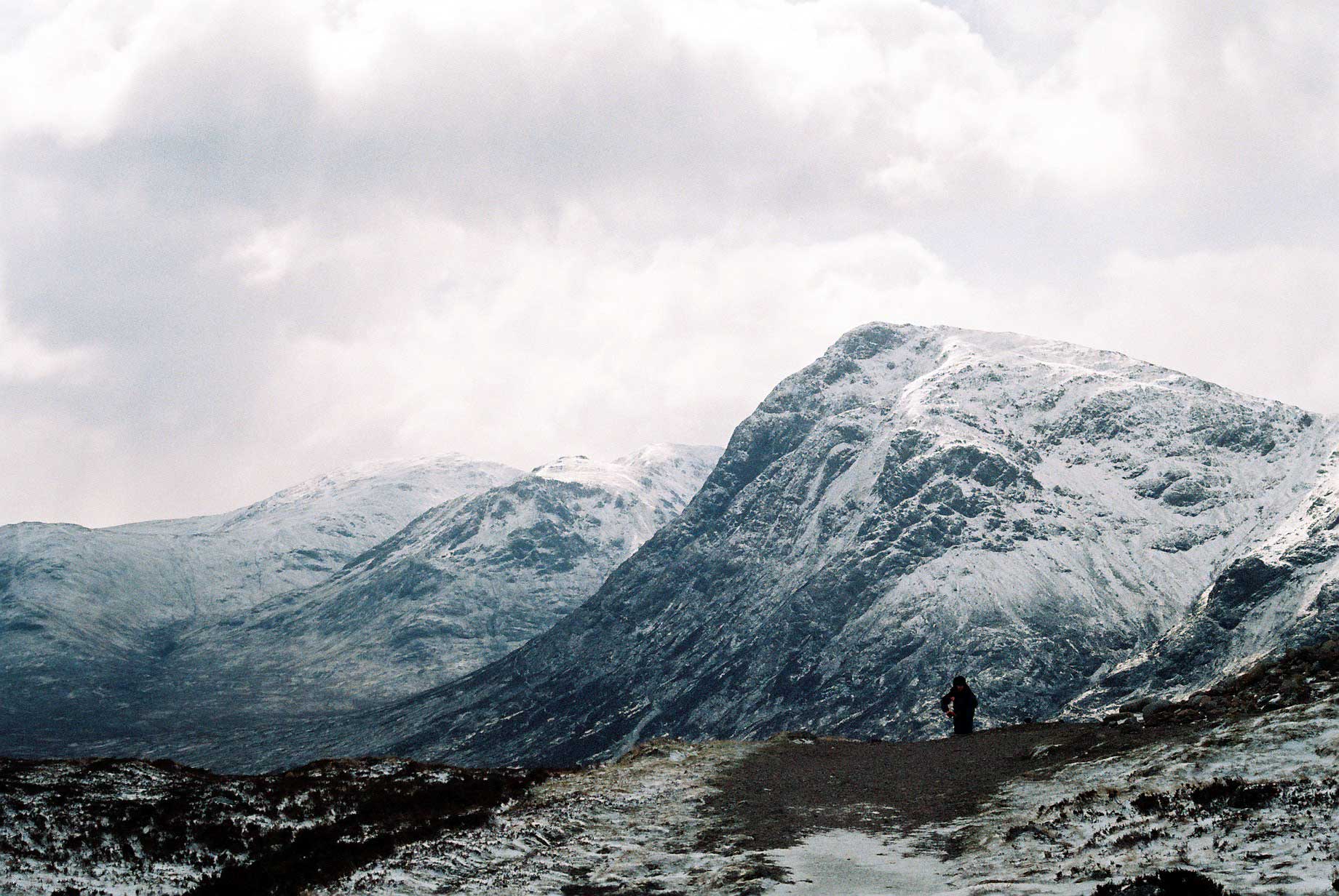
After the Jacobite rebellions, the British government built roads through the Highlands - not for travelers but for troops, to march quickly against any future uprising. The irony, realized too late, was that rebels could use the roads too. The WHW follows sections of this military road from Bridge of Orchy across Rannoch Moor, the most exposed section of the entire route.
Rannoch Moor is one of the last great wildernesses in Britain - a vast blanket bog where nothing grows higher than your boot, where the horizon is empty in every direction, where weather can turn from sunshine to horizontal sleet in minutes. The military road provides firm footing across what would otherwise be impassable mire, but it cannot provide shelter. Hikers have died here when conditions turned. The sensible walker checks forecasts obsessively, carries emergency gear, and moves quickly from the Inveroran Hotel to the Kingshouse Hotel - 14 miles of nothing in between, and both hotels often booked solid months in advance.
The Devil's Staircase
Leaving Kingshouse with Buachaille Etive Mor glowering above, the WHW climbs what locals named the Devil's Staircase - not because it's technically difficult but because it's relentlessly uphill after days of walking. The zigzags of the old military road ascend to 548 meters, the highest point on the entire route, before dropping into the valley of Kinlochleven.
From the summit, Ben Nevis finally comes into view - still a day's walk away, but present now, the goal made visible. The descent is long, the legs tired, the satisfaction of reaching the last overnight stop before Fort William tempered by the knowledge of what remains. The final section climbs again into Lairigmoor, a glacial valley threading through the Mamores, before the long drop through forestry trails to Glen Nevis and the end.
Sair Feet and Midges
Fort William materializes slowly - first the bulk of Ben Nevis, then the outlying buildings, finally the town itself, strung along Loch Linnhe. The ceremonial endpoint is a bronze bench sculpture of a weary walker, aptly named 'Sair Feet.' Touch it, and you've finished. The blisters and aching joints have bought you something: membership in a community that has walked the same miles, complained about the same weather, and emerged transformed by the same landscape.
But the WHW has one final test reserved for the unwary. North of Rowardennan, usually by early summer, the Great West Highland Midge arrives. These tiny biting flies attack in clouds so thick they seem alive, tormenting anyone who stops moving for more than thirty seconds. Bug spray helps. Head nets help more. Nothing truly defeats them. They are the final proof that Scotland's beauty comes with teeth - that this landscape demands something from those who cross it, and rewards only those willing to pay.
From the Air
The West Highland Way runs 154km (96 miles) from Milngavie (55.94°N, 4.32°W) north of Glasgow to Fort William (56.82°N, 5.11°W) at the foot of Ben Nevis. The route is visible from altitude as a continuous trail through some of Britain's most dramatic terrain. Key waypoints: Drymen (12mi), Balmaha at Loch Lomond (18mi), Inverarnan (40mi), Tyndrum (52mi), Bridge of Orchy (59mi), Kingshouse Hotel on Rannoch Moor (72mi), Kinlochleven (80mi), Fort William (96mi). Loch Lomond is the distinctive large lake in the southern section - the WHW follows its wild eastern shore. Rannoch Moor is the vast boggy plateau between Bridge of Orchy and Glencoe - look for the A82 road threading through and the West Highland Railway line. Fort William (airport: no commercial service) sits at the head of Loch Linnhe with Ben Nevis (1,345m, Britain's highest peak) immediately to the south. Glasgow Airport (GLA) is the nearest major airport, 60km south of Milngavie. Inverness (INV) serves the north. Weather is notoriously variable - plan for rain, wind, and midges (summer).