Westelijke Eilanden
Among the things stored in the warehouses on the Westelijke Eilanden in the seventeenth century, alongside the herring and grain and tobacco, were cat skins. Also pitch, anchovies, salt, and tar. The street names still preserve the inventory: Silodam for the silos, Zoutkeetsgracht for the salt sheds, Bokkinghangen for the smokehouses where bokking - smoked herring - was hung in rows. Walk these three small islands today, west of Amsterdam Centraal Station, and the harbor smell that defined them for two centuries is gone. The warehouses remain. There are 38 national monuments on Prinseneiland alone.
Three Islands Pulled Out of the Mud
When Amsterdam decided in 1610 to push its port westward, the corner of the IJ it wanted to develop was almost floating peat, too soft to build on. Between 1611 and 1615 the city stabilized the ground and shaped it into three large artificial islands, protected by a bulwark that ran out into the harbor. It was the Third Expansion of Amsterdam, the so-called Derde Uitleg, and it nearly tipped into scandal: in 1614 a faction of council members including Frans Hendricksz Oetgens was accused of speculating in the new land at the city's expense, and a riot broke out in the council chamber. The islands got built anyway. At first they were called simply Vooreiland, Middeneiland, and Achtereiland - Front, Middle, and Back Island. The proper names came later, attached to the men who had backed the project.
Bicker, the Prince, and the Realen
Jan Bicker bought Vooreiland from the city in 1631 and renamed it after himself: Bickerseiland. He built warehouses, a marina, and a small tower from which he could watch his own ships being constructed - a kind of seventeenth-century private factory floor with a viewing platform. The Middle Island became Prinseneiland, named for the first three Princes of Orange. The Back Island became Realeneiland, after the Reael family - specifically Jacob Reael, the Amsterdam alderman who had steered the islands' creation through the city council. Reynier Reael, who later bought up many lots there, offered cheap credit to ship carpenters: no rent for twelve years, but you had to deliver a finished ship. A gable stone on the Zandhoek bore the image of a Spanish coin, the Reaal, with Charles V's profile, and gave the whole neighborhood the name Gouden Reael - Golden Reael.
The Other Trading Company
Visitors to Amsterdam know about the Dutch East India Company - the VOC, with its hundred-foot warehouses and its monopoly on the spice trade. The Westelijke Eilanden belonged to the other company. The Dutch West India Company kept its yards and ropery here; so did the merchants who traded with the Levant and the Baltic. The cargoes were less glamorous than nutmeg and cinnamon. Grain from Poland for the Amsterdam bakeries. Salt from Iberia for curing fish. Wine, tobacco, pitch for the ships' seams. Anchovies in barrels. And those cat skins, used for fur trim and gloves, evidence that almost nothing went to waste in a city that lived by trade. Of the roughly 900 warehouses standing in seventeenth-century Amsterdam, more than a hundred stood on Prinseneiland alone.
When the Ships Got Too Big
By the end of the nineteenth century, the islands had run out of harbor. Steam-powered cargo ships were too big for the cramped basins between the warehouses, and Amsterdam's commercial weight shifted east, toward the new Eastern Docklands and eventually the deep-water terminals further out on the IJ. In 1878 a railway embankment connected Bickerseiland to the mainland, ending its life as an actual island. Through the first half of the twentieth century the warehouses sat half-empty and the neighborhood declined. Then, after the Second World War, something quieter began to happen. Artists started moving into the empty warehouses on Prinseneiland - the painter Reinier Lucassen, the filmmaker Johan van der Keuken, the composer Peter Schat, the jazz composer Willem Breuker. The rooms were huge and cheap. The light off the water was extraordinary.
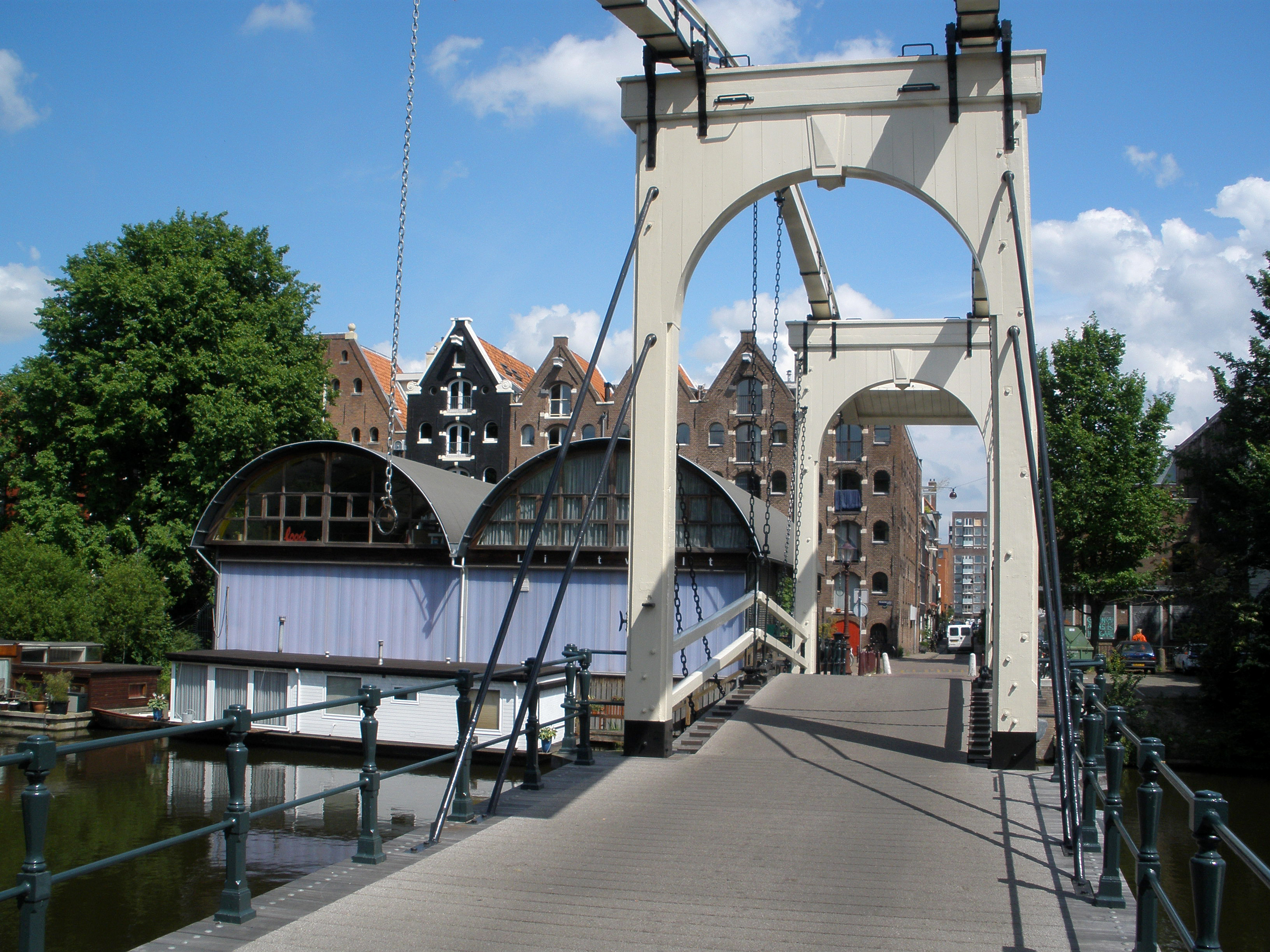
A Mokum Archipelago
Today the islands are sometimes called the Mokum Archipelago - Mokum being Amsterdam's affectionate Yiddish nickname. The drawbridges between them still tilt up for passing boats: the Drieharingenbrug, the Zandhoek bridge, the wooden Sloterdijkerbrug to Prinseneiland. The warehouses have mostly been subdivided into apartments and studios, and the residents skew artistic - actors, musicians, furniture makers, programmers, painters who arrived in the 1970s and never left. Around Pentecost each year the Open Workshop Days throw the studios open to anyone willing to wander in. The photographer Jacob Olie, who was born here, left thousands of images of the islands in their working-port days. George Hendrik Breitner painted on Prinseneiland. Kees Maks did too. The herring smoke is gone. The light has not changed.
From the Air
Coordinates 52.386N, 4.888E, in the Centrum district of Amsterdam immediately northwest of Central Station, between the Westerdok and the Westerkanaal. Schiphol (EHAM) lies 15 km southwest. Best viewed at 2,000-3,000 ft on approach to or departure from Schiphol; the three small islands are visible as a distinct cluster just west of the main canal belt, separated by narrow waterways and connected by drawbridges. The 1878 railway embankment connecting Bickerseiland to the mainland is the line that runs west from Central Station toward Amsterdam Sloterdijk. The IJ waterfront, with Central Station and the Eye Film Museum on the opposite bank, marks the northern boundary of the neighborhood.