Wetumpka Crater
For millions of years, the people of Wetumpka, Alabama, lived inside an impact crater and had no idea. The hills that ring the eastern side of town -- the ones locals drove past on their way to work, picnicked on, built houses on -- are the remnants of a rim blasted into existence 83 million years ago when a rock roughly 1,250 feet across slammed into a shallow sea at a speed and angle that released energy 175,000 times greater than the Hiroshima bomb. The crater it carved stretches 4.7 miles across. It is the only confirmed impact crater in Alabama and one of the best-preserved marine-target craters on Earth. It hid in plain sight until 1969.
The Day the Sea Exploded
Eighty-three million years ago, during the late Cretaceous period, much of central and southern Alabama lay beneath the warm, shallow waters of the northern Gulf of Mexico. Dinosaurs roamed the nearby coastline. The sea here was roughly 100 feet deep, and the impact site sat about fifteen miles offshore. Then a cosmic object -- an asteroid or comet estimated at 1,250 feet in diameter -- struck at an angle of 30 to 45 degrees from the northeast. The energy of the collision vaporized seawater, shattered bedrock, and flung debris across the region. The impact created a crater nearly five miles wide, its rim rising above the waterline like a sudden island. Over the eons, the sea retreated, sediment filled the basin, and forests covered the evidence. What remained was a subtle ring of crystalline hills surrounding a basin of softer sedimentary rock -- a geological signature invisible to anyone not specifically looking for it.
Hidden in the Hills
Thornton L. Neathery, a geologist with the Geological Survey of Alabama, was the first to suspect the truth. During regional geological mapping in 1969 and 1970, he noticed the unusual circular arrangement of rock formations east of Wetumpka. He published his findings in 1976, proposing an impact origin, but conclusive proof remained elusive. The crater is well preserved -- the original rim and impact breccia are intact -- but exposures are scarce. Vegetation and soil blanket most of the evidence, and nearly all of the crater lies on private land. It took nearly three more decades of investigation before the case was closed. In 1998, David T. King Jr. and colleagues at Auburn University drilled a core near the center of the structure and discovered shocked quartz -- mineral grains deformed by pressures that only cosmic impacts can produce.
Proof in the Rock
The drilling operation went 630 feet deep into the crater's center. Analysis of the core samples, including geochemical testing conducted in Vienna, Austria, revealed telltale signatures: elevated levels of iridium, cobalt, nickel, and chromium -- elements associated with extraterrestrial material. The shocked quartz sealed the argument. In 2002, Auburn University researchers published their evidence and Wetumpka was officially recognized as the 157th known impact crater on Earth. The confirmation transformed a local curiosity into a site of international scientific significance. The crater joined a global catalog of impact structures that helps scientists understand the frequency and effects of cosmic collisions throughout Earth's history.
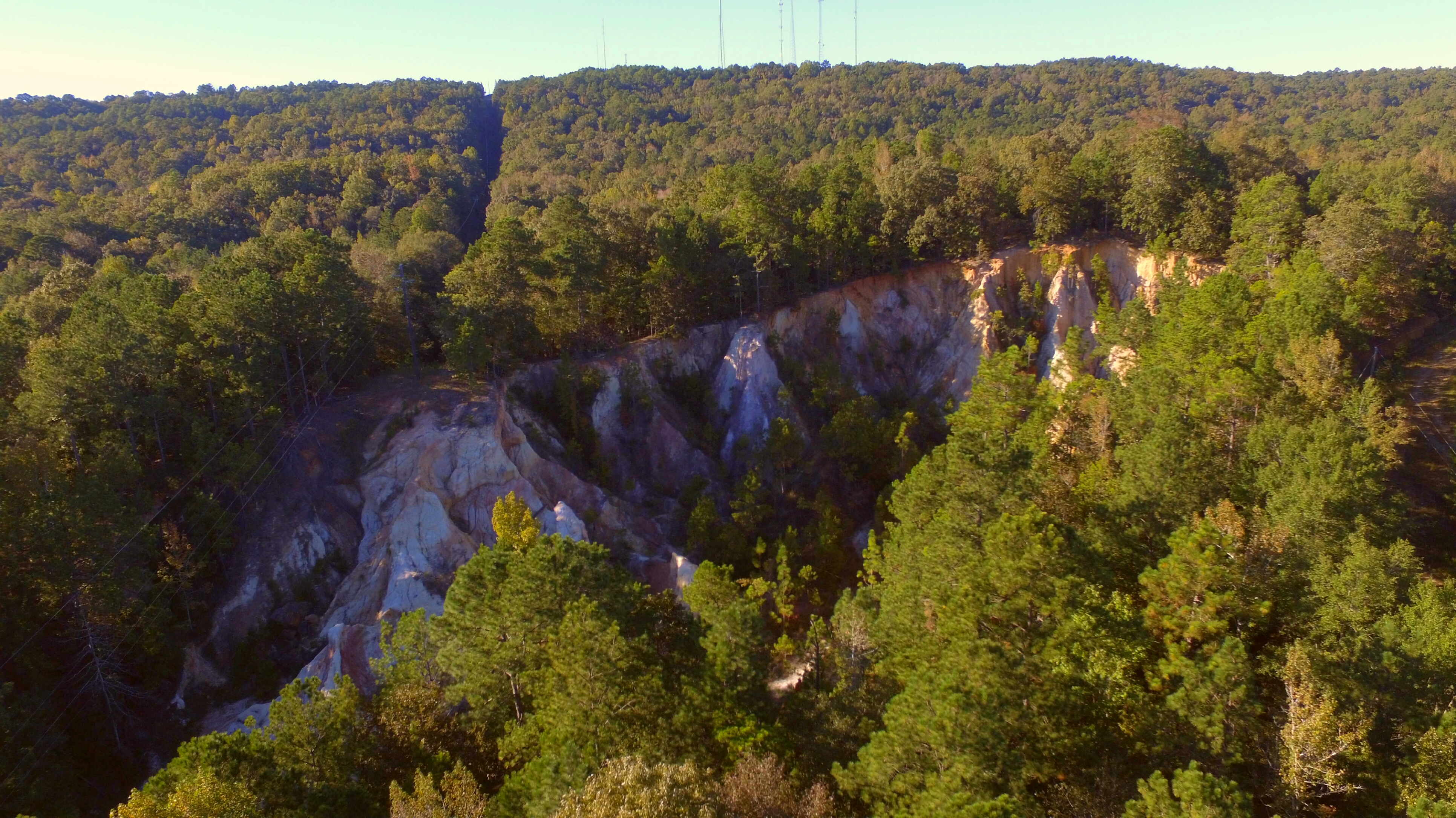
A Crater You Can Walk
Unlike the great impact craters of the Canadian Shield or the Australian outback, the Wetumpka crater does not look like a crater from ground level. The rim forms a gentle arc of wooded hills. The interior is a broad, flat basin where the town of Wetumpka has spread. The Coosa River cuts through the western edge of the structure, exposing some of the disturbed rock layers along its banks. From the air, however, the circular pattern becomes unmistakable -- a ring of elevated terrain enclosing a distinctly flatter interior, the ancient architecture of catastrophe now softened by tens of millions of years of erosion and growth. It is a landscape that carries its deepest story in its shape, visible only from the perspective that flight provides.
From the Air
Located at 32.517N, 86.167W, east of downtown Wetumpka in Elmore County, Alabama. The crater is 4.7 miles (7.6 km) in diameter and best observed from 3,000-6,000 feet AGL, where the circular rim structure becomes clearly visible as a ring of wooded hills surrounding a flatter basin. The Coosa River cuts through the western portion of the crater. Look for the distinctive circular pattern of elevated terrain east of the town center. Nearby airports: Montgomery Regional Airport (KMGM) approximately 15 nm south-southwest; Maxwell AFB (KMXF) approximately 12 nm south-southwest; Prattville-Grouby Field (1A9) approximately 10 nm west. Clear weather with good visibility recommended for best crater identification from the air.