White Sands: The Gypsum Sea Where the Bomb Was Born
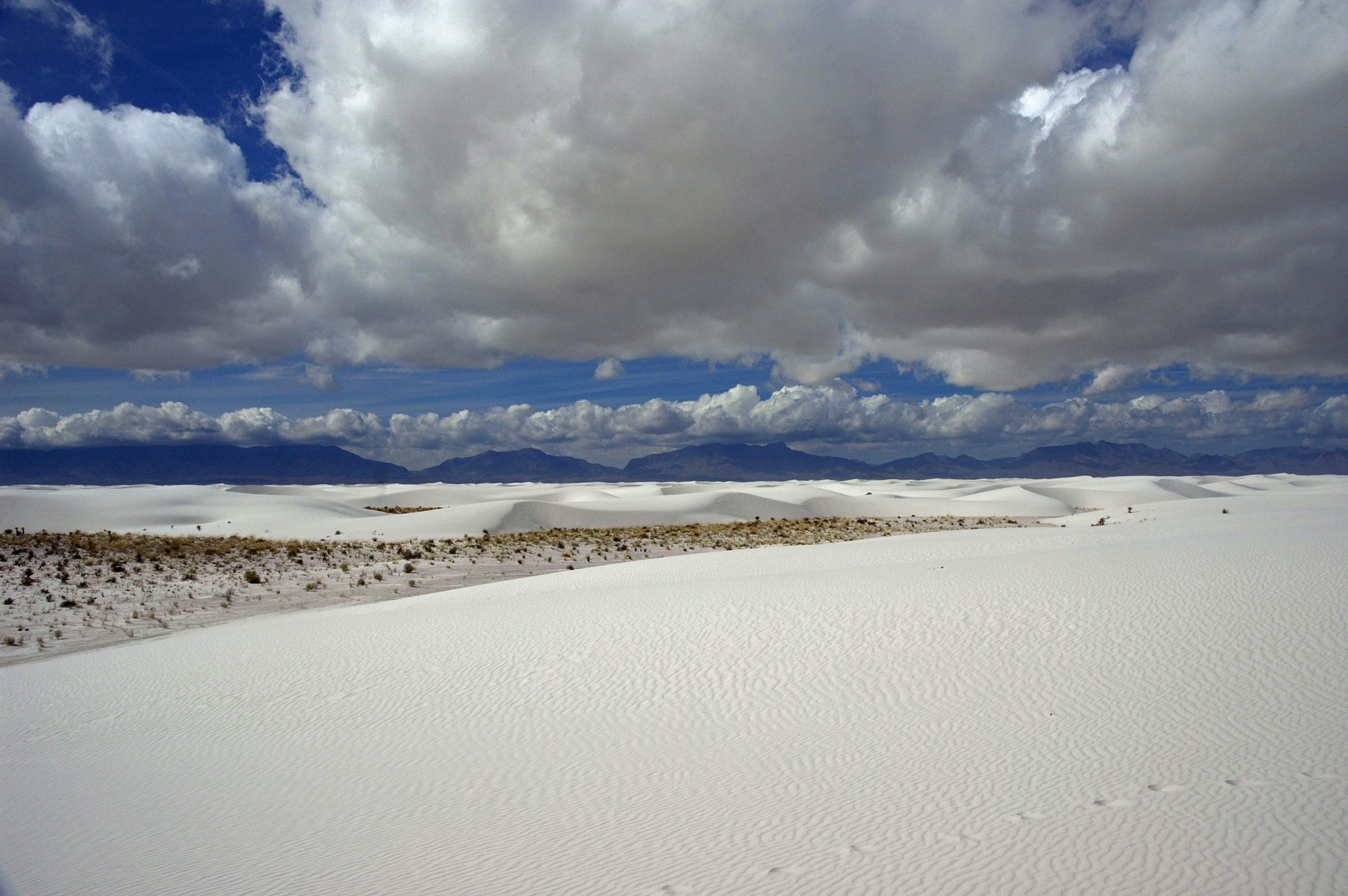
The dunes are not sand. They are gypsum crystals, washed down from the surrounding mountains into the Tularosa Basin, where evaporation leaves beds of selenite that wind grinds into the finest dust. The result is 275 square miles of dazzling white dunes, constantly shifting, swallowing roads and occasionally visitors, reflecting so much sunlight that the landscape seems to glow. White Sands became a national park in 2019, upgraded from monument status. But the dunes share the basin with White Sands Missile Range, where America tests weapons, and where the first atomic bomb was detonated on July 16, 1945, at Trinity Site, 60 miles north. The landscape of sublime beauty shares geography with the technology of ultimate destruction. The contrast is New Mexico in miniature.
The Gypsum
The Tularosa Basin has no outlet to the sea. Gypsum erodes from the surrounding San Andres and Sacramento Mountains, washes into Lake Lucero at the basin floor, and stays there when the lake evaporates. Wind picks up the crystals and builds dunes that march northeast at roughly 30 feet per year, burying everything in their path. The gypsum is water-soluble; anywhere else, rain would dissolve the dunes. Here, in one of America's driest deserts, the dunes persist. They're cool to the touch even in summer - gypsum doesn't absorb heat like silica sand. But the reflected light will burn eyes and skin without protection. The whiteness is absolute, the landscape alien.
The Wildlife
Life adapts to the gypsum. Several species have evolved white coloration found nowhere else: the bleached earless lizard, the gypsum cave cricket, the white sand dunes pocket mouse. The adaptation is recent in evolutionary terms - the dunes are perhaps 7,000 years old, and the white animals evolved in that blink of geological time. The surrounding Chihuahuan Desert is typical tan and brown; only in the white dunes do the white animals survive. They demonstrate evolution in action, natural selection favoring camouflage in an environment that appeared suddenly and may not persist. The dunes are young, the adaptations younger, and both are reshaping in real time.
The Military
The Tularosa Basin was isolated enough that the Manhattan Project chose it for the first atomic test. Trinity Site, 60 miles north of the dunes, detonated on July 16, 1945, turning desert sand to glass (trinitite) and demonstrating that the bomb worked. The missile range that followed tests rockets, missiles, and weapons systems across the basin. Highway 70, which crosses the dunefield, closes regularly for missile tests - visitors are stopped, escorted away, and must wait while explosions occur over the horizon. The park itself is dwarfed by the military reservation surrounding it. The sublime landscape exists in partnership with instruments of destruction.
The Experience
White Sands offers experiences unavailable elsewhere. Sledding down gypsum dunes on waxed plastic discs is a park tradition; the gift shop sells sleds alongside sunscreen. The Dunes Drive penetrates eight miles into the dunefield, ending at a trailhead where marked posts guide hikes across terrain without landmarks. Backcountry camping places you alone in white wilderness, the stars overwhelming when night falls. Full moon nights attract photographers; the dunes glow blue-white under lunar light. The emptiness is genuine - cell service fails, landmarks disappear, and the dunes extend to the horizon in every direction. The disorientation is the point.
Visiting White Sands
White Sands National Park is located in south-central New Mexico, 15 miles from Alamogordo. Las Cruces (55 miles) and El Paso (90 miles) provide major airports and services. The park may close for missile testing; check before arriving. Dunes Drive provides vehicle access into the dunefield; sunset hours are most dramatic. Bring sunscreen, sunglasses, and water - the reflected light is intense and the desert is dry. Sleds are available at the visitor center. Hiking trails are marked with posts; GPS is unreliable amid the dunes. Backcountry camping permits are limited and require self-sufficiency. Trinity Site (missile range, not park) opens twice yearly, in April and October. The experience is otherworldly - terrain that looks like snow, feels like powder, and exists nowhere else on Earth.
From the Air
Located at 32.78°N, 106.17°W in the Tularosa Basin of south-central New Mexico. From altitude, White Sands appears as a brilliant white patch against tan desert - unmistakable, startling, seemingly impossible. The dunefield extends roughly 30 miles from southwest to northeast, bounded by mountains on both sides. White Sands Missile Range surrounds the park; test facilities and launch pads are visible to the north. Alamogordo clusters at the basin's eastern edge. Highway 70's path through the dunes is visible as a dark line. The gypsum's whiteness reflects so strongly that satellites easily track the dunes. What appears from altitude as snow in the desert is the world's largest gypsum dunefield - young, shifting, and shared with the military installations that tested the weapons that changed the world.