White Sands National Park
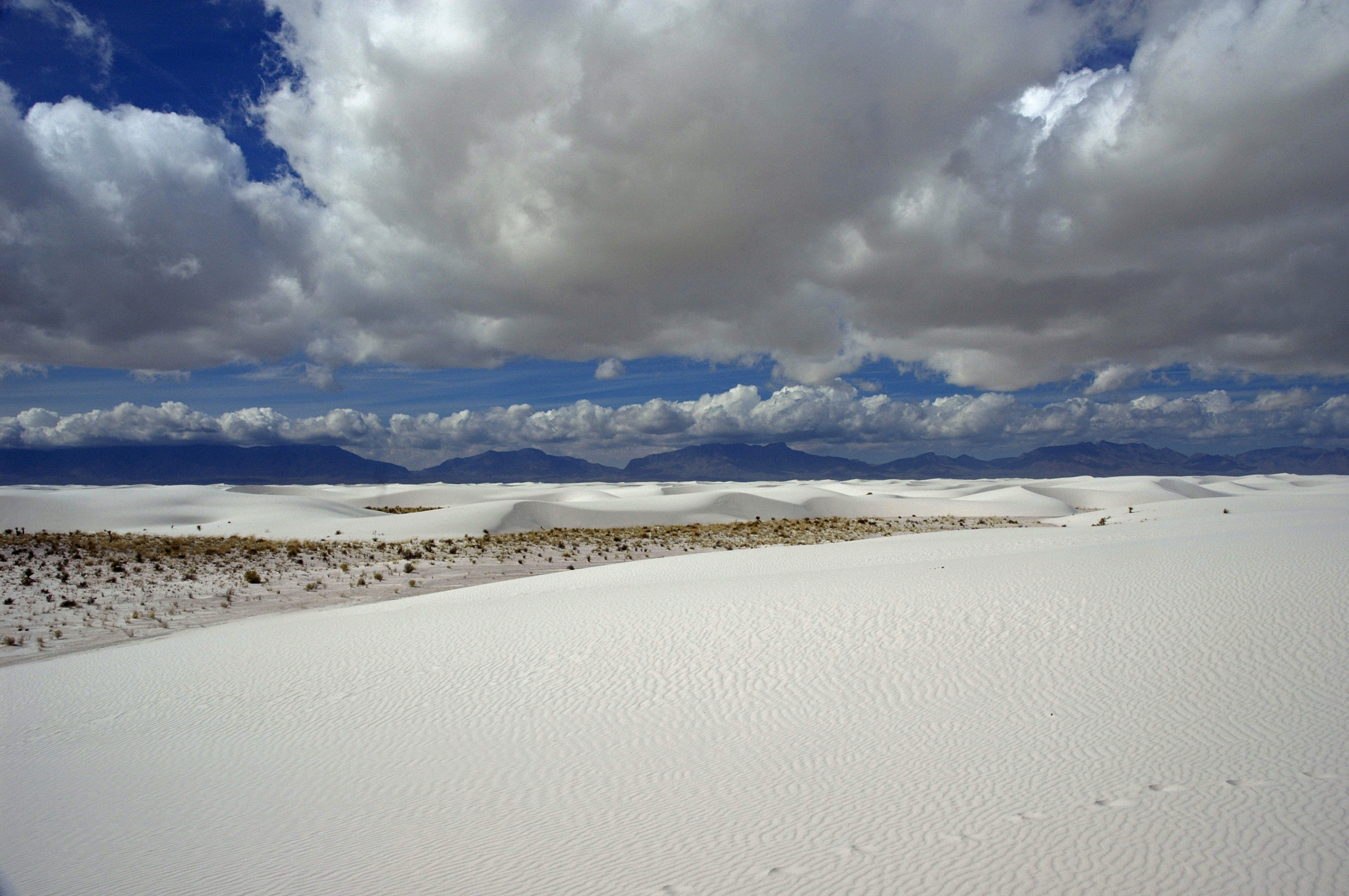
From the air, it looks like snow that refuses to melt - 275 square miles of blinding white dunes undulating across the New Mexico desert. White Sands National Park protects the largest gypsum dunefield on Earth, a landscape so otherworldly that Hollywood has used it to stand in for alien planets. But the real story here is stranger than fiction: beneath these shifting sands lie fossilized footprints proving humans walked this basin 23,000 years ago, rewriting everything scientists thought they knew about when people first arrived in the Americas.
An Ancient Sea Turned Desert
The white sands began forming 250 million years ago when shallow seas covered this land during the Permian Period. Those seas deposited vast quantities of gypsum - calcium sulfate - across the basin floor. Tectonic forces later lifted portions of this gypsum-rich seabed to form the San Andres and Sacramento Mountains that now ring the Tularosa Basin.
During the last ice age, a massive lake called Lake Otero filled the basin. When the climate warmed and the lake evaporated, it left behind a flat expanse of selenite crystals. Strong prevailing winds from the southwest began breaking up these crystals and carrying them northeast, grain by grain, building the dunefield that continues growing today. Unlike quartz sand, gypsum dissolves in water, so these dunes exist only because the Tularosa Basin has no outlet to the sea - the gypsum stays trapped, recycling endlessly between lake bed and dune.
Footprints That Changed History
In 2021, researchers announced a discovery that upended the scientific consensus about human migration to the Americas. Fossilized footprints found at White Sands dated to between 21,000 and 23,000 years ago - roughly 7,000 years earlier than the previously accepted timeline. The prints were preserved in layers of gypsum soil on a playa within the park, bracketed by seeds that allowed precise radiocarbon dating.
The tracks tell intimate stories: teenagers walking with toddlers, adults hunting alongside giant ground sloths and Columbian mammoths. Some prints show a person walking north, then returning south hours later - perhaps carrying something heavy on the return trip. Paleo-Indians lived along the shores of Lake Otero, using stone from the mountains to make Folsom and Plano points for hunting the megafauna that roamed these grasslands. When the lake dried and the big animals vanished, they left behind only these footprints, now buried under white sand.
The Pueblo Farmers and Apache Raiders
After the great lake dried and the dunes stabilized around 4,000 years ago, Archaic peoples entered the basin, drawn by Indian ricegrass and the possibility of farming. Evidence of their presence survives in hearth mounds scattered through the dunes - ancient fire pits where heated gypsum turned to plite and cemented the ash in place for millennia.
The Jornada Mogollon people arrived around 200 CE, building adobe houses and making pottery in the basin until they mysteriously departed around 1350. Then came the Apaches, following bison herds from the Great Plains. For centuries, the Mescalero Apache dominated the basin, raiding Spanish and Pueblo settlements for livestock. Spanish colonists avoided the area except for dangerous expeditions to harvest salt from the flats north of Lake Lucero - salt was essential for processing silver ore in Mexican mines, and the salt trails established in 1647 were among the few reasons anyone risked crossing Apache territory.
A Park Born of Scandal and Persistence
The idea of protecting the white sands dates to 1898, but the road to national park status took more than a century. Albert B. Fall, a New Mexico senator who later became Secretary of the Interior, championed four separate bills between 1912 and 1922 for an 'All-Year National Park' in the Tularosa Basin. His ambitious plan included the dunes, Mescalero Apache reservation land, and distant areas like Elephant Butte Reservoir. Critics called it 'disjointed' and worried about setting precedents for industrial use of parkland. When Fall resigned in disgrace during the Teapot Dome scandal in 1923, his park dreams died with his career.
The dunes finally became a national monument in 1934, with adobe buildings designed by Lyle Bennett that still stand today. The monument existed uneasily within the expanding military presence - White Sands Missile Range surrounded it completely, and errant missiles occasionally destroyed visitor facilities. In December 2019, Congress upgraded the monument to national park status, adding land and settling decades of jurisdictional tension. The park now hosts over 600,000 visitors annually, who come to sled down the dunes, hike through surreal white valleys, and camp beneath some of the darkest skies in North America.
Evolution in Real Time
White Sands is a natural laboratory for evolution. At least 45 species live nowhere else on Earth - they evolved here, in isolation, adapted to the blinding white landscape. The bleached earless lizard, the Apache pocket mouse, and the White Sands woodrat have all developed pale coloration that helps them hide from predators on the gypsum surface. Forty species of moths unique to the dunes flutter through the summer nights.
The plants are equally remarkable. Rio Grande cottonwoods grow on hardened pedestals of gypsum, their roots anchored as the dunes move around them. Skunkbush sumac, Mormon tea, and four-wing saltbush tolerate the alkaline soil that would kill most vegetation. Some plants grow fast enough to stay ahead of advancing dunes; others form symbiotic partnerships with the gypsum itself. At 600 species of invertebrates, 246 species of birds, and an ancient lineage of White Sands pupfish found nowhere else on Earth, this stark white desert teems with more life than its appearance suggests.
From the Air
White Sands National Park lies in the Tularosa Basin at 32.78N, 106.17W, approximately 15 miles southwest of Alamogordo, New Mexico. From altitude, the gypsum dunefield is unmistakable - a brilliant white expanse roughly 30 miles long and 15 miles wide, bordered by the San Andres Mountains to the west and Sacramento Mountains to the east. The park is completely surrounded by White Sands Missile Range; both U.S. Route 70 and park access roads close periodically during missile tests. Nearest airport: Alamogordo-White Sands Regional Airport (KALM), about 15 nm northeast. El Paso International Airport (KELP) is approximately 85 nm to the south. Elevation at the visitor center is approximately 4,235 feet MSL. The dunes themselves rise 60 feet above the basin floor. Expect excellent visibility most days - this is high desert with minimal precipitation. Military operations in the surrounding restricted airspace (R-5107) may affect routing.