Whitehorse
Whitehorse is the capital of the Yukon. It has spectacular scenery, and easy access to the natural splendor and recreational opportunities around it, such as paddling on the Yukon River and hiking, biking, or skiing its many trails. As the territory's largest city, it has museums and services.
Overview
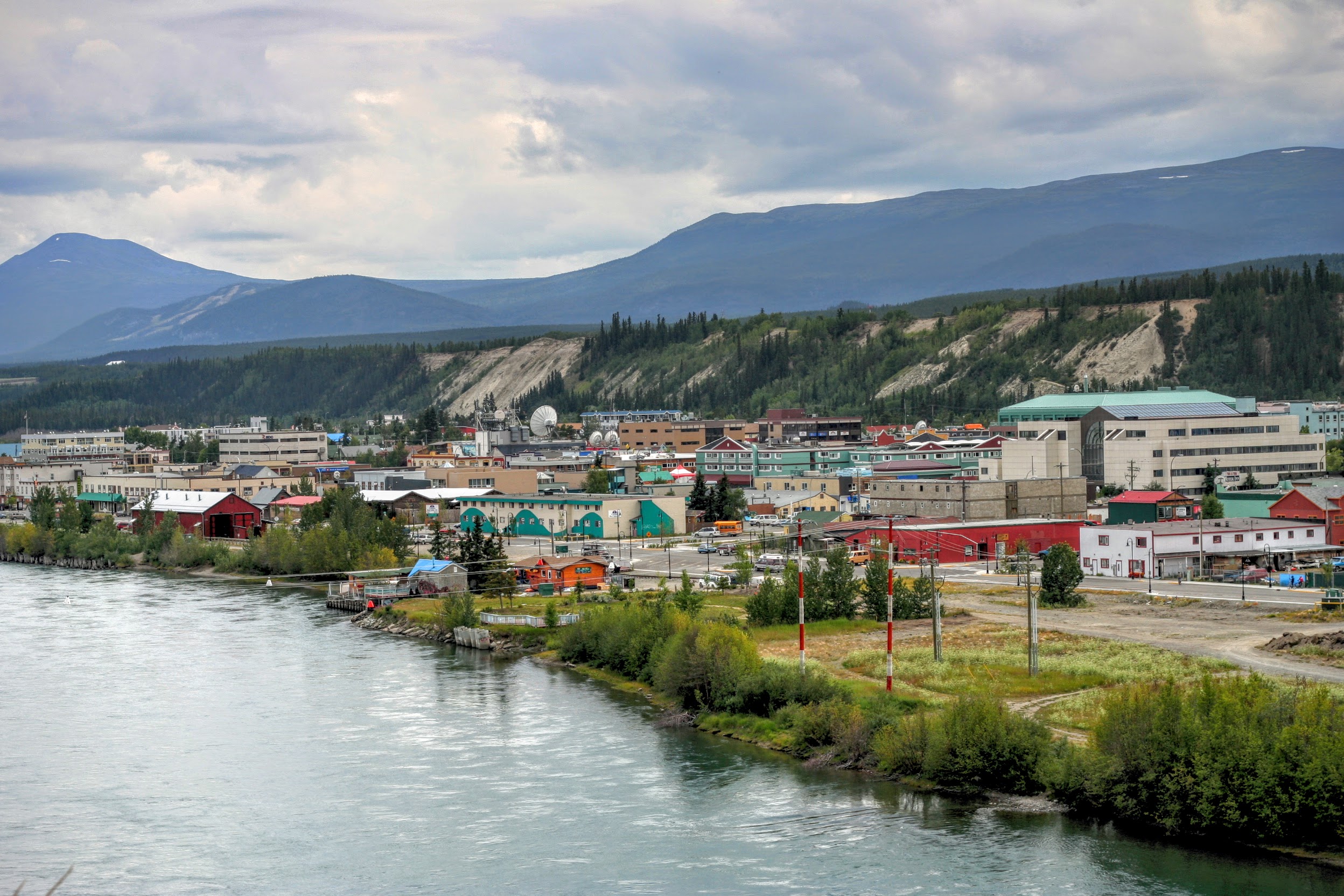
Understand Whitehorse has been the capital of the Yukon since 1953, and has a population of around 30,000 (2019), which is about 75 percent of the population of Yukon Territory. The city is along the banks of the Yukon River. It is in a rain shadow area, so Whitehorse is Canada's driest city.
Whitehorse's downtown and Riverdale areas occupy both shores of the Yukon River, which originates in British Columbia and meets the Bering Sea in Alaska. The city was named after the White Horse Rapids for their resemblance to the mane of a white horse, near Miles Canyon, before the river was dammed.
History
Archeological research south of the downtown area at Canyon City, has revealed evidence of use by First Nations (Indigenous people) for several thousand years. The surrounding area had seasonal fish camps, and, in 1883, there was a portage trail used to bypass Miles Canyon. Before the Gold Rush, several different First Nations passed through the area seasonally and their territories overlapped.
The discovery of gold in the Klondike in August 1896 set off a major change in the historical patterns of the region. Early prospectors used the Chilkoot Pass, but by July 1897, crowds of neophyte stampeders had arrived via steamship and were camping at "White Horse". By June 1898, there was a bottleneck of stampeders.
On their way to find gold, stampeders also found copper in the "copper belt" in the hills west of Whitehorse. The first copper claims were staked in 1898 and 1899. Two tram lines were built, one 8 km (5 mi) stretch on the east bank of the Yukon River from Canyon City to the rapids, just across from the present day downtown, the other was built on the west bank of the river. A small settlement was developing at Canyon City but the completion of the White Pass railway to Whitehorse in 1900 put a halt to it.
The White Pass and Yukon Route narrow-gauge railway linking Skagway to Whitehorse was completed in 1900. By 1901, the Whitehorse Star newspaper was already reporting on daily freight volumes. That summer there were four trains per day. Whitehorse was booming.
Until 1942, rail, river, and air were the only way to get to Whitehorse, but in 1942 the US military decided an interior road would be safer to transfer troops and provisions between Alaska and the US mainland and began construction of the Alaska Highway. The entire 2,500-km (1,553-mi) project was accomplished between March and November 1942. The Canadian portion of the highway was only returned to Canadian sovereignty after the war.
In 1953, the city was designated the capital of the Yukon Territory when the seat was moved from Dawson City after the construction of the Klondike Highway.
Climate
Whitehorse has a dry-summer subarctic climate. However, because of its relative proximity to the Pacific Ocean, winter temperatures are milder than other comparable northern communities such as Yellowknife. With an average annual temperature of −0.1 °C (31.8 °F), Whitehorse is the warmest city in the Yukon.
At this latitude winter days are short and summer days have just over 19 hours of daylight. Whitehorse has an average daily low of −19.2 °C (−2.6 °F) in January. In the summer months, average daily highs are around and average lows around. Particularly hot days can see summer tempertaures climb upwards to around with nighttime lows up to around.
Get in By plane
Airport Airlines Air North, "Yukon's Airline," and provides scheduled service to Whitehorse from Vancouver (2.5 hours), Victoria, Kelowna, Edmonton, Calgary (2.75 hours), Dawson City, Inuvik, Old Crow. Seasonal flights to Whitehorse from Yellowknife (2 hours), Toronto Pearson (via Yellowknife) and Ottawa (via Yellowknife). Operates to Whitehorse from Vancouver (2.25 hours). Seasonal service is provided by:
Two highways combine on to the same road within Whitehorse, and diverge once they leave this city:
Highway 1 (Alaska Highway) travels northwest from Dawson Creek, British Columbia via Watson Lake and travels southeast from Delta Junction, Alaska. Highway 2 travels north from Skagway, Alaska via Carcross and travels south from Dawson City via Carmacks.
Get around
The Trans-Canada Trail runs through the city, and there are some bike trails.
By public transit By taxi Taxis are metered and cost $4.50 plus $2.25/km; a trip from downtown to the airport is $18 (as of 2018).
By car
The downtown core has metered parking six days a week. Visitors can obtain a free parking pass, valid for 3 days, from the tourist information.
Drink Sleep
Accommodation in Whitehorse ranges from hostels to B&Bs, motels and quality hotels. They tend to get full quick, so advance bookings are recommended during summer.
Budget Mid-range Splurge Connect Go next Drive West on the Alaska Highway towards Haines Junction to visit the Kluane National Park, or drive South and then take the Klondike Highway towards Carcross and Skagway to see and the.
From the Air
Located at 60.72°N, 135.06°W. Visible from cruising altitude in clear weather.