Willapa Bay
Half the water inside Willapa Bay leaves with every tide. Twice a day, over sixty square miles of mudflat emerge from the receding Pacific, glistening and alive with shorebirds, crabs, and the patient work of oyster farmers who have harvested these shallows for more than a century. Old maps call this place Shoalwater Bay, and the name still fits: more than half the bay's 120-square-mile surface sits in the intertidal zone, a vast breathing membrane between ocean and land that ranks as the second-largest riverine estuary on the Pacific coast of the continental United States.
Shaped by Ice and Sand
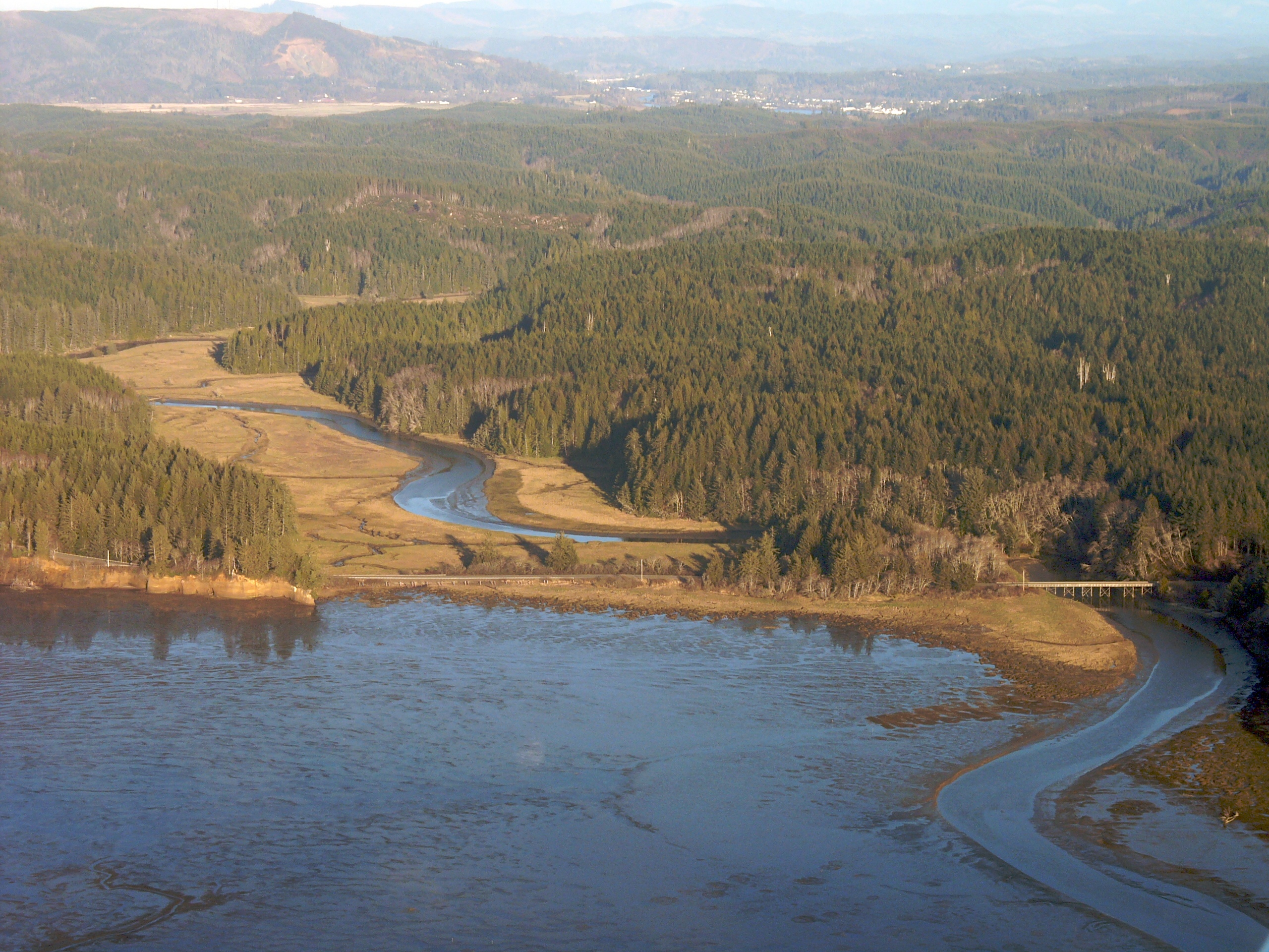
Willapa Bay is a ria, a drowned river valley formed when sea levels rose at the end of the last ice age and flooded the mouths of several small coastal rivers. What makes it distinctive is its shield: the Long Beach Peninsula, a narrow sand spit built by sediment drifting north from the Columbia River, stretches roughly 28 miles and separates the bay from the open Pacific. Behind that barrier, the North River, Willapa River, and Naselle River pour freshwater into the estuary, joined by the Bone, Niawiakum, Palix, Cedar, and Bear rivers. The mixing of salt and fresh water creates the nutrient-rich conditions that have made these flats extraordinarily productive. From the air, the bay at low tide looks almost emptied -- a maze of dark channels threading through pale, exposed sand, with the Long Beach Peninsula curving along the western edge like a drawn bow.
The Oyster Capital
Approximately nine percent of all oysters consumed in the United States are grown in Willapa Bay. That single statistic has shaped the economy and identity of every community on these shores. Small towns like Oysterville, Nahcotta, Bay Center, and Tokeland sit directly on the bay, their histories inseparable from the shellfish beds that surround them. Oysterville, founded during the oyster rush of the 1850s, once served as the Pacific County seat before South Bend wrestled it away in a legendary county-seat war. Further inland, Raymond and South Bend anchor the upper bay along the Willapa River, processing and shipping seafood that travels to restaurants across the country. The oyster beds do more than feed people. They filter the water, improving its clarity and quality, and provide habitat for dozens of other species -- an economic engine that doubles as an ecological one.
A Refuge Under Siege
The bay's biodiversity earned federal protection through the Willapa National Wildlife Refuge, which encompasses the entirety of Long Island -- one of the largest estuarine islands on the Pacific coast -- along with mainland marshes and forest. The refuge shelters migratory shorebirds on the Pacific Flyway, old-growth red cedar groves on Long Island, and the tidal ecosystems that connect them. But in the 1990s, an invasion threatened to choke the bay's ecology. Atlantic cordgrass, Spartina alterniflora, began spreading aggressively across the mudflats. The grass may have arrived as packing material in crates of East Coast oysters, or it may have been planted intentionally to stabilize wetlands -- the exact origin remains debated. What was not debatable was its effect: dense stands of Spartina converted open mudflat into thick meadow, eliminating the feeding grounds that shorebirds and juvenile fish depended on.
Fighting Back
Beginning around 2005, the State of Washington launched a sustained herbicide campaign against the invasive cordgrass, using chemicals carefully selected to minimize harm to native species. The effort required years of aerial and ground-based spraying across thousands of acres of tidal flat. By the mid-2010s, the Spartina threat was much reduced, though vigilance remains necessary to prevent regrowth. The campaign became a case study in estuarine restoration, demonstrating both the fragility of tidal ecosystems and the possibility of reclaiming them. Today, the mudflats are largely open again, and the bay's rhythm has reasserted itself: the tide pulls out, the flats emerge, the birds descend, and the oyster farmers wade back to their beds. Willapa Bay remains one of the cleanest estuaries in the nation, a distinction its communities guard fiercely.
From the Air
Willapa Bay sits at 46.66°N, 124.01°W on Washington's southwest Pacific coast. From altitude, the Long Beach Peninsula is the dominant feature -- a thin sand spit curving northward and enclosing the bay's 120 square miles of shallow water. At low tide, the exposed mudflats are clearly visible. The nearest airports include Willapa Harbor Airport (2S1) near Raymond and Astoria Regional Airport (KAST) across the Columbia River in Oregon. Approach from the west for the best view of the peninsula-bay relationship. Elevation is sea level; recommended viewing altitude 3,000-5,000 feet AGL.