William B. Ide Adobe State Historic Park
The sign inside the park delivers the punchline with bureaucratic directness: William B. Ide never lived here. The adobe that bears his name, the state historic park dedicated to his memory, the carefully recreated 1850s homestead overlooking the Sacramento River, all of it honors a man who owned property elsewhere. Yet California kept the name anyway, because Ide's twenty-five days of unlikely fame earned him a place in history that transcends the boundaries of any single building.
The Twenty-Five Day President
William Brown Ide arrived in California as a pioneer seeking opportunity. He found something stranger: a nation. On June 14, 1846, Ide led the Bear Flag Revolt, a ragtag uprising of American settlers who seized the town of Sonoma from Mexican authorities and declared the California Republic. They raised a homemade flag featuring a grizzly bear and a red star, and Ide became the new republic's first and only president. His administration lasted precisely twenty-five days. On July 9, 1846, American naval forces arrived and raised the Stars and Stripes, absorbing the California Republic into the United States before most Californians knew it had existed. Ide's presidency ended not with defeat but with success, the very outcome the revolt had sought to achieve. He settled along the Sacramento River, building a life in the new American territory he had helped create.
The Adobe That Wasn't His
The adobe building at the heart of the park has its own history, separate from Ide's story. A.M. Dibble, an early settler in Red Bluff, constructed it in 1852. Over the following nine decades, approximately twenty different owners held the property. A. Mount and Willette Mount maintained the longest tenure, from 1882 to 1913. At some point, local legend began attributing the adobe to Ide, though records show he owned land downriver, not here. By the 1940s, enthusiasm for preserving California's pioneer heritage led to plans for a state park on the site. The state acquired the land in the 1950s and dedicated the park in 1960. Rather than correct the historical record by changing the name, California decided to honor Ide's contribution to state history regardless of the address. The sign explaining this decision has become one of the park's more charming features.
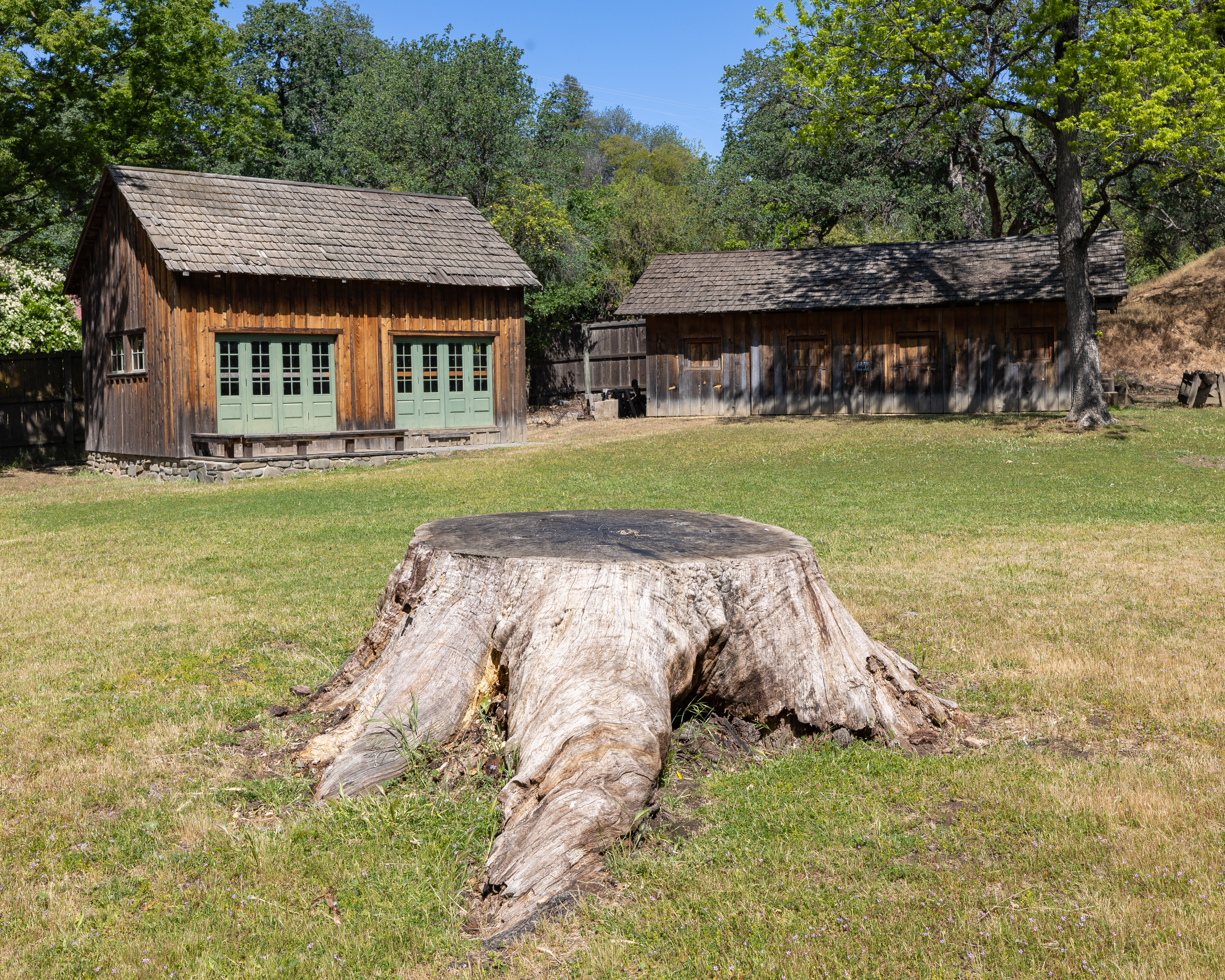
Living History on the Sacramento
Today the park offers a window into 1850s California life. The restored adobe houses a museum filled with pioneer artifacts. A recreated homestead includes replicas of a schoolhouse, wood shop, and blacksmith shop, the essential infrastructure of a frontier community. Visitors can picnic along the Sacramento River, watching the same waters that carried Gold Rush traffic past this spot more than 170 years ago. The park maintains several annual traditions: Ide's Ferry Championship Horseshoe Pitchers Contest in June, Adobe Day in September, and a Pioneer Christmas Party in December. School groups can participate in educational programs like "Life in the 1850s," spending a full day experiencing how California's early settlers worked, learned, and survived.
The Bear Flag Legacy
Ide's influence outlasted his brief presidency. The bear he placed on that first California flag still prowls across the state banner today, one of America's most recognizable state symbols. The revolt he led, while quickly superseded by American annexation, established the principle that California would join the Union on its own terms, having already declared independence. Ide himself lived until 1852, long enough to see California become the thirty-first state but not long enough to see the park that would eventually bear his name. He died knowing he had played a pivotal role in one of history's shortest and most successful rebellions. The adobe on the Sacramento River may not have been his home, but it stands as a fitting memorial to a man whose moment of glory lasted less than a month yet shaped California forever.
From the Air
Located at 40.20N, 122.23W on the west bank of the Sacramento River, approximately one mile north of Red Bluff in Tehama County, California. The park is visible from low altitude along the river corridor, with the adobe building and recreated homestead structures distinguishable against the riparian landscape. Red Bluff Municipal Airport (RBL) lies approximately 3 miles to the south. The Sacramento River provides an excellent navigation reference, running north-south through the Central Valley. Best viewed at 2,000-4,000 feet AGL for detail of the historic structures.