Willow River State Park
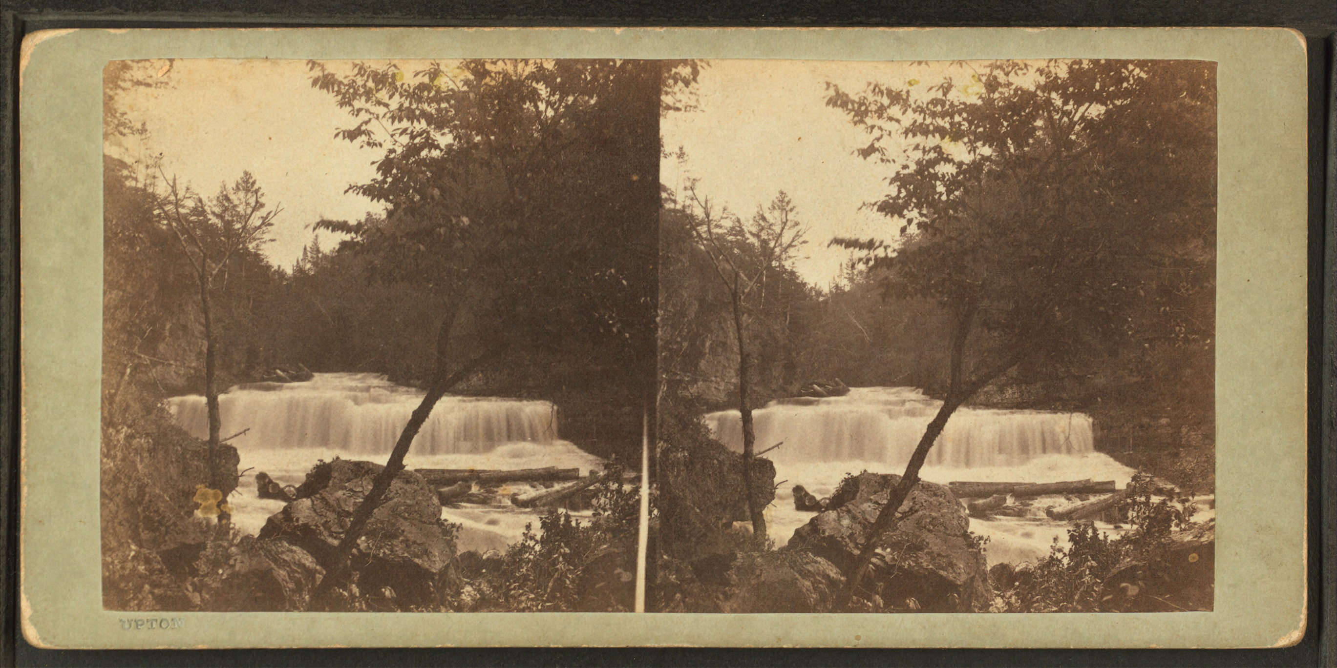
The rock at the bottom of the gorge is 600 million years old. Trilobite fossils peer out from layers of limestone and dolomite laid down when this part of Wisconsin sat beneath a shallow tropical sea. Above those ancient strata, water still thunders over Willow Falls, carving deeper into stone that predates complex life on land. Willow River State Park, five miles north of Hudson, Wisconsin, draws visitors to this improbable collision of deep time and present-day beauty. Its proximity to the Minneapolis-St. Paul metropolitan area makes it one of the most visited state parks in Wisconsin, yet the gorge and its fossils give the place a wildness that crowds cannot diminish.
Battles at the River's Mouth
Long before settlers arrived, the Willow River valley was contested ground. Santee Sioux and Ojibwe tribes lived in the region and clashed over rights to the wild rice lakes that dotted the landscape. European explorers witnessed one of their battles in 1795 at the mouth of the Willow River, where it empties into the St. Croix. By 1830, a different kind of exploitation was underway. Logging and wheat farming spread through the valley, and the river itself became an industrial highway. Timber companies floated white pine logs downstream to the St. Croix, feeding the sawmills that were transforming Minnesota and Wisconsin's forests into lumber for a growing nation. The old-growth forest vanished, but the river kept flowing.
Burkhardt's Electric Vision
Christian Burkhardt, a German immigrant, saw in the Willow River something beyond timber and grain. He built a grist mill here in 1868, harnessing the river's power to grind wheat. As he prospered, Burkhardt kept his eye on technological developments in water power. In 1891 he traveled home to Germany to study hydroelectric plants, then returned to Wisconsin and built his own on the Willow River. Over the following years, Burkhardt constructed four dams and power plants along the river, generating electricity for the town of Hudson. A single immigrant's ambition had electrified an entire community. Northern States Power purchased Burkhardt's company in 1945 and ran the operations until 1963, when a lightning strike damaged one of the plants badly enough that the company decided to liquidate its Willow River holdings.
From Power Company to State Park
In 1967, Northern States Power sold the land to the Wisconsin Conservation Commission for use as a state park, even stabilizing the dams at a financial loss as part of the deal. The park opened to the public in 1971. In the 1990s, some of the dams were removed to restore the natural scenery and improve the trout fishery. Only one dam remains today, impounding the Willow River to form Little Falls Lake, a shallow reservoir that serves as the park's swimming and boating hub. The land is still recovering from more than a century of damming and farming, a slow process of ecological restoration playing out across meadows being returned to native prairie.
Gorge Walls and Overhanging Limestone
The gorge below Willow Falls has become an unexpected draw for rock climbers. Several bolted sport routes ascend the gorge walls, ranging from 5.9 to 5.14c in difficulty, with the majority graded 5.12 and above. The rock -- a mixture of limestone and dolomite -- offers steep, overhanging terrain that concentrates some of the hardest sport climbing in the region into a compact area. The park enforces strict climbing restrictions: no climbing on Saturdays or after noon on Fridays and Sundays, no fixed gear left behind, and no rappelling from the gorge rim. Climbers share these ancient walls with hikers on the Pioneer Trail, which leads past the gravesite of early European settlers to an overlook above the falls where Burkhardt once dreamed of harnessing the river below.
Trails Through Recovering Land
A network of trails fans out from the campground and lake, threading through landscapes at various stages of recovery. The Knapweed Trail passes through former agricultural fields being restored to prairie and forest. The Mound Trail follows the Willow River into the undeveloped northeastern section of the park, past a glacial mound left behind by the ice sheets that once covered this region. The Hidden Ponds Nature Trail, a paved accessible loop, circles a wetland teeming with birdlife. Mountain bikers have their own system of seventeen singletrack trails in the park's northwestern section. From the bluffs above Little Falls Lake, where families spread picnic blankets on summer weekends, you can look out across a landscape that has been logged, dammed, farmed, and electrified -- and is now, gradually, finding its way back.
From the Air
Located at 45.019°N, 92.688°W, five miles north of Hudson, Wisconsin, near the St. Croix River which forms the Minnesota-Wisconsin border. The park's centerpiece is the Willow Falls gorge and Little Falls Lake, a small reservoir visible from altitude. The St. Croix River itself is a major visual reference, running north-south as a wide ribbon between the two states. Nearest airports: New Richmond Regional Airport (KRNH) approximately 12 nm north; Lake Elmo Airport (21D) approximately 15 nm southwest across the river in Minnesota; Minneapolis-St. Paul International (KMSP) approximately 25 nm southwest. The park is identifiable from the air by the narrow gorge cutting through forested bluffs just east of the St. Croix. Best viewed at 2,000-4,000 feet AGL.