Windy Hill Open Space Preserve
You can pick out Windy Hill from twenty miles away. It is the only "naked" part of the Peninsula Range -- a bald, grassy summit rising 1,905 feet above sea level while the ridgeline on either side is covered in forest. From the flatlands of the South Bay, where the tech campuses spread in monotonous grids, the hill's bare crown stands out against the Santa Cruz Mountains like a gap in a treeline, an invitation to anyone who needs to remember that wilderness exists fifteen minutes from the office.
Views in Every Direction
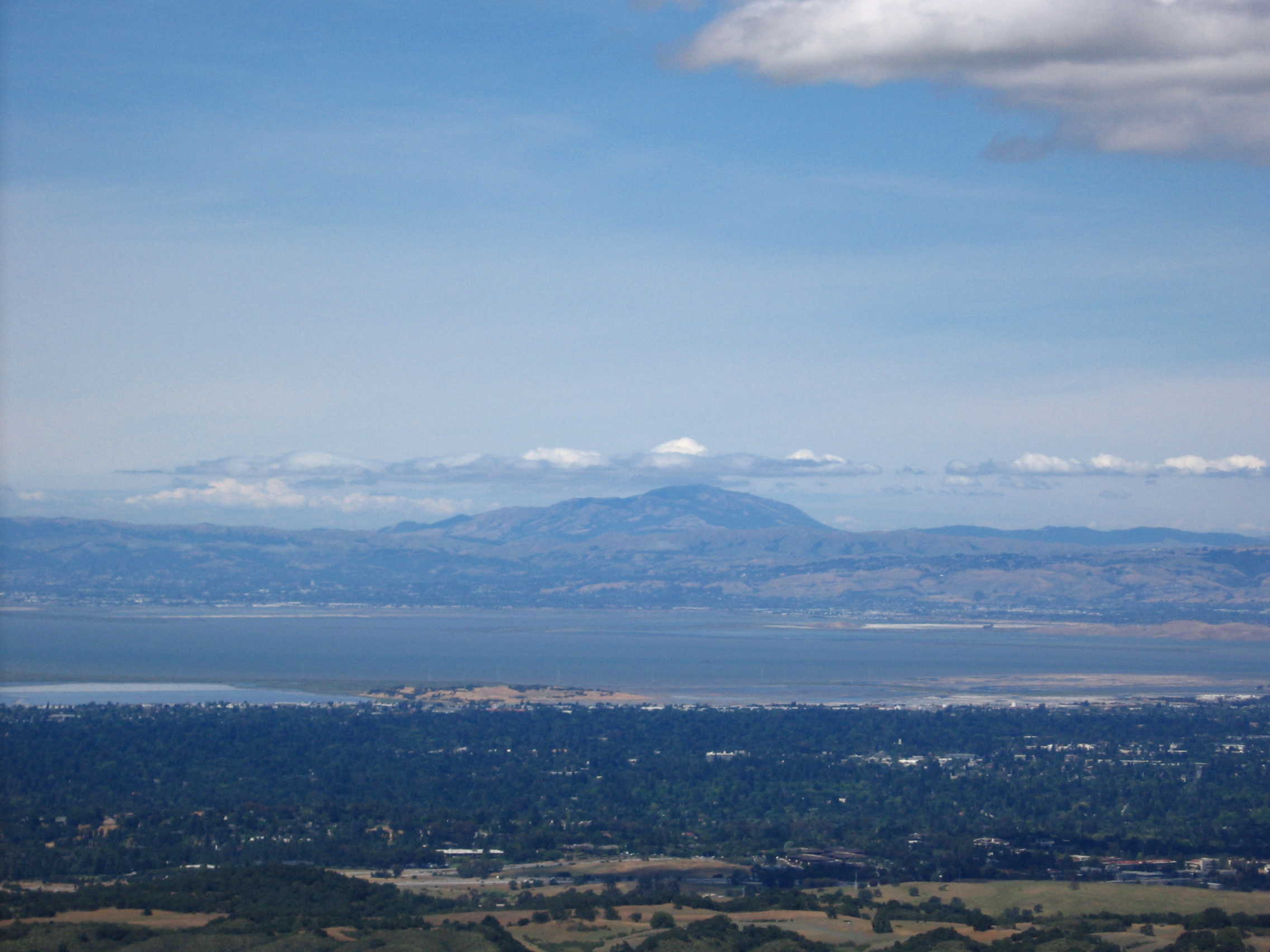
The summit of Windy Hill earns its name. The prevailing weather comes off the Pacific, and what feels like a pleasant afternoon at the Portola Valley trailhead can be bitterly cold, foggy, or wind-blasted at the top. But on clear days, the reward is extraordinary: the Stanford campus spreads below, with Hoover Tower marking the center of the quad. Beyond it, the San Francisco Bay glitters, and Mount Tamalpais and Mount Diablo bookend the horizon. Downtown San Francisco is visible to the northwest, and on the clearest days, the Pacific Ocean gleams to the west. The half-mile walk from Skyline Boulevard to the summit is moderate in grade and short enough that the views feel almost too easy to reach.
Fourteen Miles of Trail
Windy Hill Open Space Preserve encompasses 1,132 acres of conservation land on the eastern slope of the Santa Cruz Mountains. The Spring Ridge Trail climbs from Portola Valley through the open, grassy upper section to Skyline Boulevard -- a fire road open to cyclists, hikers, and equestrians. Further south, the Hamms Gulch and Lost Trail-Razorback Ridge-Eagle Trail routes are single-track paths through oak, fir, buckeye, bay laurel, and madrone forest, with the occasional redwood. At the bottom, Sausal Pond sits dark and murky green -- the steep shores reflect so little sky that the water appears almost black. Coots, mallards, dragonflies, and bullfrogs occupy the marshy edges.
Wildlife and Wind
The preserve supports California mule deer, coyotes, bobcats, and the occasional mountain lion -- though the warning signs are more common than the cats themselves. Rattlesnakes and gopher snakes sun on the trails, and banana slugs are common in the forested lower sections. In winter, when east winds blow across the summit, paragliders and hang gliders launch from the hilltop with special permits, riding the thermals above a landscape that has been protected open space since 1979. Managed by the Midpeninsula Regional Open Space District, Windy Hill preserves something increasingly rare in the Bay Area: a large, undeveloped hillside visible from the valley floor, a reminder of what all of this looked like before the parking lots arrived.
From the Air
Windy Hill is at 37.363°N, 122.224°W on the eastern slope of the Santa Cruz Mountains. The bald, grassy summit is readily identifiable from the air as the only unforested peak on the Peninsula Range. Paragliders may be active in winter east winds. Nearest airports: Palo Alto (KPAO) 6 nm east, Half Moon Bay (KHAF) 8 nm northwest.