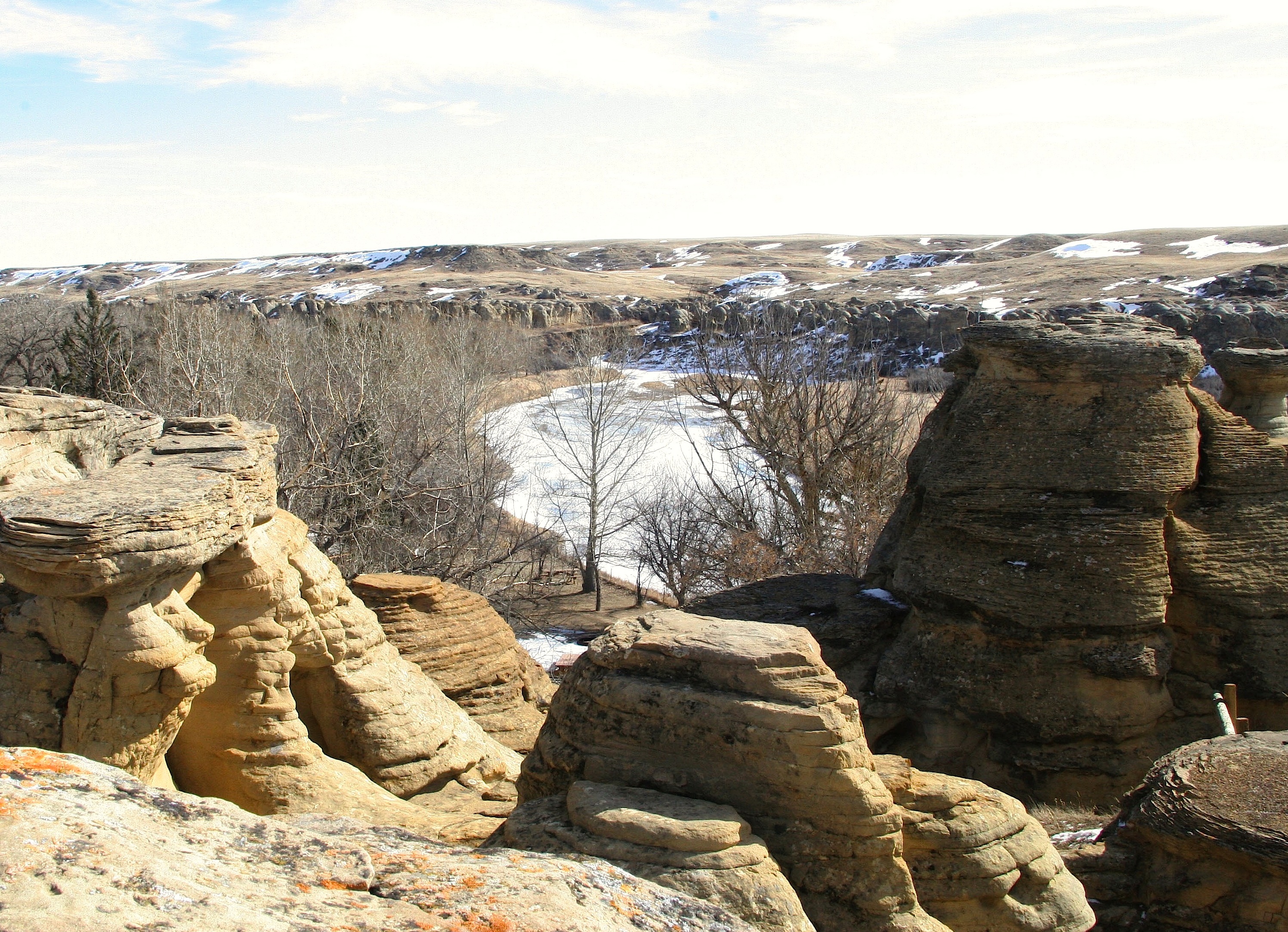
Writing-on-Stone Provincial Park
The Blackfoot call it Aisínai'pi, meaning 'it is pictured' or 'written,' and when you see the thousands of petroglyphs and pictographs carved into these sandstone cliffs, you understand why. This corner of southern Alberta, where the Milk River cuts through rolling prairie, holds the greatest concentration of rock art anywhere on the North American Great Plains. For 9,000 years, Indigenous peoples have been leaving their marks here, transforming these hoodoos and cliff faces into a sacred gallery that stretches across millennia.
Homes of Powerful Spirits
The towering sandstone hoodoos and cliffs that rise above the Milk River Valley made a profound impression on the First Nations peoples who traveled through this landscape. They believed these otherworldly rock formations were the homes of powerful spirits. The shelter of the coulees provided protection from the prairie winds, while game and berries drew nomadic bands to stop here during seasonal migrations. Evidence of their presence remains scattered across the landscape: tipi rings, a medicine wheel, and the vast galleries of rock art that earned this place its English name. The Blackfoot, Shoshone, and other nations left their stories carved and painted into these cliffs, records of hunts, battles, spiritual visions, and the journeys of those who passed through.
When Horses Changed Everything
Around 1730, horses, metal goods, and guns began appearing on the western plains, transforming Indigenous life in ways that echoed through the rock art itself. Before this time, the petroglyphs showed hunters on foot, warriors carrying body shields. After, the images shifted: hunters rode horseback, warriors depicted themselves without shields, their mobility now their greatest weapon. Horse raids became feats of bravery that gave young Blackfoot men status and prestige. The petroglyphs recorded these coups, these war honours, alongside depictions of Spirit Beings and battles between tribes. The rock walls became a timeline of cultural transformation, written in stone.
Mounties, Whiskey, and Arson
In 1887, the North-West Mounted Police established a camp at Writing-on-Stone to combat cross-border whiskey smuggling, which was devastating Indigenous communities, and to halt horse-raiding parties. The reality proved far less dramatic. The Mounties spent most of their time fighting grass fires, herding stray American cattle back across the border, and riding hundreds of uneventful kilometers on patrol. Settlers arriving before World War I provided welcome relief from the isolation. When the outpost closed in 1918, someone burned it down, the arsonist never identified. The reconstructed outpost, rebuilt between 1973 and 1975 for the NWMP centennial, now stands on its original foundations as one of the park's attractions.
Where Prairie Meets Canyon
The park protects 17.8 square kilometers of coulee and prairie habitat, a pocket of biodiversity where pronghorn antelope roam the surrounding grasslands and prairie falcons nest in the cliffs. Great horned owls, American kestrels, and cliff swallows share the skies, while tiger salamanders and plains spadefoot toads represent the amphibians. Balsam poplars and cottonwoods flourish in the coulees, alongside chokecherry, juniper, and wild rose. Even cactus survives here: prickly pear and pincushion species push the northern limits of their range. Watch your step, though. Prairie rattlesnakes call this home too, timid creatures that will strike only if threatened.
Sacred Ground, Protected Heritage
UNESCO inscribed Writing-on-Stone/Aisínai'pi as a World Heritage Site on July 6, 2019, recognizing what the Blackfoot have always known: this place holds irreplaceable value. Over 50 petroglyph sites contain thousands of individual works. Most require a guided tour to visit, a necessary protection for art that survived 9,000 years but now faces threats from vandalism and graffiti. Damaging any cultural resource here carries penalties of up to $50,000 and a year in jail. The park exists as both nature preserve and archaeological sanctuary, ensuring that these messages from the past continue speaking to future generations.
From the Air
Located at 49.07N, 111.63W in southern Alberta, approximately 100 km southeast of Lethbridge. The Milk River Valley cuts through prairie landscape, with distinctive hoodoo formations visible from altitude. Nearest airports include CYQL (Lethbridge) to the northwest. Best viewed at lower altitudes where the sandstone formations and cliff faces become apparent against the rolling grassland.