Wular Lake
Every afternoon, the wind rises over Wular Lake and the surface breaks into what Sanskrit writers called Ullola -- stormy, leaping waves that gave this body of water its name. Stretching across the floor of the Kashmir Valley near Bandipora, the lake swells from 30 square kilometers in the dry months to 189 square kilometers during the monsoon, a sixfold expansion that makes it one of the largest freshwater lakes in the Indian subcontinent. The Jhelum River feeds it from the south, and the streams Madhumati and Arin pour in from the surrounding mountains. It is a lake that refuses to hold still -- its boundaries redrawn by the seasons, its fate contested by nations.
A Name Written in Waves
The lake has carried many identities. Ancient texts called it Mahapadmasar, the great lotus lake. The Nilamata Purana, a sixth-century chronicle of Kashmir's origins, records it as Mahapadmasaras. But the name that stuck came from the water itself -- those afternoon waves, the Ullola, which over centuries softened into Wulor and then Wular. There is another explanation, too: the Kashmiri word wul means a gap or fissure, pointing to the lake's tectonic origins. The basin was not carved by glaciers or rivers but split open by the restless geology of the Himalayas, a crack in the earth that filled with water and became the valley's largest natural reservoir.
The Sultan's Island
In 1444, the Kashmiri sultan Zain-ul-Abidin ordered something audacious: an artificial island in the middle of the lake. His builders sank a spacious barge, then piled bricks and stones on top of it until the foundation rose above the waterline. On this platform the sultan erected a mosque and other buildings, naming the islet Zaina Lank -- Lanka, after the mythical island. The expense was defrayed, legend holds, by a fortunate discovery: divers brought up two solid gold idols from the lake floor. Local tradition insists that an entire city once stood where the lake now lies, ruled by a king called Raja Sudrasen, whose crimes were so great that the waters rose and drowned him along with his subjects. In winter, when the lake drops low, people have long claimed to see the ruins of a submerged temple breaking the surface.
A Wetland Under Siege
Wular Lake earned designation as a Ramsar Wetland of International Importance in 1990, recognition of its role as habitat for snowtrout species like the Sattar and Chirruh, common carp, and migratory waterfowl. But protection on paper has not matched reality on the ground. In the 1950s, willow plantations were built along the shore, draining large sections of the lake. Agricultural encroachment has converted swaths of catchment into farmland. Fertilizer runoff and animal waste pollute the water. Weed infestations choke stretches that were once open. Trash piles along the embankments and spills into the water, and sedimentation has made the lake progressively shallower. India's Environment Ministry approved a 4-billion-rupee restoration project under the National Lake Conservation Programme, which included cutting two million willow trees to reclaim lost lake area, though the project faced long delays before being scheduled in late 2011.
The Barrage That Became a Border Dispute
Since the early 1980s, India has sought to build the Tulbul Lock Project at the lake's outflow -- a barrage 439 feet long and 40 feet wide designed to regulate water levels in the Jhelum River downstream to Baramulla during lean winter months, maintaining a minimum draught of 4.5 feet for navigation. Construction began in 1984 but halted three years later when Pakistan objected, claiming the project violated the 1960 Indus Waters Treaty. India maintained the project was permissible; Pakistan argued that storage above 10,000 acre-feet for non-power purposes breached the agreement. For nearly four decades, the dispute froze the project in place. The Jhelum, which provides essential transport through the valley below Wular Lake, continued to run low each winter while engineers on both sides of the border argued over treaty language. In 2025, India placed the Indus Waters Treaty in abeyance, clearing the path to revive the Tulbul Barrage project and prepare a revised plan.
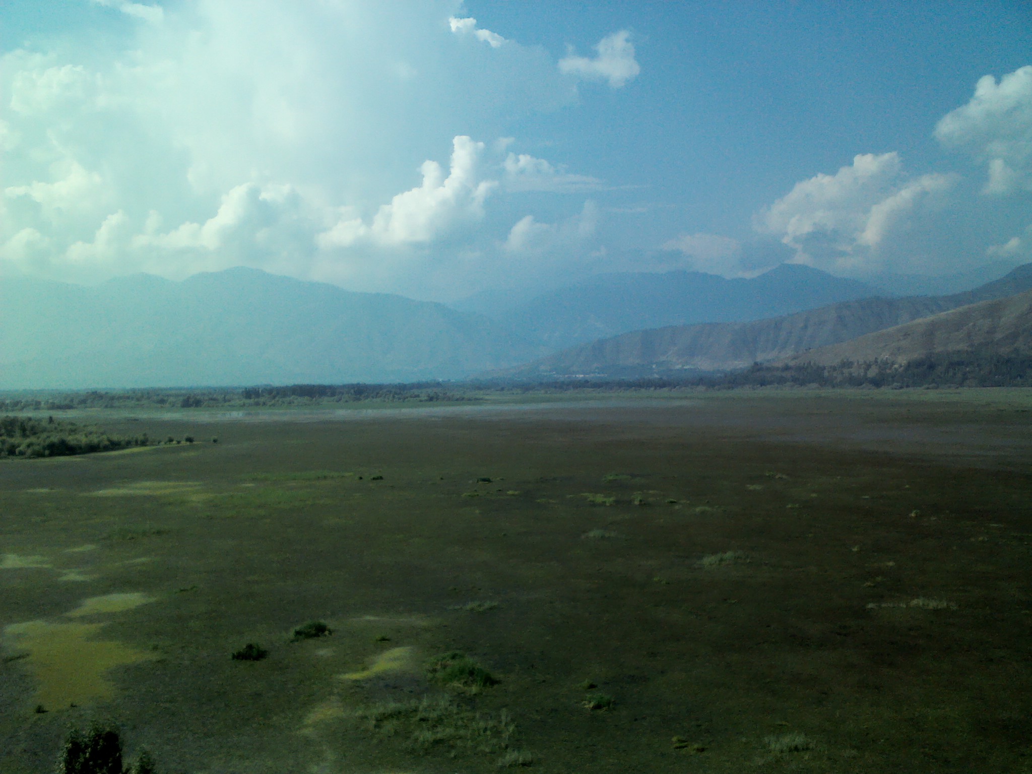
From the Air
Seen from altitude, Wular Lake is an unmistakable feature of the Kashmir Valley -- a broad, irregular sheet of water flanked by the foothills of the Pir Panjal range to the south and the main Himalayan chain to the northeast. The seasonal variation is dramatic: in summer, the lake sprawls wide and reflects the surrounding peaks, while in winter it contracts, revealing mudflats and the remnants of willow encroachment along its margins. The artificial island of Zaina Lank is visible near the center. The nearby town of Bandipora marks the eastern shore. From this vantage, the tension between the lake's ecological significance and the pressures closing in on it -- the settlements, the farmland, the planned barrage -- becomes legible in a single glance.
From the Air
Wular Lake sits at approximately 34.35N, 74.55E in the Kashmir Valley at an elevation of about 1,580 meters MSL. Visible as a large irregular lake body from cruising altitude. The nearest airport is Sheikh ul-Alam International Airport (VISR) in Srinagar, approximately 55 km to the south. The lake is flanked by the Pir Panjal range to the south and the Great Himalayan range to the northeast. Best viewed in summer months when the lake is at maximum extent.