Yamal Peninsula
In the Nenets language, Yamal means "End of the Land," and the name is literal. This 700-kilometer peninsula juts northward from Siberia into the Kara Sea like a frozen finger pointing at the pole, its tip separated from Bely Island by the narrow Malygina Strait. On a map it looks desolate, featureless. On the ground, it is anything but. Half a million reindeer move across its permafrost in seasonal migrations that have continued for millennia, guided by Nenets and Khanty herders whose knowledge of this landscape runs deeper than any satellite survey. Beneath their feet, an estimated 55 trillion cubic meters of natural gas wait in the frozen rock -- a reserve so vast it has drawn the full weight of Russian industrial ambition to one of the most remote corners of the planet.
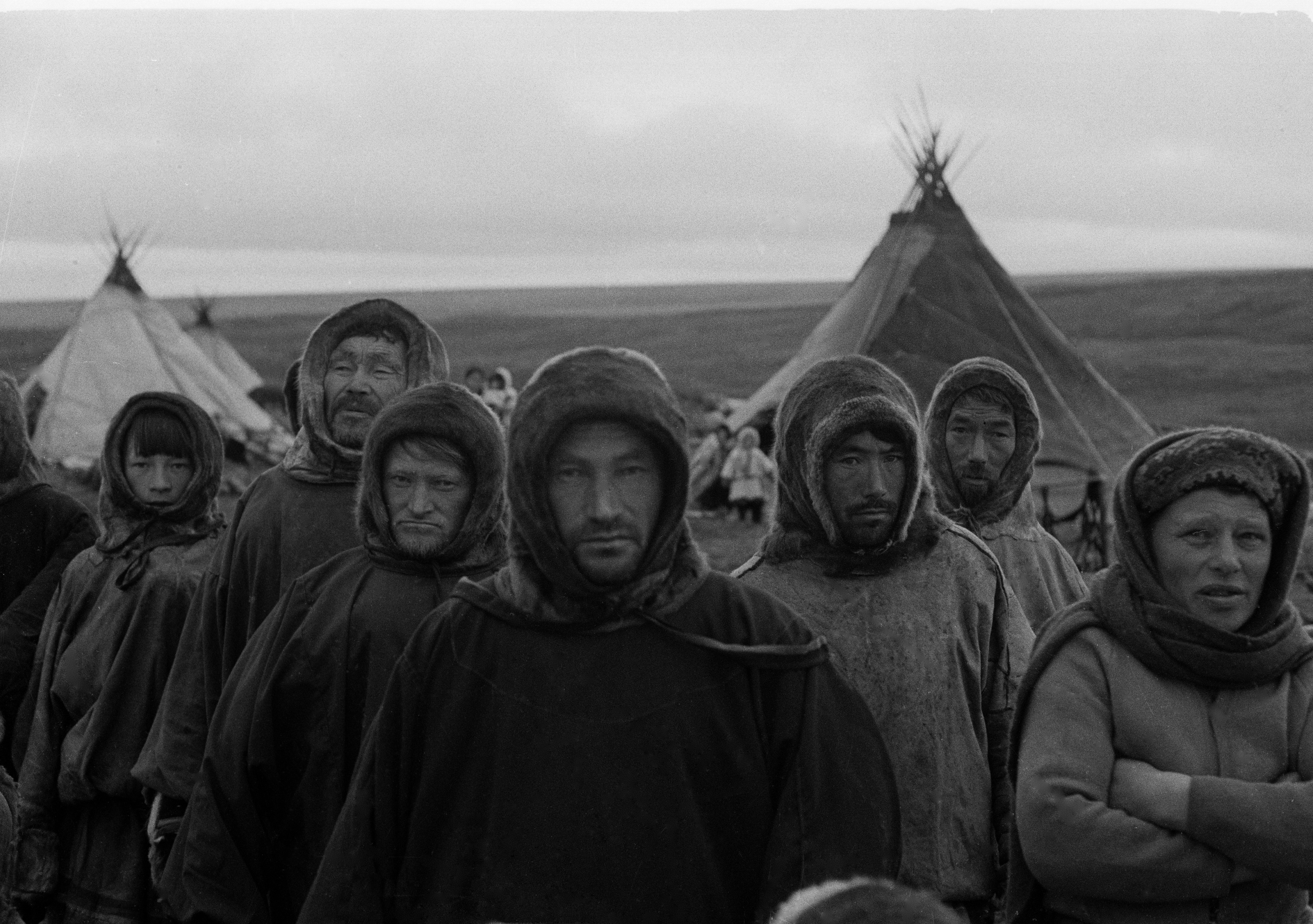
The Herders and the Land
The Yamal Peninsula belongs to the Yamalo-Nenets Autonomous Okrug of northwest Siberia, bounded by the Kara Sea and Baydaratskaya Bay to the west and the Gulf of Ob to the east. Its surface is overwhelmingly permafrost, pocked with thermokarst lakes -- bodies of water formed when underground ice melts and the ground collapses. The largest, Neito and Yambuto, sit in the central lowlands like dark mirrors reflecting endless sky. According to anthropologist Sven Haakanson, this peninsula is the place within the Russian Federation where traditional large-scale nomadic reindeer husbandry is best preserved. The Nenets herders do not simply live here; they move with the land's rhythms, migrating hundreds of kilometers each season with herds that can number in the thousands. It is one of the last great nomadic cultures on Earth, and it is under siege.
Frozen Time Capsule
In the summer of 2007, a Nenets reindeer herder named Yuri Khudi made a discovery that would captivate paleontologists worldwide. Exposed by erosion in the permafrost, the remarkably well-preserved remains of a mammoth calf lay waiting -- a female, just one month old at death, who had been frozen for 42,000 years. Scientists named her Lyuba. Her skin, internal organs, and even her mother's milk were intact, offering an unprecedented window into Pleistocene life. The peninsula's permafrost functions as a deep-freeze archive stretching back millennia. Dendrochronologists have built tree-ring records here spanning nearly 9,000 years, among the longest continuous chronologies on Earth, providing crucial data about how Siberian climate has shifted over the ages. What the permafrost preserves, it also conceals -- and what it conceals is increasingly being released.
When the Ground Explodes
In 2014, helicopter pilots spotted something baffling on the Yamal tundra: a gaping crater, roughly 60 meters across, blown into the earth as if by an explosion. Media speculation ran wild -- meteorite strike, collapsed bunker, even UFOs. Andrei Plekhanov of the Scientific Research Center of the Arctic traveled to the site and found something more alarming than any of those theories. Methane concentrations near the crater's floor were extraordinarily high. The culprit was cryovolcanism: as regional temperatures warmed, destabilized gas hydrates deep in the permafrost released enormous bursts of methane, blowing the ground apart from below. More craters followed. Another appeared in August 2020. Meanwhile, researchers from Norway's Centre for Arctic Gas Hydrate, Environment and Climate reported that permafrost extending beneath the Kara Sea seabed was also thawing, leaking methane offshore. The peninsula that preserved Lyuba for 37,000 years is now losing its grip.
The Pipeline and the Nomads
Russia's largest energy project in history bears this peninsula's name. The Yamal megaproject has transformed the landscape with infrastructure once unimaginable at this latitude: the 572-kilometer Obskaya-Bovanenkovo railway, completed in 2011, is the northernmost railway line in the world. Pipelines thread across permafrost to connect gas fields like Bovanenkovo and Yuzhno-Tambeyskoye to processing facilities and the port at Sabetta, where ice-breaking tankers carry liquefied natural gas along the Northern Sea Route. Gas reserves here represent 80 percent of Russia's total and 15 percent of the world's supply. But the industrial infrastructure that extracts this wealth cuts directly across the migration routes that the Nenets have followed for generations. Pipelines, railways, and access roads fragment the tundra. The future of one of the last great nomadic reindeer herding cultures now depends on whether industrial planning can accommodate paths that were ancient before the first drill bit turned.
Edge of the World
Viewed from altitude, the Yamal Peninsula is a study in vastness and vulnerability. Its flat, lake-dotted surface stretches to the horizon in every direction, the color palette shifting between white, brown, and brief summer green. The Ob estuary divides it from the neighboring Gyda Peninsula to the east. Bely Island floats just beyond its northern tip. From above, the reindeer migration routes are invisible, but their traces are everywhere -- trails worn into the tundra over centuries, converging and diverging with the seasons. The craters are visible, though, dark circles punched into an otherwise featureless plain. In the Nenets worldview, this was always the end of the land. What no one anticipated was that the land itself might be changing faster than any of its inhabitants -- human, reindeer, or ancient mammoth calves locked in ice -- could have predicted.
From the Air
Coordinates: 70.67°N, 70.14°E. The peninsula extends roughly 700 km north-south, visible as a broad, flat protrusion into the Kara Sea. Look for the Gulf of Ob to the east and Baydaratskaya Bay to the west. The Obskaya-Bovanenkovo railway line is visible as a thin thread running north from the coast. Nearest airport is Sabetta International (USDA) at the peninsula's northeast edge. Overflights at 10,000-15,000 ft offer the best perspective on the thermokarst lake patterns and tundra expanse. Weather is frequently overcast with low cloud ceilings; best visibility in summer months.