Yangbajain Geothermal Field
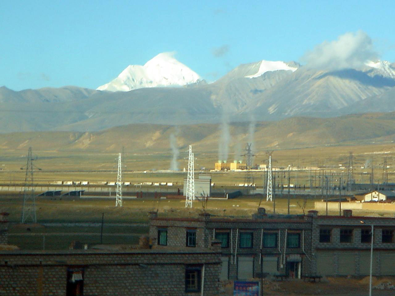
On a clear morning, steam rises from the plateau basin in columns thick enough to see from kilometers away. At over 4,000 meters elevation on the southern slopes of the Nyainqentanglha Mountains, the earth's heat breaks through in geysers, boiling springs, and a 7,300-square-meter hot water lake that never cools below 49 degrees Celsius. This is the Yangbajain Geothermal Field, the largest proven geothermal field in China and arguably the highest-altitude hot springs in the world -- a place where the boundary between geology and daily life has been erased.
Fire Beneath the Roof of the World
The heat at Yangbajain comes from deep below. A granite batholith underlies the basin, and magmatic intrusions dating back nearly 90 million years to the Yanshanian period have left the rock fractured and warm. Rain and snowmelt from the Nyainqentanglha Range seep downward through fissures, heating as they descend. A drill hole in the northern part of the field reached 2,006 meters and found thermal fluid at 329 degrees Celsius -- hot enough to melt lead. The shallow reservoir, covering 14.8 square kilometers, holds water at up to 165 degrees. The deep reservoir, at 3.8 square kilometers below 750 meters, reaches that extraordinary 329 degrees. The field covers 40 square kilometers in total and delivers natural thermal energy at the surface of up to 107,000 kilocalories per second.
Powering a Capital
The Yangbajain Geothermal Station, established in 1977, was the first geothermal power station built in Tibet and remains the largest geothermal steam power plant in China. By 1981, 4,000 kilowatts of electricity were flowing to Lhasa along a transmission line running southeast along the Duilong River. For nearly two decades, this was the main source of power for Tibet's capital, until the Yamdrok Hydropower Station came online in 1998. By 2000, eight steam turbine generators with a combined capacity of 25 megawatts were producing roughly 100 gigawatt-hours annually. But the shallow reservoir was losing pressure. Workers were drawing 1,200 tons of water per day, and the turbines could no longer run at full capacity. Deeper wells began reaching toward the hotter fluid below.
Where Tourists Soak at 4,000 Meters
Alongside the industrial infrastructure, Yangbajain has become a tourist destination. A government-developed resort opened in 1998, offering hot spring baths reputed to have curative powers. Two warm indoor pools and an outdoor pool let visitors soak while the Nyainqentanglha Mountains fill the horizon. To the east of the geothermal ground, the hot water lake steams visibly into the thin air -- at 15.5 meters deep, it is not a puddle. Local people have carved their own bathing pools along the lake's western shore. The Qinghai-Tibet Highway passes nearby, and the Qinghai-Tibet Railway, which terminates in Lhasa, runs through Yangbajain, making the field accessible to travelers on what many call the world's most dramatic train journey. The geothermal energy also powers greenhouses, an unlikely sight on the barren plateau.
The Cost Downstream
The Duilong River carries more than electricity transmission lines alongside it. A 2015 study found that arsenic levels in the river during the non-monsoon season reached 205.6 micrograms per liter -- more than twenty times the World Health Organization's guideline of 10 micrograms per liter for drinking water. The source appears to be untreated water discharged from the Yangbajain power station. The contamination is detectable 90 kilometers downstream. Tibet's rivers are generally considered among the cleanest in China, which makes the Duilong an uncomfortable exception. The geothermal field that lit Lhasa's homes and filled tourists' baths also introduced a pollutant into a river system that communities depend on -- a tension between energy, development, and environmental cost that plays out across the world but feels particularly stark on the Tibetan Plateau.
Geology as Landscape
Yangbajain sits within the Himalayan Geothermal Belt, in the Lhasa-Gangdise terrane, between the Nyainqentanglha Range to the northwest and the Yarlu-Zangbo suture zone to the south. The basin itself is a semi-graben, a depression formed by a detachment fault that began developing about 8 million years ago. The rocks exposed at the surface tell a story spanning hundreds of millions of years: metamorphosed Paleozoic formations, Paleogene volcanic debris, Neogene conglomerates, and Quaternary glacial deposits. The field's estimated power generation potential is 150,000 kilowatts -- six times its current output. What rises as steam into the cold plateau air is only a fraction of the energy stored in the fractured rock below, where water has been circulating and heating for longer than humans have existed.
From the Air
Yangbajain Geothermal Field is located at 30.10°N, 90.51°E in Damxung County, Tibet, on the southern slopes of the Nyainqentanglha Mountains. Elevation approximately 4,300 m (14,100 ft). The Qinghai-Tibet Highway (China National Highway 318) passes nearby. The nearest major airport is Lhasa Gonggar Airport (ZULS), approximately 100 km to the southeast. Steam plumes from the geothermal field may be visible from altitude on clear days. The hot water lake to the east of the field is a notable landmark.