Yangmingshan National Park
The smell reaches you before the view does. Sulfur -- sharp, unmistakable, rising from vents that have been exhaling since long before humans arrived in this corner of Taiwan. At Xiaoyukeng, the best-known fumarole field in Yangmingshan National Park, gases hiss from cracks in the earth, hot springs discharge streams of boiling water, and bright yellow sulfur crystals catch the light like something precious spilled from underground. This is the volcanic heart of Taipei's backyard, a collection of peaks and craters just northeast of the capital where the island's geological violence is not ancient history but an ongoing performance.
Grass Mountain, Philosopher's Mountain
The peaks were originally called Caoshan -- Grass Mountain -- a name given by locals for the tall silvergrass that waves across the highest slopes like a silver sea. After the Nationalist government retreated to Taiwan in 1949, Chiang Kai-shek renamed the mountains Yangmingshan after Wang Yangming, a Ming Dynasty philosopher who lived from 1472 to 1529 and whose teachings on the unity of knowledge and action Chiang admired. The park was formally established in 1985, encompassing the Datun Volcano Group and its surrounding forests and hot springs. Today the tallest peak, Mount Qixing -- Seven Star Mountain -- rises to 1,120 meters, making it the highest point within Taipei City's administrative boundaries.
Two Worlds, One Thousand Meters
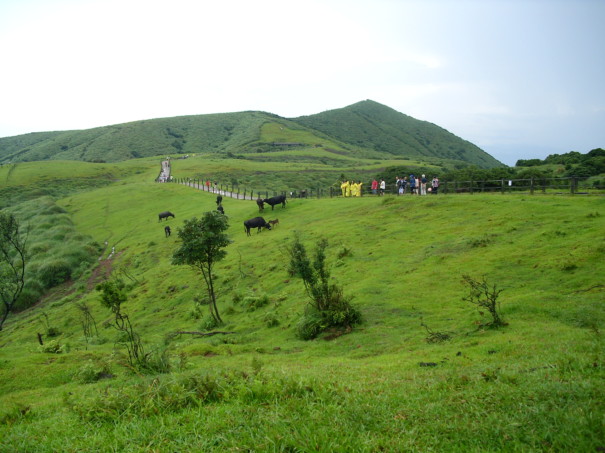
The park splits into two ecological zones along an invisible line at roughly 1,000 meters elevation. Below it, subtropical rainforest crowds the slopes with dense canopy and dripping ferns. Above it, the landscape transforms: scrubby trees give way to windswept grasslands and clumping silvergrass, and the air thins enough that hikers notice the effort. The trails are paved with basalt, steep in places, and treacherous in rain. Regulars include elderly locals who make the climb weekly and pass younger visitors with barely a nod. At Qingtiangang, a broad lava terrace north of Mount Zhugao, the terrain flattens into an undulating grassland several kilometers across, ringed by peaks above 800 meters. Cattle once grazed here under the Taipei City Agricultural Association's watch. Now it draws picnicking families and students.
Milk Lakes and Sulfur Dreams
Yangmingshan's volcanic features are not relics. They are active. At Lengshuikeng -- Cold Water Pit -- sulfurous gases vent into a marshy lake, turning the water opaque and milky white. The sulfur gradually precipitates, forming whitish-yellow and pale gray layers on the lake bed. Despite its volcanic origin, the water hovers around 40 degrees Celsius, cool enough that the park maintains two hot springs pools and a foot-soaking pool for visitors. In spring, migratory barn swallows arrive at Lengshuikeng, their white bellies flashing as they eat on the wing, gathering mud for nests between meals. The resident Pacific swallows, bellies brownish-gray, stay year-round. At Xiaoyukeng, the volcanic display is more dramatic: sulfur vents roar, boiling springs flow endlessly, and the crystals that form on the rocks are genuinely beautiful -- nature's jewelry, created by the same forces that could one day reshape the entire landscape.
Old Trails, Living Memory
Before the park was a park, these mountains were a working landscape. The Jinbaoli Trail -- also known as the Old Fish Trail -- was built as a shortcut for carrying fresh fish from the coastal town of Jinshan over the mountains to the markets of Shilin, Dalongdong, and Dadaocheng. Porters walked it loaded with the day's catch, racing to get the fish to buyers before it spoiled. The trail still exists, in good condition, winding past old cultural sites and through scenery that has changed little since the days of the fish carriers. The Tianmu Trail climbs from the Tianmu neighborhood up a stairway of roughly a thousand steps, passing a historic water pipeline built in the 1940s. At the top, the stairs give way to flat forest paths and clean mountain air. It has become one of Taipei's most popular day hikes -- a thousand steps between the city's noise and the silence of the canopy.
The Escape Valve
Yangmingshan is the first place Taipei residents think of when the city becomes too much. The park is reachable by public bus in 40 minutes from Taipei Main Station, and there is no entrance fee. For the price of a bus ticket, you can soak in a milky sulfur bath, hike to a summit with views in every direction, or simply sit in the azalea restoration area on Mount Datun and watch rhododendrons bloom in spring. The park's proximity to a capital of nearly seven million people means it is never truly empty, but the mountains absorb the crowds the way they absorb the rain -- with patience and an indifference that predates the city by geological ages.
From the Air
Located at 25.17°N, 121.56°E, the park covers the Datun Volcano Group directly northeast of Taipei city center. Mount Qixing (1,120 m) is the dominant peak, identifiable from the air by its twin summits. Fumarole fields at Xiaoyukeng produce visible steam plumes. Nearest major airport is Taipei Songshan (RCSS), approximately 12 km south. Taiwan Taoyuan International Airport (RCTP) lies roughly 35 km southwest. Best viewed at 5,000-8,000 ft altitude approaching from the south over Taipei, where the volcanic peaks rise sharply from the urban plain.