Yehliu
The Spanish called it Punto Diablos, the Devil's Point, and the name suited a cape that seems designed to unsettle. Yehliu juts 1,700 meters into the sea from Taiwan's northern coast, a narrow finger of Miocene sandstone lined with rock formations that look like they belong on another planet. Mushroom-shaped hoodoos stand in rows like alien sentinels. Honeycombed boulders dissolve in slow motion. And at the center of it all, a slender stone figure resembling a woman's profile has become one of the most photographed natural landmarks in East Asia. The Queen's Head is losing her neck, millimeter by millimeter, and the clock is running.
Deep Time on Display
The Yehliu Promontory is part of the Daliao Miocene Formation, a geological layer deposited roughly five to twenty-three million years ago when this stretch of coast lay beneath a shallow sea. Tectonic forces later pushed the Datun Mountains skyward, and the promontory emerged as a narrow ridge of sedimentary rock extending into the ocean. What makes Yehliu extraordinary is what happened next. Millennia of wind, rain, salt spray, and wave action carved the exposed sandstone into an outdoor gallery of hoodoo stones, geological formations where a harder capstone protects softer rock beneath, creating mushroom and pedestal shapes. The process is ongoing. Every typhoon season reshapes the cape, and formations that existed a century ago have since collapsed or transformed beyond recognition.
Her Majesty's Eroding Neck
The Queen's Head is a natural rock formation that took over 4,000 years to achieve its current profile: a narrow neck supporting a head-shaped mass of harder stone, the whole assembly bearing an uncanny resemblance to a woman's silhouette. The neck measures roughly 125 centimeters in circumference — as of 2017 — and shrinks by roughly one centimeter per year from wind erosion and salt weathering. Simple arithmetic delivers a sobering conclusion. The formation has become an iconic image in Taiwan, an unofficial emblem of the town of Wanli, and one of the most visited natural landmarks in the country. Its fragility is part of its appeal and its tragedy. Authorities have installed a protective stone collar, a kind of geological necklace, to slow the erosion. A successor formation called the Princess' Head has been designated nearby, chosen partly to divert tourist attention and reduce the foot traffic that accelerates the original's deterioration.
The Geopark's Strange Garden
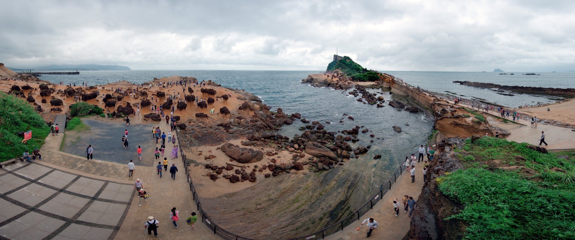
The Yehliu Geopark, operated by the North Coast and Guanyinshan National Scenic Area administration, preserves and provides access to the cape's formations. Visitors walk among rocks that have been given fanciful names based on their shapes: the Fairy Shoe, the Beehive, the Ginger Rocks, the Sea Candles. Each name reflects a moment of human pattern recognition imposed on millions of years of geological process. The Beehive formations, pocked with small cavities from differential erosion, cluster along the cape's edges. The Sea Candles, narrow pillars of stone, stand near the waterline where wave action continues to sculpt them. Together, they form a landscape that feels curated, as if some vast intelligence had arranged the pieces for maximum strangeness. In reality, the curator is entropy, and the exhibition is temporary.
Devil's Point from the Air
From above, Yehliu reveals its full geometry: a thin promontory extending from the coastline like a breakwater, surrounded by the dark blue of the East China Sea. The Wanli District stretches inland behind it, backed by the volcanic mass of the Datun Mountains. The geopark occupies the cape's tip, where the rock platforms are most exposed. On clear days, the hoodoo formations cast long shadows across the flat stone surfaces, creating a texture visible even from moderate altitude. The cape's orientation means it catches the full force of northeast monsoon winds during winter, the same winds that have spent millennia carving the stone into shapes that draw more than a million visitors each year.
From the Air
Located at 25.2139N, 121.6984E on the northern coast of Taiwan in Wanli District, New Taipei. The cape is a distinctive narrow promontory extending roughly 1,700 meters into the East China Sea, clearly visible from the air. Best viewed at 1,500-3,000 feet to appreciate the cape's geometry against the coastline. Nearest airports are Taipei Songshan (RCSS), approximately 20 nm south-southeast, and Taiwan Taoyuan International (RCTP), approximately 22 nm southwest. The Kuosheng Nuclear Power Plant is visible along the same stretch of coast to the southwest. Datun Mountain provides a strong inland visual reference.