Yola
The name gives it away. In Fulfulde, the language of the Fulani people, Yola -- or more precisely, Yoola -- means "Great Plain." The city sprawls across the hillside of northeastern Nigeria, capital of Adamawa State, split into two distinct halves that have never quite merged. Old Yola is where the Lamido, the traditional emirate ruler, still resides. Five kilometres to the northwest, Jimeta is the administrative and commercial centre, connected to the Benue River by a port that once gave the city its economic reason for existing. Between them, 337,000 people as of 2010, living in a city that claims two Nigerian firsts: the country's first airport and the first town to receive electricity.
The Learned One's Fortress
Yola was founded in 1841 by Modibbo Adama, whose honorific title -- Modibbo, the Fulani word for "Professor" -- reflected both his Islamic scholarship and his martial ambition. Recognized by Shehu Usman Dan Fodio during the early nineteenth-century Fulani jihad, Adama was charged with leading the faithful in the Upper Benue area. He established Yola as the political centre of the Adamawa Emirate, a base from which he launched campaigns against the indigenous Bata and Vere peoples. The emirate that grew from this founding lasted as an independent Fulani state until the British took control in 1901. A decade after that, the first European to see the area had already come and gone: Heinrich Barth arrived in 1851, travelling the Sahara route through Kukawa near Lake Chad, which was then the capital of the Borno Empire. Barth's journals remain among the earliest European accounts of the region.
A City of Two Centres
The split between Old Yola and Jimeta defines daily life. Jimeta, built around the river port 9 kilometres north-northwest of the old town, handles the buses, the markets, and the commercial traffic. Taxis and buses radiate outward from here: north to Mubi and Maiduguri, west to Numan and Gombe, south to Makurdi. Cross-border taxis run to Garoua in Cameroon. Yola International Airport connects the city to Abuja, Kano, Maiduguri, and Lagos -- flights to the capital take just over an hour. Old Yola, meanwhile, retains the character of a traditional seat of power. The ethnic texture is rich: Fulbe, Yungur, Kilba, Higgi, Hausa, Bata, Yoruba, Kanuri, and Igbo communities all coexist here. Educational institutions have become a defining feature -- the American University of Nigeria, Modibbo Adama University of Technology, Adamawa State Polytechnic, and one of the six campuses of the Nigerian Law School all operate in the city.
Three Sisters and Fishing Nets
An hour's drive from the city, the Three Sisters mountains rise from the landscape of Song local government area. The three peaks lean inward to the right as you approach, a visual trick that makes them appear to be conspiring. Only the leftmost peak can be climbed. Further afield, the Mandara Mountains extend 190 kilometres along the Cameroon-Nigeria border, a volcanic range that frames the northern horizon. The Kiri Dam, built in 1982 across the Gongola River in Shelleng, impounds 615 million cubic metres of water to irrigate the vast Savannah Sugar Company plantations. But the event that draws the largest crowds is the Njuwa fishing festival, an annual tradition of the Buatiye (Bata) people held when water levels in the lake drop low enough, usually in April. For two days, fishermen compete using nets, bare hands, and hollowed gourds, while the surrounding villages stage traditional dances, tug-of-war contests, boat races, and swimming competitions.
Resilience on the Benue
Yola's modern history has not been gentle. On 17 November 2015, a suicide bombing killed more than 30 people in the city, a reminder that northeastern Nigeria's security challenges reach even its state capitals. Adamawa State was carved from Gongola State in 1991, and Yola inherited the role of capital for a region that stretches from the Benue River valley to the Cameroonian highlands. The city's yearly average temperature of 30.81 degrees Celsius -- slightly above the national average -- keeps the air heavy and warm for most of the year. But the Benue itself, flowing 800 kilometres above its confluence with the Niger, gives the city a riverine character that distinguishes it from the drier Sahelian cities to the north. Jimeta's port, though diminished from its peak, still connects Yola to a network of river commerce that has sustained the region since long before Modibbo Adama chose this vast plain as the seat of his emirate.
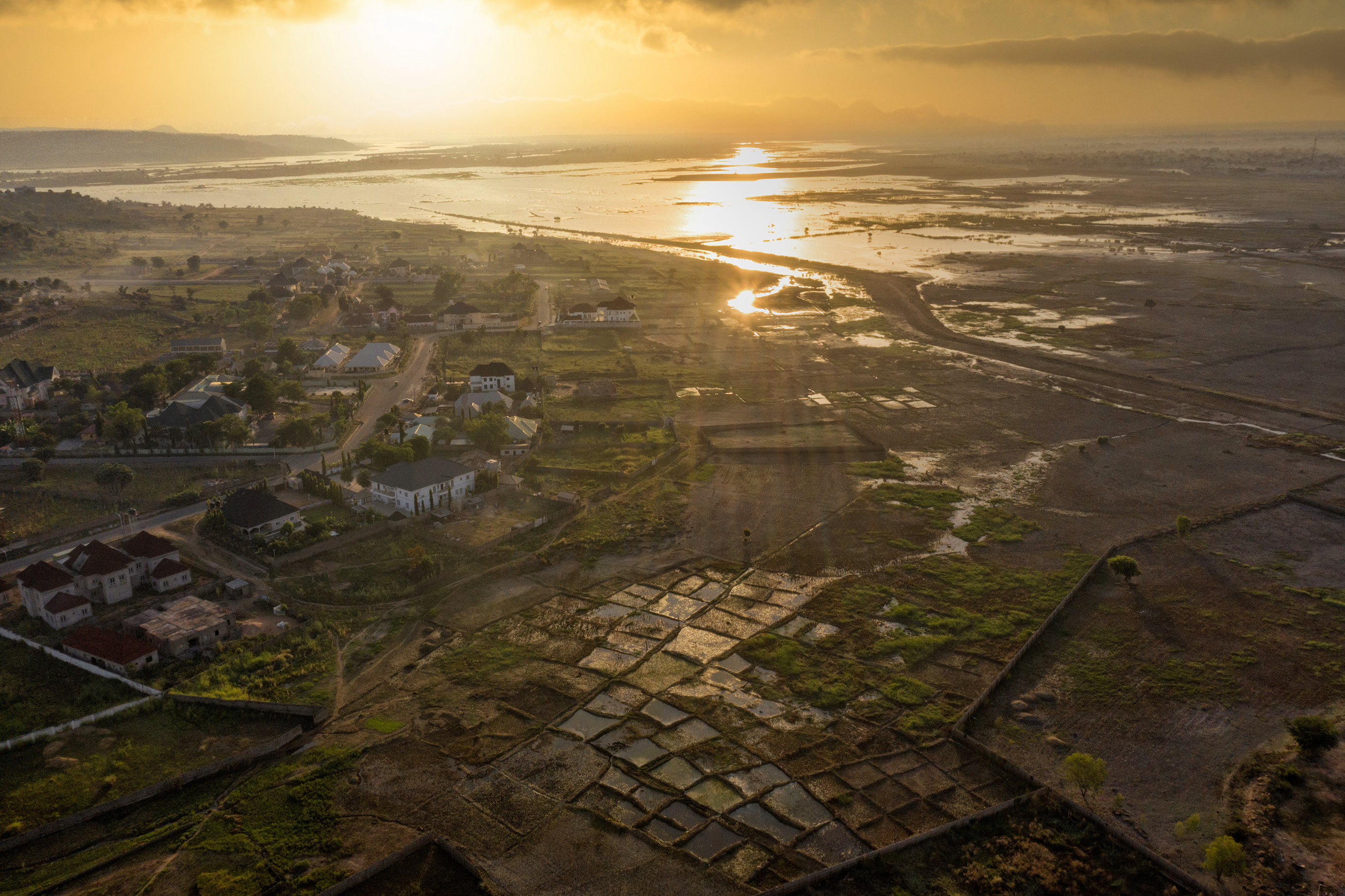
From the Air
Located at 9.20N, 12.48E in Adamawa State, northeastern Nigeria. Yola International Airport (DNYO) sits approximately 10 km north of the city centre on the road to Mubi. The city is clearly visible along the Benue River, with the split between Old Yola to the south and Jimeta to the northwest apparent from altitude. The Mandara Mountains are visible along the Cameroon-Nigeria border to the north. The Three Sisters mountains in Song LGA and the Kiri Dam on the Gongola River are notable landmarks in the surrounding area. Garoua, Cameroon (FKKR) is accessible by road to the east.