Yolla Bolly-Middle Eel Wilderness
The Wintun people who lived in these mountains named them 'Yo-la Bo-li': snow-covered high peaks. The name has survived longer than the people who gave it, now attached to one of California's largest and least-visited wilderness areas. The Yolla Bolly-Middle Eel Wilderness sprawls across nearly 180,000 acres of rugged terrain where the southern Klamath Mountains collide with the Inner Coast Ranges, protecting the headwaters of five rivers and harboring the westernmost stand of quaking aspen in North America.
Origins of Wild
In 1927, U.S. Chief Forester William Greeley directed forest supervisors across the nation to identify areas suitable for a new classification: wilderness. By 1929, fourteen areas in California's Region 5 forests were proposed for protection under what became known as the L-20 Regulations. The rules called for maintaining 'primitive conditions of environment, transportation, habitation, and subsistence' for public education and recreation. Of the three new primitive areas designated in northern California, the Middle Eel-Yolla Bolly was the largest. Federal protection became permanent with the Wilderness Act of 1964, and subsequent legislation in 1984 and 2006 expanded the area to its current size: 172,998 acres managed by the US Forest Service across three national forests, with additional acreage under Bureau of Land Management control.
Where Rivers Begin
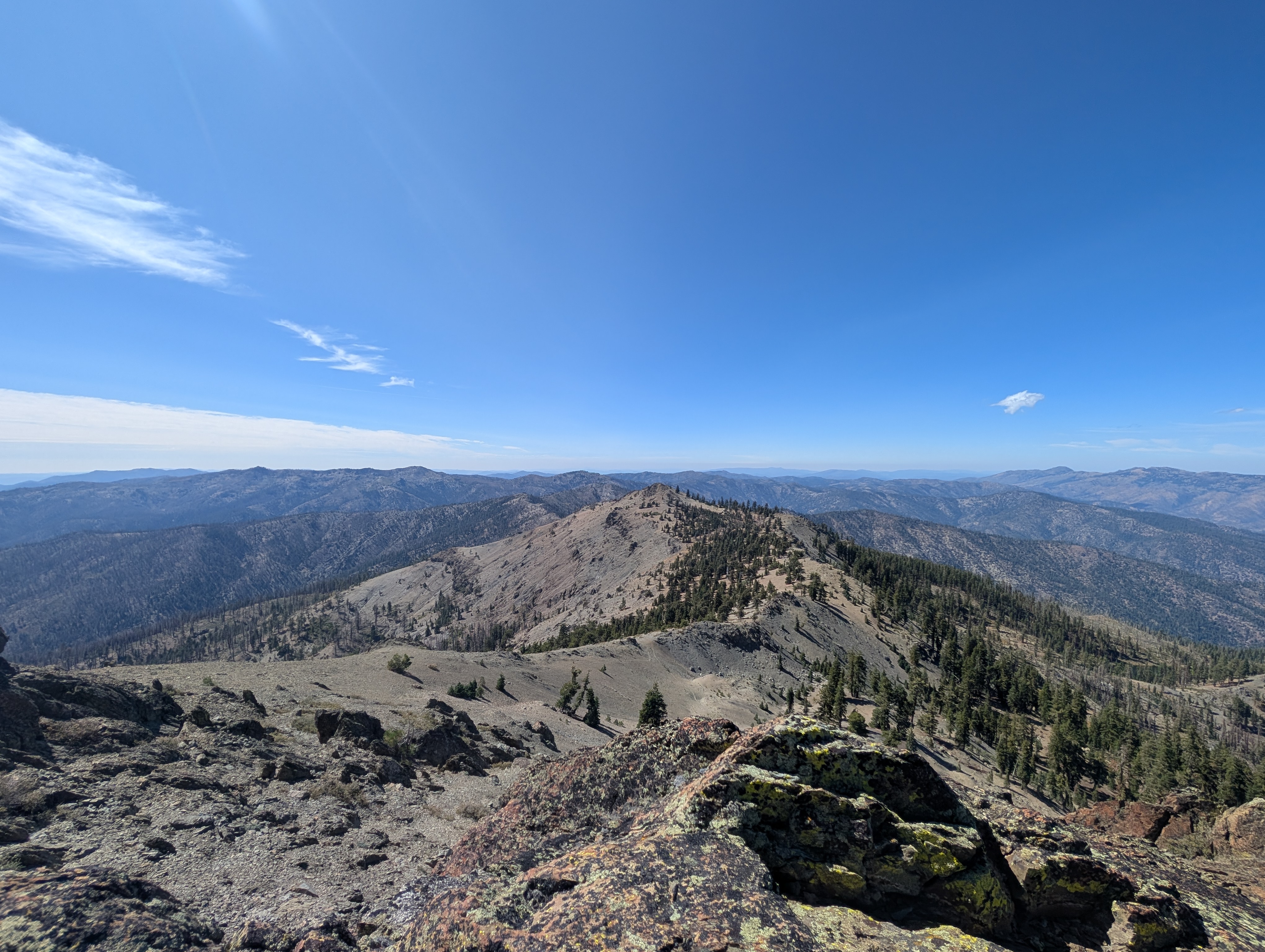
The rugged topography of the Yolla Bolly-Middle Eel Wilderness protects something increasingly rare: intact headwaters. The Middle Fork and North Fork of the Eel River begin here, as do the Mad River, the South Fork of the Trinity River, and its eastern tributary. On the eastern slopes, Cottonwood and Thomes Creeks gather snowmelt that eventually reaches the Sacramento River. Both the Middle and North Forks of the Eel carry Wild and Scenic River designation, as does the South Fork of the Trinity. Glaciers carved cirque basins near the highest peaks, leaving behind shallow lakes fed by countless springs: North Yolla Bolly Lake, Black Rock Lake, Square Lake, Long Lake. Mount Linn rises to the highest point in the wilderness, anchoring a landscape where water flows in every direction.
A Forest of Survivors
The Cedar Basin area holds the westernmost stand of quaking aspen in North America, trees that found refuge here while their relatives retreated eastward during climatic shifts. Shell Mountain's southern slopes shelter a rare grove of juniper. The wilderness supports Coast Range and Klamath montane forest types: Douglas fir, ponderosa pine, red fir, white fir, the rare western white pine, sugar pine, incense cedar, Pacific yew, and the California endemic foxtail pine. Below the tree line, wet meadows and open grasslands sustain abundant deer herds. Lower elevations give way to chamise, manzanita, and ceanothus chaparral. Rainbow trout swim in the larger streams and Black Rock Lake. The Middle Fork Eel and South Fork Trinity watersheds still support summer and winter steelhead runs, plus spring and fall chinook salmon.
Unstable Ground
The rocks here tell a story of collision and upheaval. The northern mountains are predominantly gray greenstone, while the southern ranges expose sandstone and serpentine of the Franciscan formation. Extensive faulting makes the region prone to erosion, slumping, and landslides. One modern slide near Ides Cove, on the north flank of Mount Linn, traveled more than two miles toward South Fork Cottonwood Creek, upending old-growth forests and leaving large fissures along its margins. Cirque basins from ancient glaciers appear above higher elevations, remnants of ice ages that sculpted the peaks into their current forms. The northern tip of the wilderness, around Black Rock Mountain and North Yolla Bolly Peak, crosses into the Klamath Mountain Range proper.
Solitude and Access
Fifteen trailheads ring the wilderness boundary, yet visitor use remains among the lowest of any designated wilderness in California. Hunters dominate the autumn months, seeking black bear, Roosevelt elk, and black-tailed deer across the remote ridges. The Ides Cove Loop Trail stretches over scenic miles and marks the southern terminus of the Bigfoot Trail, a 360-mile route traversing the Klamath Mountains to Redwood National Park. Paved roads from Ruth reach the northwest side. Passenger vehicles can access the south boundary from Covelo and the eastern boundary from Corning or Red Bluff off Interstate 5. Wildlife includes mountain lion, bobcat, gray fox, northern flying squirrel, fisher, and marten. Northern spotted owls call from the old-growth stands. On rare occasions, wild horses and wild turkeys have been spotted in the backcountry.
From the Air
The Yolla Bolly-Middle Eel Wilderness centers around 40.06 degrees N, 123.22 degrees W, spanning eastern Mendocino County, western Tehama County, and Trinity County. Mount Linn marks the high point. The wilderness lies northeast of Covelo, west of Red Bluff and Interstate 5, and east of Garberville and Highway 101. Approach from the east via Red Bluff for the clearest views of the main ridge. The nearest airports are Red Bluff Municipal (KRBL) to the east and Ukiah Municipal (KUKI) to the south. Expect rugged terrain with elevations ranging from valley floors to well over 8,000 feet. Mountain weather can change rapidly; maintain safe altitude over the peaks.