Yoshino-Kumano National Park: Cherry Blossoms, Sacred Water, and Ancient Stone
The park does not make sense on a map. Established in 1936, Yoshino-Kumano National Park is scattered across the Kii Peninsula in non-contiguous pieces, as if someone dropped a handful of protected zones across three prefectures -- Mie, Nara, and Wakayama -- and let them land where the sacred places already were. That is roughly what happened. This is not a park drawn around scenery for its own sake. It is a park drawn around places where, for over a thousand years, the Japanese have gone to encounter the divine: a mountain where 30,000 cherry trees bloom in waves from base to summit, a waterfall worshipped as a god, gorges where volcanic cliffs plunge into pools of impossible blue-green water, and forest trails walked by emperors and monks since the eighth century. The park encompasses elements of the UNESCO World Heritage Site "Sacred Sites and Pilgrimage Routes in the Kii Mountain Range," and understanding it means understanding that in Japan, the line between natural wonder and holy ground has never existed.
Thirty Thousand Trees in Bloom
Mount Yoshino, in Nara Prefecture, is the park's most celebrated feature and Japan's most famous cherry blossom site. Over 30,000 cherry trees cover the mountainside in four distinct zones: Shimo-Senbon (the lower thousand), Naka-Senbon (the middle thousand), Kami-Senbon (the upper thousand), and Oku-Senbon (the inner thousand). In spring, the blossoms ignite from the bottom of the mountain upward over roughly two weeks, a slow-motion pink wave climbing the slope. The tradition of planting cherry trees here is itself a religious act -- the trees were originally planted as offerings to the deity of Kinpusen-ji Temple, the spiritual heart of Shugendo mountain asceticism. Standing on Mount Yoshino during peak bloom, watching the entire valley fill with pale pink and white, you are looking at what is simultaneously a natural spectacle and a thousand years of accumulated prayer.
The Waterfall That Is a God
At the park's southeastern edge, Nachi Falls drops 133 meters in a single uninterrupted plunge -- the tallest such waterfall in Japan. The falls are 13 meters wide, and the volume of water pouring over the cliff face shifts with the seasons, from a thundering curtain after the summer rains to a delicate silver thread in the dry months. Nachi Falls is not merely adjacent to the sacred. It is the sacred. Kumano Nachi Taisha, one of the three grand shrines of the Kumano Sanzan, enshrines the waterfall itself as a deity named Hiryu Gongen, the flying dragon incarnation. On the first day of each month, Shinto priests descend to the base of the falls to offer flowers to the cascading water. The primeval forest surrounding the falls, protected as the Nachi Primeval Forest, contains towering cryptomeria trees that have stood here for centuries, their canopy filtering the light into green cathedral columns above the spray.
Rivers Through Volcanic Stone
The Dorокyo Gorge, carved by the Kitayama River, reveals the peninsula's geological history in sheer cliff faces. The gorge is divided into three sections -- Oku-Doro, Kami-Doro, and Shimo-Doro -- each with its own character. Vertically sheared walls, created through the erosion of geological layers formed by the solidification of magma, rise directly from pools of water so clear the stone is visible at depth. Oddly shaped rocks punctuate the riverscape. The best way to experience the gorge is by jet boat, cutting between walls that seem to close in overhead, or on traditional log rafts that ride the current through rapids. Elsewhere in the park, Mount Odaigahara reaches 1,695 meters and receives some of the heaviest rainfall in Japan, creating a moss-draped subalpine landscape often shrouded in mist. Mount Omine, sacred to Shugendo practitioners, remains closed to women by religious tradition -- one of the last such prohibitions in Japan.
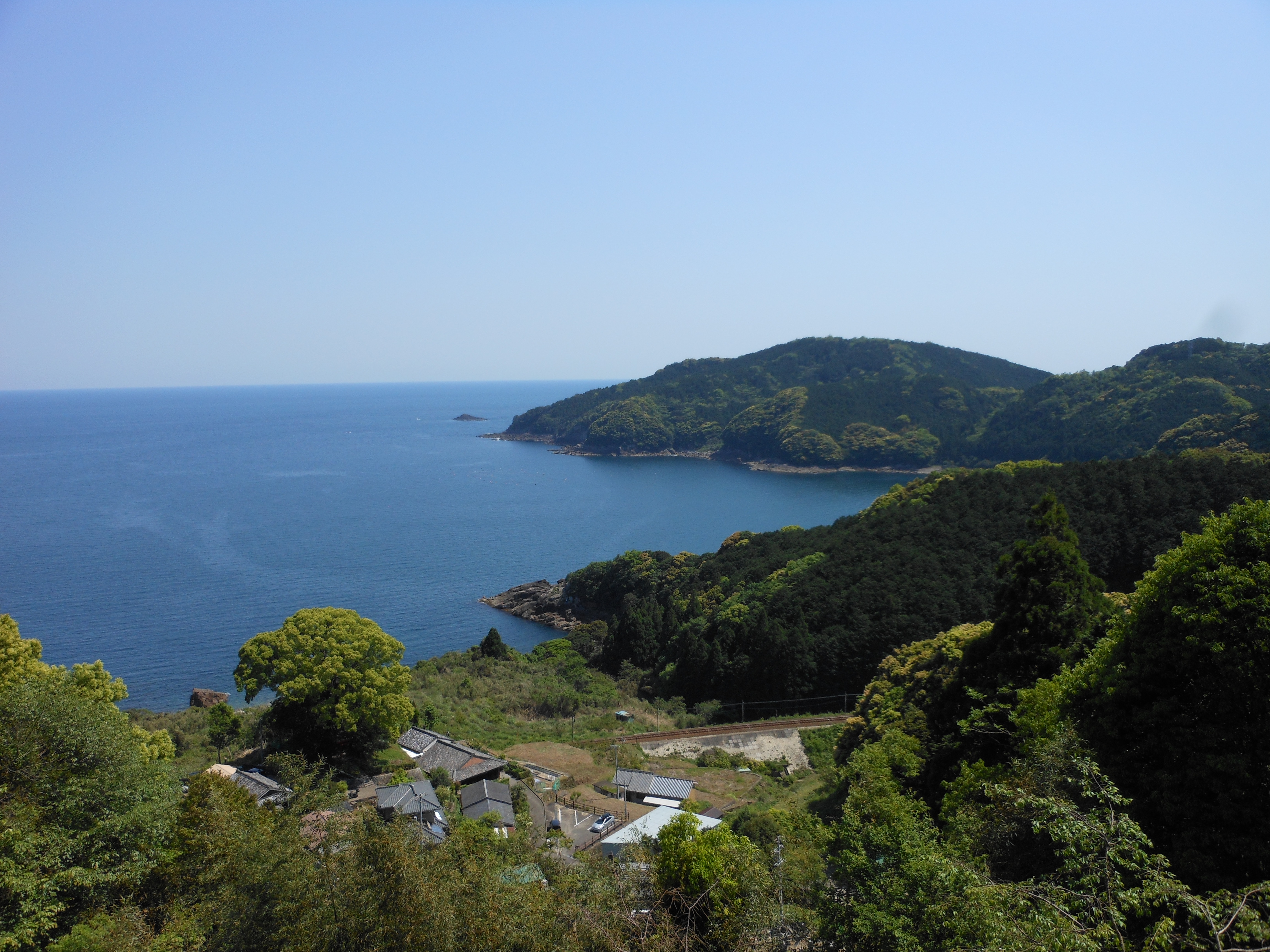
A Park in Pieces
The park's fragmented geography tells its own story. It spans the borders of five cities, seven towns, and six villages, from the mountain temples of inland Nara to the Pacific coastline of Mie and Wakayama. The separate parcels include Kushimoto Marine Park at the peninsula's southernmost tip, where warm Kuroshio Current waters support coral reefs and subtropical marine life -- a world away from the misty mountain forests just kilometers inland. This patchwork design preserves the actual pattern of sacred geography on the Kii Peninsula, where holy places are not concentrated in one valley but scattered across the landscape, connected by pilgrimage routes that turn the journey between them into the spiritual practice itself. Kumano Hongu Taisha, the head shrine of the Kumano Sanzan and the destination of every Kumano Kodo pilgrimage route, sits within the park's boundaries. So do sections of those ancient trails. The park does not impose order on the landscape. It follows the order the pilgrims established a thousand years ago.
From the Air
Yoshino-Kumano National Park spans non-contiguous areas across the Kii Peninsula, centered approximately at 33.80N, 135.94E, across Mie, Nara, and Wakayama Prefectures. Key visual landmarks from altitude include Mount Yoshino (in the north, famous cherry blossom coverage visible in spring), Nachi Falls (133m waterfall on the southeastern coast near Nachikatsuura), and the deep Dorокyo Gorge along the Kitayama River. The terrain is heavily mountainous with dense forest cover. Nearest airport is Nanki-Shirahama Airport (RJBD) on the southwestern coast. Kansai International Airport (RJBB) is approximately 130 km northwest. The coastline along Kushimoto at the peninsula's southern tip provides dramatic visual contrast between Pacific Ocean and mountain interior. Best appreciated at 5,000-10,000 feet AGL traversing the peninsula from coast to interior.