Yumeshima: Osaka's Dream Island
The name means "Dream Island," which is exactly the sort of aspirational branding you give a place built from garbage. Yumeshima sits in Osaka Bay at the mouth of the Yodo River, a 390-hectare slab of reclaimed land in Konohana ward that began life in 1977 as a licensed landfill site. For fourteen years, barges dumped waste onto the bay floor. Then, in 1991, engineers began reshaping the refuse into something more permanent -- a land creation project that would take decades to complete. By 2002, the island had its first container terminal and the striking Yumemai Bridge connecting it to neighboring Maishima. By 2025, it held a World Expo. The trajectory from waste dump to world stage is the most Osaka story imaginable: pragmatic, ambitious, and slightly improbable.
From Waste to World Stage
Yumeshima was part of the "Technoport Osaka" plan, a 1988 vision to create a new city center from three artificial islands in the bay. The plan was characteristically bold -- Osaka in the late 1980s was still riding the Japanese economic bubble -- but reality intervened. The bubble burst, and development on Yumeshima stalled for years. The island found purpose piecemeal: two deep-water container terminals with 15-meter depth opened along the southern edge in 2002, positioning the area as a logistics hub. In the early 2000s, the island was proposed as the Olympic Village for Osaka's bid to host the 2008 Summer Games. That bid failed, losing to Beijing. For more than a decade afterward, most of Yumeshima sat empty, a vast expanse of flat reclaimed ground surrounded by the gray waters of the bay.
Six Months Under the Grand Ring
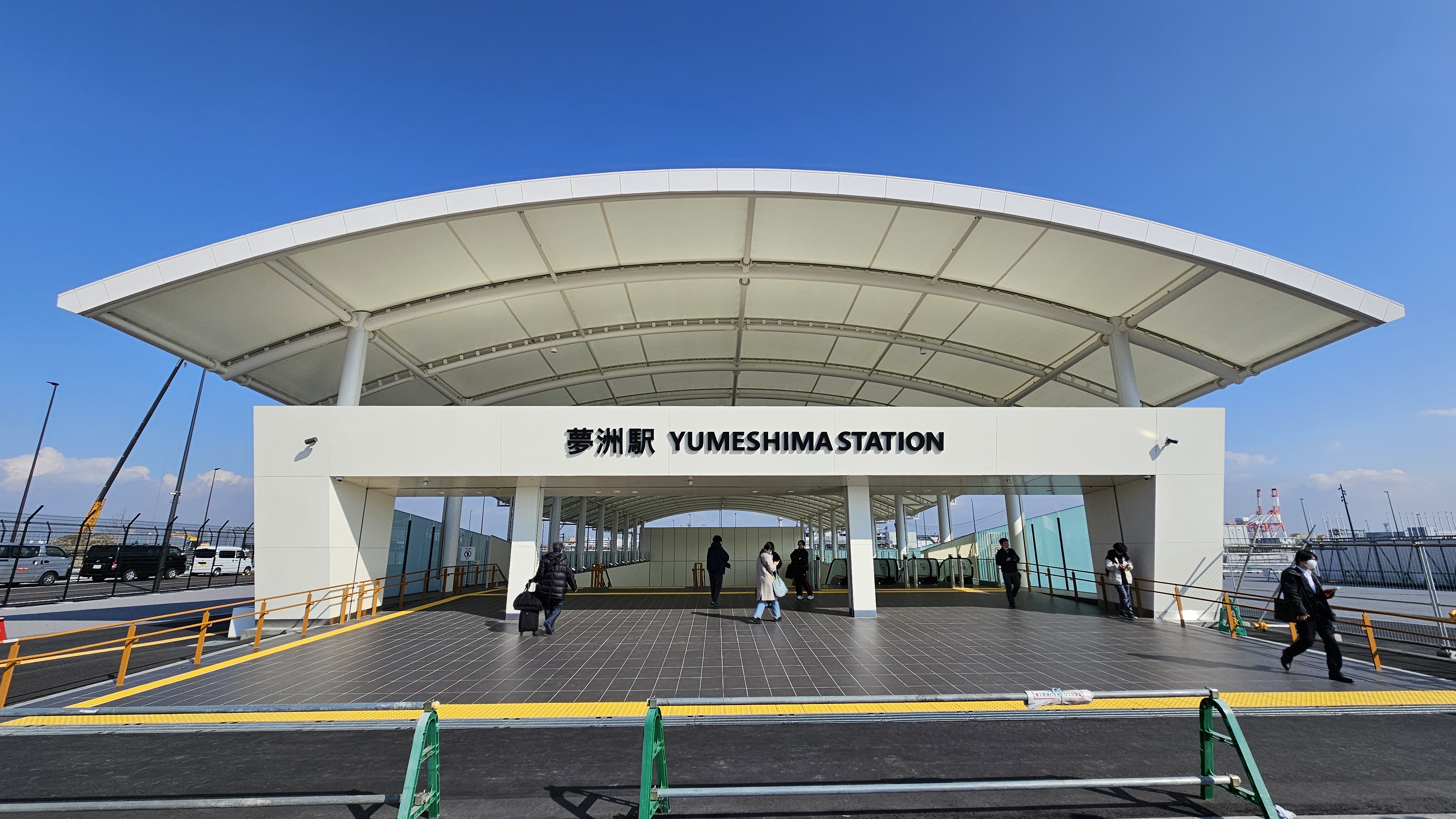
When Osaka won the right to host Expo 2025 in November 2018, beating bids from Yekaterinburg and Baku, Yumeshima finally had its defining purpose. From April 13 to October 13, 2025, the World Exposition operated under the theme "Designing Future Society for Our Lives." The centerpiece was architect Sou Fujimoto's Grand Ring, a massive circular wooden roof structure enclosing the 155-hectare site. Beneath it, national pavilions from countries around the world showcased visions of the future. Getting to the island required crossing the Yumesaki Tunnel from Cosmosquare Station on the newly extended Osaka Metro Chuo Line, which reached Yumeshima Station in January 2025. The tunnel remains closed to pedestrians and bicycles -- the only way across is by rail, bus, or bridge.
Japan's First Casino Bet
Even before the Expo tents came down, Yumeshima's next chapter was already under construction. In April 2014, Osaka Governor Ichiro Matsui announced the island as the candidate site for an integrated resort with a casino -- the first of its kind in Japan. After years of regulatory debate and national legislation, MGM Osaka broke ground in April 2025. The project, valued at $8.9 billion, will create Japan's first commercial casino alongside hotels, conference facilities, and entertainment venues. It is a striking pivot for a country that has historically prohibited casino gambling. For Yumeshima, the resort represents another layer of reinvention: landfill to logistics hub to world expo site to gambling destination, each identity laid atop the last like the strata of fill beneath the pavement.
An Island Connected by Thread
For all its ambition, Yumeshima remains tethered to the mainland by remarkably thin connections. The Yumemai Bridge, opened in 2002, links the island to Maishima to the northeast. The Yumesaki Tunnel, opened in 2009, carries road traffic and the Metro Chuo Line to Sakishima. There are no other routes. During Expo 2025, this bottleneck became dramatic: tens of thousands of visitors funneled through a single metro station daily. A sightseeing bus connects to Cosmosquare Station, and the island's southern container terminals maintain their own freight routes, but the essential character of Yumeshima is isolation -- a manufactured place floating just beyond reach, requiring deliberate effort to visit. From the air, the geometry is unmistakable: a rectangular island dropped into the curved shoreline of the bay, connected by a single bridge and a buried tunnel.
From the Air
Located at 34.652N, 135.388E in Osaka Bay, Yumeshima is a rectangular artificial island visible at the mouth of the Yodo River. The Yumemai Bridge to the northeast and the flat, largely undeveloped terrain make it easy to identify from altitude. Kansai International Airport (RJBB) lies approximately 25 nautical miles south across the bay. Osaka Itami Airport (RJOO) is roughly 12 nautical miles north-northeast. Kobe Airport (RJBE) sits about 15 nautical miles to the west. Best viewed at 3,000-5,000 feet AGL to appreciate the island's geometry against the bay and surrounding urban coastline.