Zaghouan Aqueduct
Water took a day and a half to make the journey. Flowing by gravity alone at roughly four kilometers per hour, it traveled 132 kilometers from springs in the Djebel Zaghouan mountains to the cisterns of Carthage, dropping barely 264 meters along the way. The Zaghouan Aqueduct, among the longest ever built in the Roman Empire, is an exercise in patience made permanent in stone. It has been destroyed at least three times -- by Vandals in 439, by the Eastern Romans under Justinian, and by Arab conquerors in 698. Each time it was rebuilt. When a French engineer restored it in 1862, he found that most of the ground-level channels could simply be reused. The aqueduct still functions today, delivering an average of 12 million liters of water per day in winter.
The Sacred Spring
The primary source lies near the town of Zaghouan, about 60 kilometers south of Carthage, where five springs emerge from an underground bed beneath an artificial terrace. The Romans built a sacred fountain structure over these springs that became one of the most important in ancient North Africa. A crescent-shaped portico, divided into 26 sections by engaged columns with niches for statues, enclosed an open space on the southern side. At its center stood a cella -- the holiest chamber -- from which the spring water flowed. The walls combined Roman concrete with coarse limestone, while the vaults were porous travertine covered in marble. The floor gleamed with mosaic. A second source was added during the Severan dynasty at Djouggar, 33 kilometers from the junction point at Moghrane, though it never rivaled the sanctity of the original.
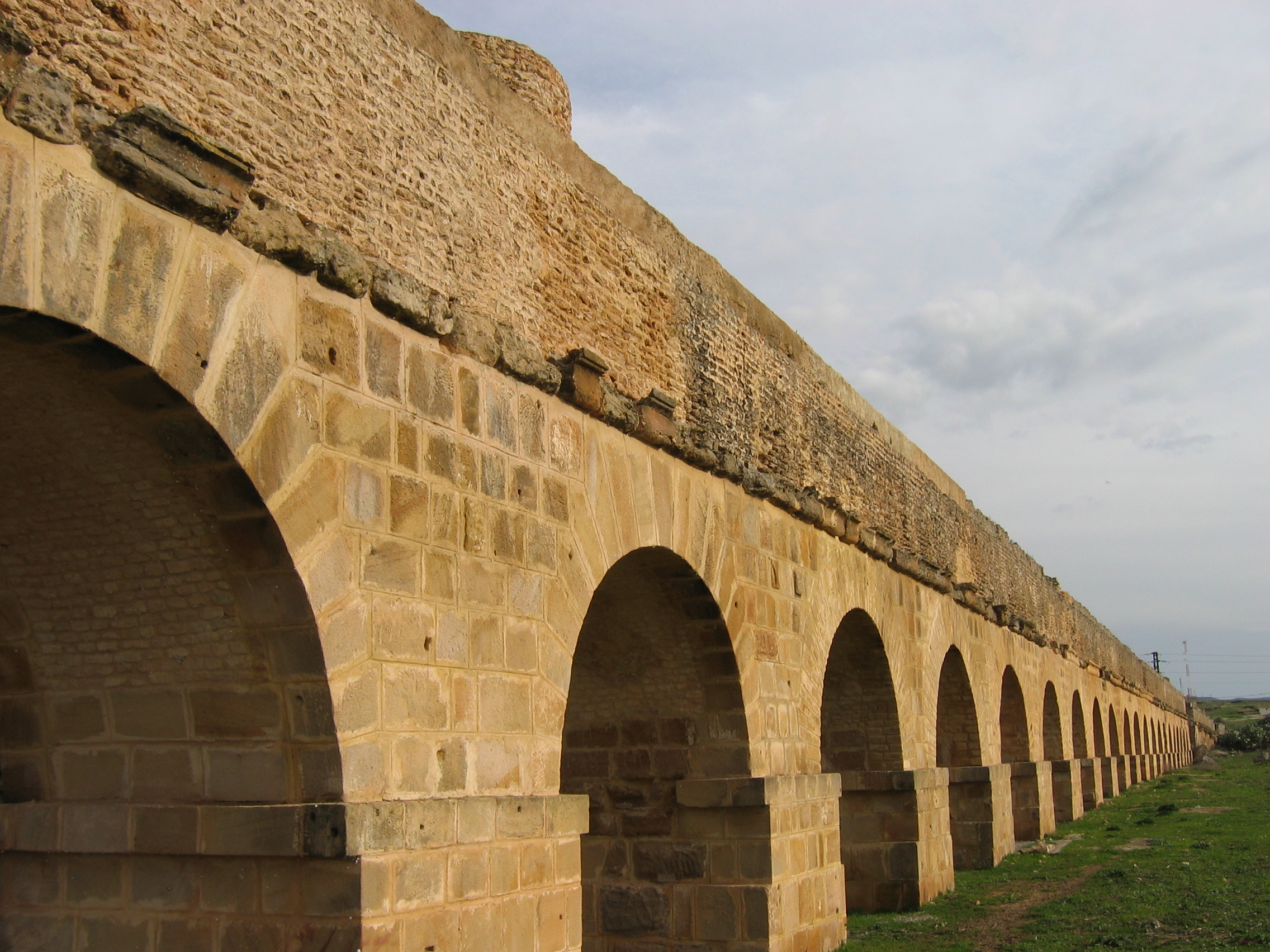
Engineering by Gravity
The technical achievement defies easy summary. Over a 90-kilometer journey from source to city, the channel drops only 264 meters in elevation -- an average gradient of just 0.3 percent. But 130 meters of that drop occurs in the first six kilometers from Zaghouan to Moghrane. For the remaining distance, the gradient averages a nearly imperceptible 0.15 percent. The channel itself measures roughly 90 centimeters wide and 130 centimeters tall, closed on top by a vault, its walls clad in waterproof opus signinum. Circular depressions in the channel floor caught sediment and had to be cleaned regularly. Where the terrain dipped too low, Roman engineers erected soaring arcades: 10 kilometers across the plain of La Soukra reaching 20 meters high, 5 kilometers across the plain of Oudna including a double-arcade bridge that stood 33 meters tall before being demolished in 1859 for its stone.
Cisterns at the World's Edge
At Carthage, the water flowed into two enormous cistern complexes. The cisterns of La Malga -- the largest surviving from the ancient world -- held approximately 51 million liters. Their mortar dates them to the first century AD, which creates an unsolved puzzle: the aqueduct had not yet been built, and this colossal volume could never have been filled by rainwater alone. The cistern of Bordj Djedid, composed of 18 barrel-shaped basins arranged in parallel, held between 25 and 30 million liters and supplied the Baths of Antoninus, facilities built on the same scale as the great imperial baths of Rome. The construction of the aqueduct may have been inspired by Emperor Hadrian's visit to Carthage in 128 AD, at the end of a five-year drought that demonstrated the folly of depending solely on rain.
The Aqueduct That Would Not Die
Few structures in the ancient world have been destroyed and rebuilt so many times. The Vandal siege of 439, the Byzantine reconquest, the Arab conquest of 698 -- each wave of conquerors recognized the strategic importance of the water supply and targeted it accordingly, and each new ruler eventually restored it. In the thirteenth century, a Hafsid ruler added a branch leading to his palace at Manouba. By the sixteenth century, the aqueduct had deteriorated into a quarry. Today, its crumbling arches and pillars serve an unexpected purpose: the cavities and holes in the ancient stonework have become nesting sites for lesser kestrels, lanner falcons, European rollers, and common ravens. BirdLife International has designated 40 hectares along the aqueduct as a protected area, making this Roman engineering marvel an accidental bird sanctuary stretching across the Tunisian landscape.
From the Air
Located at 36.62N, 10.13E. The aqueduct stretches approximately 132 km from the Djebel Zaghouan mountains southward to the ruins of Carthage near Tunis. The most visible sections from the air are the restored arcade pillars on the plain of La Soukra, approaching Carthage from the south, standing up to 20 meters tall. Best viewed at 2,000-4,000 feet following the line from Zaghouan northward. Nearest airport is Tunis-Carthage International (DTTA), approximately 10 km northeast of the Carthage terminus.