The Y-Bridge of Zanesville
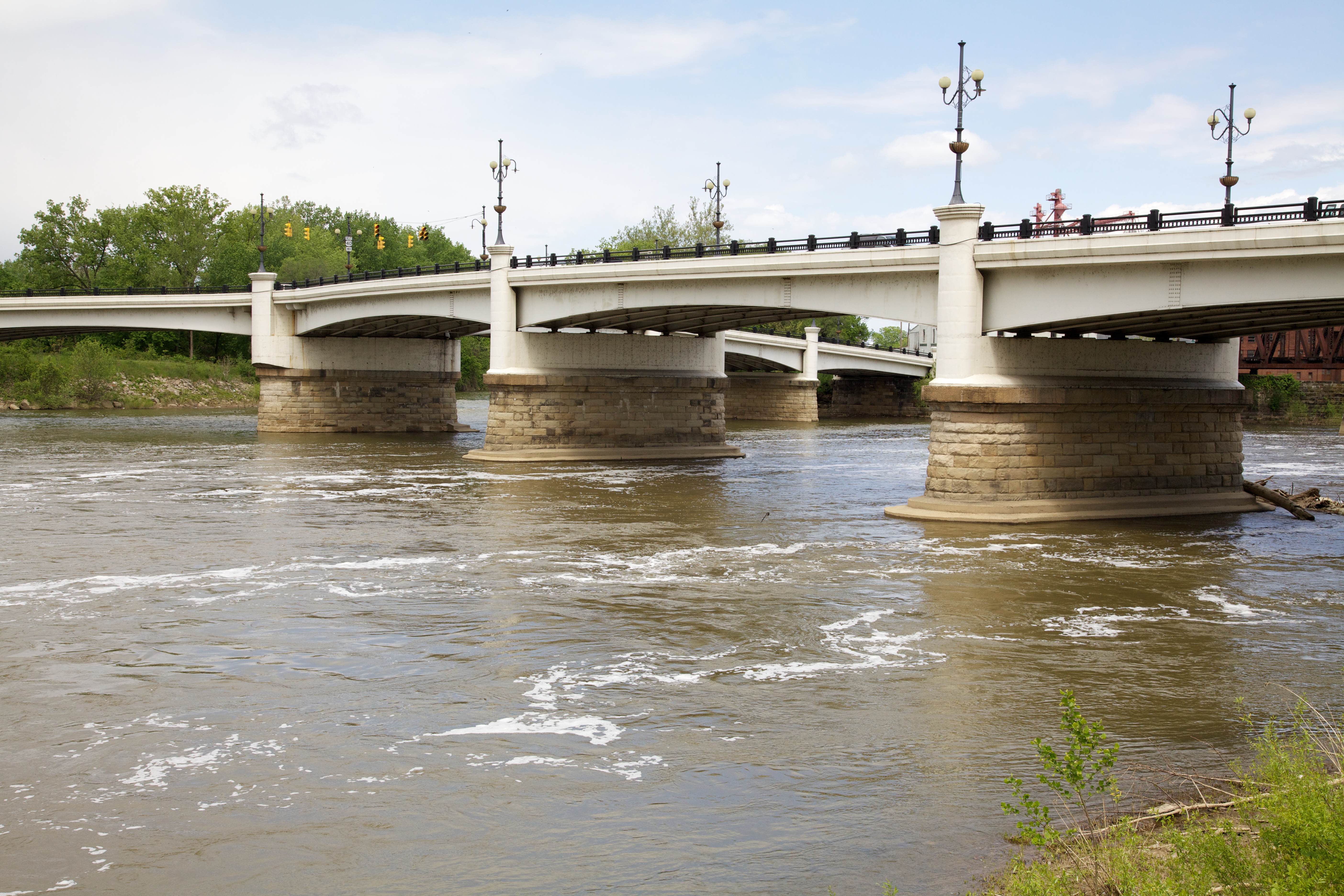
In Zanesville, Ohio, where the Muskingum and Licking Rivers meet, stands a bridge like no other. The Y-Bridge spans both rivers and the point of land between them, forming - you guessed it - a Y shape. It's the only bridge in the world where you can cross and end up on the same side of the river you started. The design isn't arbitrary: Zanesville sits at a confluence, and connecting all three pieces of land with a single structure made engineering sense in 1814. The current bridge is the fifth Y-Bridge on the site, completed in 1984. Each rebuilding has maintained the distinctive shape that makes Zanesville's bridge unique in the world - a geographic oddity that has put this Ohio town in guidebooks for two centuries.
The Geography
Zanesville's unique situation created the need for a unique bridge. The Licking River flows into the Muskingum River in the middle of town, creating a triangular point of land. Early Zanesville developed on both sides of both rivers - three distinct areas that needed connection. A conventional bridge would require two separate spans. The Y-Bridge solution connected all three areas with a single continuous structure. Travelers crossing from one side to the other would pass over the confluence point. The design was practical for 1814 Zanesville; that it remained practical through five rebuildings speaks to the enduring geography.
The History
The first Y-Bridge was built in 1814, a covered wooden structure that served Zanesville until 1832 flood damage required replacement. The second Y-Bridge (1832-1868) was also wooden. The third (1868-1900) introduced iron construction. The fourth (1902-1979) was a concrete structure that became famous for the Amelia Earhart reference (she reportedly got lost trying to follow directions to 'cross the bridge and turn left'). The current fifth Y-Bridge opened in 1984, maintaining the historic shape in modern materials. Each bridge has connected the same three land areas; each has faced the same water challenges; each has preserved Zanesville's claim to uniqueness.
The Confusion
The Y-Bridge has confused visitors for centuries. Directions involving the bridge are notoriously unclear - 'turn left at the middle of the bridge' makes sense to locals but baffles newcomers. Amelia Earhart allegedly landed in Zanesville because she couldn't figure out which way to turn. The bridge appears in 'Ripley's Believe It or Not' and various compilations of American oddities. The confusion is real: the bridge has three ends, three directions, and connects three pieces of land. Crossing the bridge can leave you on the 'same side' of the river in a different neighborhood. Understanding the Y-Bridge requires understanding Zanesville's geography.
The Legacy
Zanesville embraces its Y-Bridge identity. The structure appears on city logos, tourism materials, and local business names. The Y-Bridge is the city's most distinctive landmark, drawing curious travelers who want to see the only bridge of its kind. The bridge demonstrates how geography shapes communities - Zanesville grew around its confluence, and the bridge reflects that growth. The fifth Y-Bridge maintains the historic form while meeting modern traffic requirements. The shape that made sense in 1814 still makes sense today; the bridge remains the most efficient way to connect Zanesville's three pieces.
Visiting the Y-Bridge
The Y-Bridge is located in downtown Zanesville, Ohio, spanning the confluence of the Muskingum and Licking Rivers. The bridge is free to drive across (there's no other way to experience it fully). Park in downtown Zanesville and walk onto the bridge to appreciate the geometry. The National Road/Zane Grey Museum nearby provides regional history. Zanesville is on Interstate 70, approximately 55 miles east of Columbus and 70 miles west of Wheeling, West Virginia. Columbus International Airport is the nearest major airport. The bridge is accessible year-round. Allow 30 minutes to drive and walk the structure, more if you want to contemplate the geometry from different angles.
From the Air
Located at 39.94°N, 82.01°W in Zanesville, Ohio. From altitude, the Y-Bridge is visible at the confluence of the Muskingum and Licking Rivers - three arms of bridge meeting at a central point over the water. The distinctive shape is apparent from above, making it clear why this bridge configuration works for this location. Zanesville spreads around the confluence. The Muskingum River flows south; the Licking River enters from the west. Interstate 70 passes through the city. Columbus is 55 miles west. The terrain is hilly Ohio River watershed country - the topography that created this river confluence is visible in the landscape.