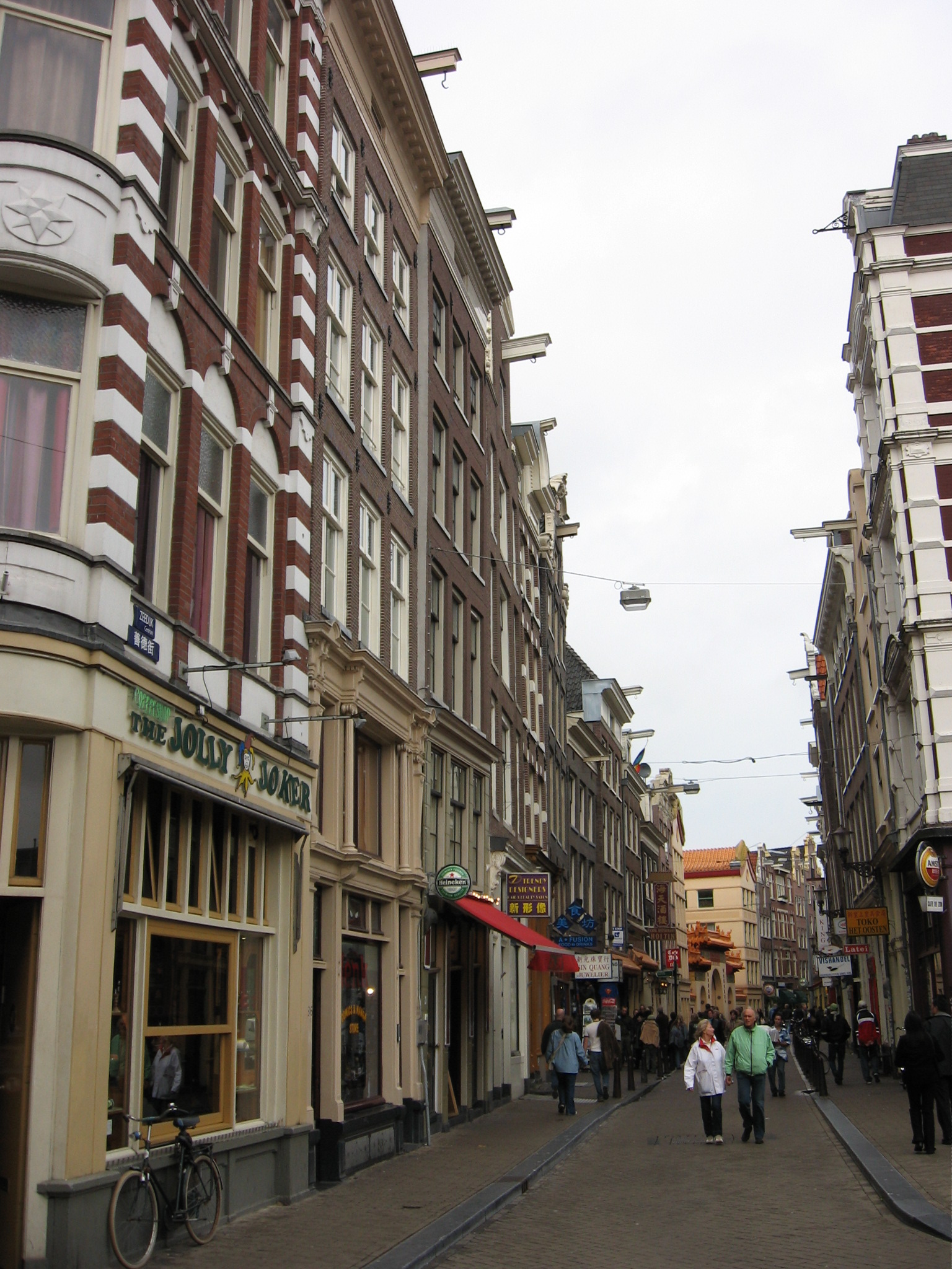
Zeedijk
The street curves because the dike curved. Eight centuries ago, Zeedijk was not a street at all but a wall of packed earth holding back the sea: the IJ, then in open connection with the Zuiderzee, slapping at Amsterdam's northern edge whenever the wind blew wrong. Stand on Zeedijk today and the gentle bend in the pavement is the last trace of that defensive curve - the dike preserved by accident as the city grew up around it. In 1544, Zeedijk became the first street in Amsterdam to get permanent street lights. By the 1980s, it was the most dangerous address in the city. Today, the bilingual street signs read in Dutch and Chinese. Few streets anywhere have been so many different places in such a small amount of time.
Respectable, Briefly
Until the seventeenth century, Zeedijk was one of the addresses where prosperous Amsterdammers genuinely wanted to live. The curve of the promenade caught light from the harbor; the merchants who built the early city were close enough to the docks to mind their cargoes. Halfway along the dike stood the Sint Anthoniespoort, the medieval city gate that still survives, now called the Waag, on the Nieuwmarkt. Beyond it the dike continued southeast as Sint Antoniesdijk, today Sint Antoniesbreestraat. Then came the construction of the great canal ring in the early 1600s: Herengracht, Keizersgracht, Prinsengracht. The wealthy merchants moved out to the new water. Zeedijk became what was left over - the close-quarters tangle near the harbor, where the men who actually sailed the ships came to drink, eat, and sleep when they were ashore.
Sailors' Town
For three centuries it was the Nautisch Kwartier, the Nautical Quarter. Ship chandlers sold rope and tackle out of narrow shopfronts. Sailors' bars served brown beer and ran upstairs rooms. The De Wallen red-light district, which still wraps around Zeedijk's southern flank, formed in the same pattern of cheap rooms, transient men, and women whose work was made permanent by the regularity of the trade. By the late nineteenth and early twentieth centuries, Zeedijk had become rough but knowable: the kind of street where everyone who belonged on it understood the rules. Then the rules changed.
The Bad Years
In the 1970s and into the 1980s, heroin arrived in Amsterdam and Zeedijk became the place where it changed hands. Open dealing in doorways, addicts living in abandoned buildings, syndicates pushing out the old bars and the old residents. Crime tipped past whatever line residents could tolerate. By the mid-1980s, ordinary Amsterdammers avoided the street. The municipal response, when it finally came, was unusual: instead of policing the street into submission, the city worked with a housing association called Stichting Zeedijk that bought up the worst buildings, kicked out the slumlords, renovated the apartments above the shops, and rented them at controlled prices to people who would live there as neighbors. The transformation took most of a decade. By the early 2000s, the street worked again.
Chinatown and the Lotus
What grew back was something the medieval dike-builders could never have predicted. Vietnamese, Thai, and Chinese restaurants now line the curve: Nam Kee, whose oysters became famous enough to inspire a novel by Kees van Beijnum and the 2002 film Oesters van Nam Kee. The street signs are bilingual. The He Hua Temple, Fo Guang Shan Buddhist temple inaugurated in 2000, is the largest traditional Chinese-style Buddhist temple in Europe; its red tiled roof rises three stories above the dike, with stone lions flanking the entrance. Once a year the temple hosts Chinese New Year celebrations that close the whole street. There is a quieter monument too, a small plaque marking the spot outside the Prins Hendrik Hotel where the jazz trumpeter Chet Baker fell to his death from a second-floor window on the night of May 13, 1988. Zeedijk keeps absorbing its history without ever quite letting any layer disappear.
From the Air
Zeedijk runs at 52.374 N, 4.900 E in Amsterdam's old center, between Prins Hendrikkade at the IJ waterfront and the Nieuwmarkt square. From the air, look for the gentle arc of the street running southeast from the Centraal Station harbor toward the Waag building on the Nieuwmarkt - the curve is a survival of the medieval dike line. Nearest airport: Amsterdam Schiphol (EHAM), 13 km southwest. Best viewed at 2,000-3,500 feet in clear weather.