Zeeland Bridge
From above, it looks like a pencil line drawn across the water, impossibly thin and impossibly long. The Zeeland Bridge stretches 5,022 meters across the Eastern Scheldt estuary, connecting the islands of Schouwen-Duiveland and Noord-Beveland in the Dutch province of Zeeland. When Queen Juliana inaugurated it on December 15, 1965, it was the longest bridge in Europe. Today it remains the longest in the Netherlands, a spare and elegant structure of fifty spans that paid for itself through twenty-four years of tolls before finally becoming free to cross.
Born from Necessity
The Zeeland Bridge emerged from the same national trauma that created the Delta Works. After the catastrophic North Sea flood of 1953 killed nearly 2,000 people in the southwestern Netherlands, the Dutch launched an unprecedented program to protect their vulnerable delta. The bridge was not originally part of the Delta Plan's flood defenses, but it served the same larger purpose: unifying the isolated islands of Zeeland into a connected whole. Before the bridge, reaching Noord-Beveland from Schouwen-Duiveland required a long ferry crossing or an even longer drive around the estuary. The bridge transformed regional geography.
Engineering Across the Estuary
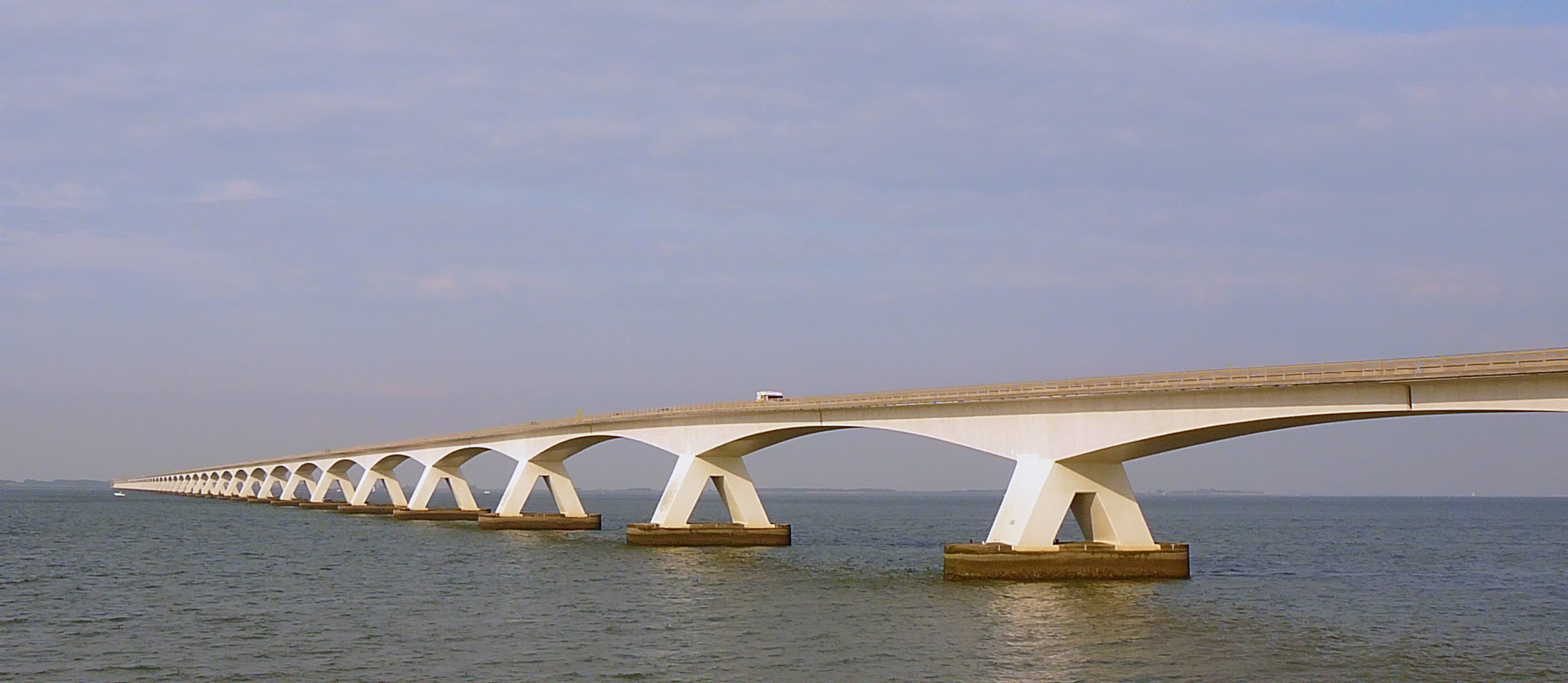
Construction began in 1963 and proceeded with remarkable speed. The bridge consists of forty-eight primary spans of 95 meters each, two smaller spans of 72.5 meters, and a movable bascule section with a 40-meter opening. This movable section allows larger vessels to pass through, preserving navigation in the Eastern Scheldt. The structure rises and falls gently with the terrain, its concrete deck supported by slender piers that barely interrupt the wide sweep of water and sky. The simplicity is deceptive; this was precision engineering executed on an ambitious scale, completed in just two years.
Paying the Price
The province of Zeeland could not afford to build the bridge outright. Instead, it borrowed the construction costs and repaid them through tolls collected from every vehicle that crossed. For decades, drivers stopped at the toll booths, paying their share of the provincial debt. The loan was fully repaid by 1989, but tolls continued for another four years to build a maintenance fund. On January 1, 1993, the bridge finally became free to use. It was a practical Dutch solution: the people who benefited from the infrastructure paid for it, one crossing at a time, until the books balanced.
A Different Kind of Monument
Unlike the massive storm surge barriers of the Delta Works, the Zeeland Bridge makes no claim to be a wonder of the world. It is not a feat of defensive engineering against an existential threat. It is simply a very long road over water, as utilitarian in its purpose as the ferries it replaced. Yet there is beauty in its restraint. The bridge does not dominate the landscape; it threads through it. The Eastern Scheldt stretches away on either side, the light reflecting off the water, the vast Dutch sky arching overhead. For five kilometers, drivers cross not just a body of water but a meditation on flatness and distance.
The View from Above
From the air, the Zeeland Bridge reveals its full geometry: a straight line bisecting the estuary, connecting two island shapes in a landscape defined by water. To the west lies the Eastern Scheldt storm surge barrier, part of the Delta Works that protects this region from the sea. To the east, the intricate patchwork of polders, dikes, and drainage channels that characterize Zeeland. The bridge appears almost fragile against the scale of the estuary, yet it has carried traffic continuously for sixty years. It has outlasted governments, survived storms, and watched the Delta Works rise around it. A quiet triumph of persistence.
From the Air
The Zeeland Bridge crosses the Eastern Scheldt estuary at 51.61N, 3.89E, connecting Schouwen-Duiveland to Noord-Beveland in Zeeland province. At 5,022 meters, it is clearly visible from altitude as a thin line across the water. The bascule section in the middle occasionally opens for large vessels. To the west, the Eastern Scheldt storm surge barrier (part of the Delta Works) is visible. Rotterdam The Hague Airport (EHRD) lies to the north; Antwerp (EBAW) to the south. Best viewed at 2,000-4,000 feet in clear conditions.