Zhongyuan
The Chinese word for 'China' -- Zhongguo, the Central State -- began as a description of this place. Zhongyuan, the Central Plains, is the stretch of the North China Plain surrounding the lower and middle reaches of the Yellow River, centered on the territory between Luoyang and Kaifeng in modern Henan province. For the Huaxia people, the confederation of tribes that evolved into the Han Chinese ethnicity, Zhongyuan was not merely the geographic center of their world. It was the world -- everything beyond its borders was periphery, and the peoples living there were classified as the Siyi, the 'four barbarians.'
The Land That Named a Nation
Human activity in Zhongyuan dates back half a million years. By 80,000 to 100,000 years ago, the region's inhabitants were using stone tools. The Yangshao culture (5000-3000 BC) and Longshan culture (3000-1900 BC) left painted pottery and refined stone implements across the region, placing Zhongyuan at the forefront of Chinese civilization throughout the Stone Age. When the Erlitou culture emerged around 1900 BC, Zhongyuan entered the Bronze Age and produced what is traditionally considered China's first dynasty, the Xia. From that point forward, the pattern held: from the rise of the Xia around 2070 BC to the fall of the Song dynasty in 1279, more than twenty dynasties established their capitals within Zhongyuan. The region did not just witness Chinese history -- it generated it.
Mountains, Rivers, and the Breadbasket
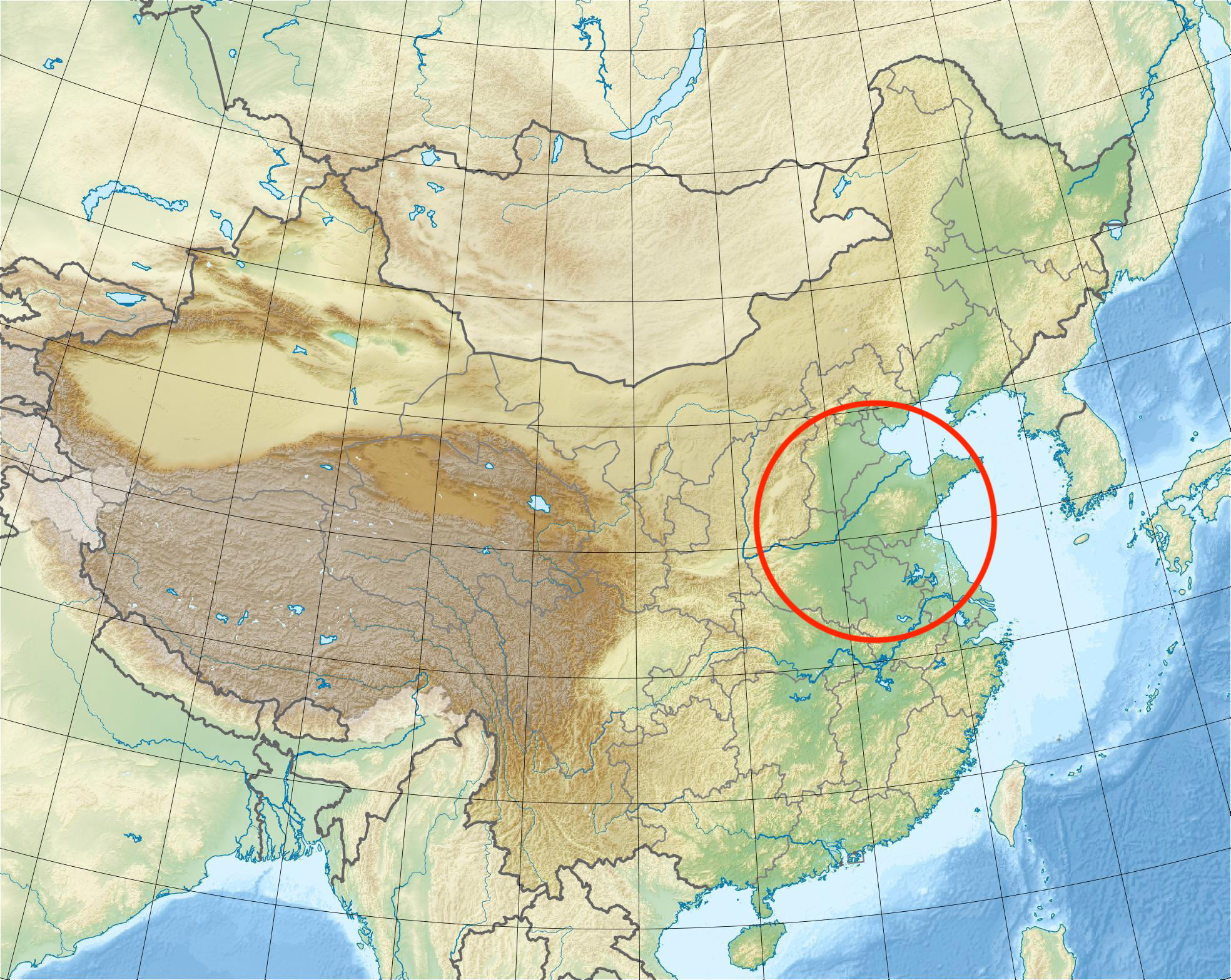
Zhongyuan's geography explains its dominance. Mountains encircle it on three sides -- the Taihang range from the northwest, the Funiu and Xionger ranges to the west -- while the central and eastern areas open onto the vast North China Plain. The Yellow River flows through the heart of the region from west to east, and its alluvial deposits created the fertile soil that made Zhongyuan the agricultural engine of ancient China, known as the 'Breadbasket of China.' The Huai River and tributaries of the Yangtze also pass through the region, providing additional water resources. This combination of natural barriers for defense and rich farmland for sustenance made Zhongyuan what ancient strategists called 'the center and hub of the world.'
When the Center Shifted
Zhongyuan's political centrality was not permanent. It was not until the Yuan dynasty (1271-1368) that the Mongol Empire moved China's capital decisively away from the Central Plains, establishing Dadu -- present-day Beijing -- as the seat of power. The Ming dynasty's Yongle Emperor confirmed the shift by relocating the capital to Beijing, his own power base. After more than three thousand years as the political center of Chinese civilization, Zhongyuan became a province rather than a capital region. Yet the cultural weight remained. The language spoken across the region, Central Plains Mandarin, is spoken by approximately 124 million people today and played a formative role in the development of standard Mandarin Chinese.
A Concept Larger Than a Map
Zhongyuan has always been as much an idea as a place. The term first appeared in the Classic of Poetry without specifying exact geographic coordinates, and it was not until the Spring and Autumn period (770-476 BC) that it came to denote a specific region. Even then, its boundaries shifted depending on who was drawing them. In the narrow sense, Zhongyuan means Henan province. In a broader interpretation, it encompasses parts of Shaanxi, Hebei, Shanxi, Shandong, Anhui, and Jiangsu. As a cultural concept, it represents the historic dominance of Han Chinese civilization -- the belief, deeply embedded in Chinese identity, that this stretch of yellow earth beside a yellow river is where everything began.
From the Air
Zhongyuan refers to the Central Plains region of China, centered approximately at 34.878N, 113.084E between Luoyang and Kaifeng in Henan province. The region encompasses the lower and middle reaches of the Yellow River across the North China Plain. Major airports include Zhengzhou Xinzheng International (ZHCC/CGO) in the heart of the region, Luoyang Beijiao Airport (ZHLY) to the west, and Kaifeng is served by Zhengzhou. The Yellow River is the dominant navigation feature, visible from any altitude as a broad, sediment-laden waterway crossing the plains. Best appreciated at higher altitudes of 10,000-20,000 feet where the vast scale of the plains and their mountain boundaries becomes apparent.