Zuider Ee
On a 1718 Dutch map of Oostdongeradeel, the cartographer wrote the river's name twice: 'De Zuyder Ee vulgo de Suyr Ee' — the Zuider Ee, commonly called the Suyr Ee. That single phrase tells you most of what you need to know about this small Frisian river. It has been on maps since at least 1616. It has been called several things in several languages. And the people who live along it have never quite agreed on which name, or which spelling, or which engineering decision, is the right one. Four hundred years of arguing about a single waterway — that is the Zuider Ee.
Why 'Southern'
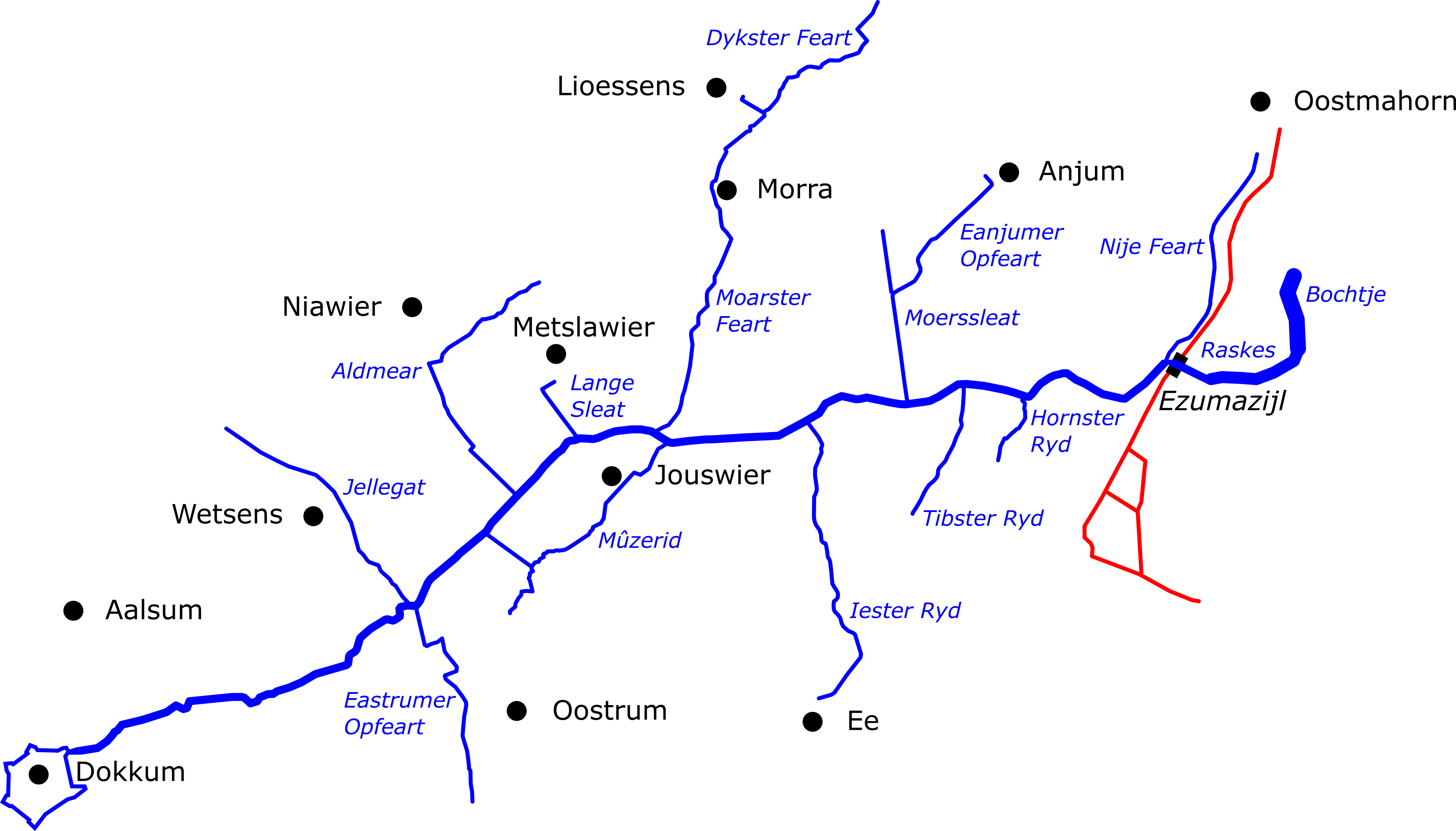
The Zuider Ee runs roughly fourteen kilometers from Dokkum northeast to the Lauwersmeer at Ezumazijl. Its name simply means 'southern Ee' — Ee being an old Frisian word for a flowing water — and the south part comes from a map convention that was unusual for the northern Netherlands. On 17th and 18th century Frisian charts, the cartographers oriented their world so that the Dokkumer Ee, which flows from Leeuwarden to Dokkum, was the 'northern' Ee, and the river flowing on from Dokkum to the sea was the 'southern' Ee. A parallel logic would have made the nearby Paesens river the Noorder Ee. The orientation never quite caught on elsewhere in the region, but the names stuck. In Frisian, the river is the Súd Ie. In Dutch, the Zuider Ee. In the deeper past, simply De Suir Ee on Nicolaes van Geelkercken's 1616 map of Dokkum.
The Drainage War
The interesting thing about the Zuider Ee is not its scenery — it's a calm canal-like river running across flat farmland — but the argument it caused. The whole of the Eastergoa region drained through this small valley, and from 1600 onward the local water authorities spent over two centuries trying to make the system work. Around 1600 the Paesens was dammed near Dokkum, sending more water into the Zuider Ee. In 1604, the Oostrumerzijl sluice was closed, pushing still more discharge through Ezumazijl. The infrastructure couldn't handle it. The Oostrumerzijl was renovated, then in 1633 a new sluice was built at Dokkum, but the water still won. By 1672 the Oostrumerzijl had silted up entirely and was permanently abandoned. In 1729 the Dokkumer Nieuwe Zijlen lock opened and the Dokkum sluice was dropped — water free again, problem returned. Only in 1821, when a dike was built between Holwert and Dokkum, did Friesland finally manage to wall off the impounded water from the rest of the province.
The Pumping Station
In 1931 the Dongerdielen pumping station went into service at Ezumazijl, taking over the job that two centuries of sluices and dikes had struggled to do. It still runs today, managing the water level of the Zuider Ee and most of East and Westdongeradeel, its flume discharging into the lock bowl of the Ezumazijl sluice. Walk along the river and you can still read its older shape in the landscape: the channelized 20th-century course runs more or less straight, but the original meanders survive as cut-off oxbows in the surrounding fields. The river kinks visibly between Metslawier and Jouswier, a relic of where two originally separate streams were once joined by digging through the salt marsh that lay between them. Excavations in Dokkum in 1954 uncovered the buried evidence of that older marsh, the prehistoric ancestor of both the Zuider Ee and the Paesens.
Súd Ie and the Water Front
In 2013, the Dutch launched the Súd Ie & Wetterfront Dokkum project — a long-term effort to make the Zuider Ee navigable for medium-sized motorboats all the way from Dokkum to the Lauwersmeer. That means raising the bridges that currently sit too low, dredging the channel back to a workable depth, building fishing spots and trailer ramps along the banks, and restoring the old jaagpad — the towpath that horses once walked while pulling boats upstream. The eventual goal is to extend the route past Ezumazijl to Oostmahorn via the New Canal. The Zuider Ee won't ever be a major shipping artery. That isn't the point. The point is that a quiet Frisian river that has been worked, dammed, sluiced, pumped, channelized, and argued over for four hundred years is being asked to do one more useful thing: carry small boats and the people in them through some of the most rural country the Netherlands has.
From the Air
Located at 53.35°N, 6.07°E (mid-river, near Dokkum), running from Dokkum (53.33°N, 5.99°E) northeast to Ezumazijl on the Lauwersmeer (53.40°N, 6.07°E). Recommended viewing altitude FL060-FL100 to follow the channel's path against the surrounding farmland, with the cut-off meanders visible as crescent-shaped scars in the fields. Nearest airports: Drachten (EHDR) to the south-southwest, Groningen Eelde (EHGG) to the southeast. Dokkum's star-shaped historic fortifications mark the river's southern end.