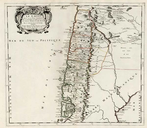

1751 Concepción Earthquake
Some cities are destroyed and rebuilt on the same ground out of stubbornness or sentiment. Concepción chose differently. On a night in May 1751, the earth shook hard enough that, in the words of one chronicler, the residents "could not remain standing." Then the sea drew back more than a kilometer, gathered itself, and returned in a series of waves, each taller and angrier than the last. When the survivors counted what was left, they did not just rebuild. Fourteen years later, they abandoned the spot entirely and carried their city to higher, safer ground inland. The place they left behind keeps its old name in a single surviving word.
A City That Had Learned to Fear the Ground
By 1751, the people of Concepción were not strangers to catastrophe. Their city, then sitting on the Bay of Concepción at the site now called Penco, had been razed by earthquakes before. It was still recovering from the quake and tsunami of 1730 when the ground began to stir again. On the night of May 25, tremors rolled through in waves. The residents, schooled by generations of disaster, read the warning correctly. Some prepared for the worst, moving outdoors, watching the dark water of the bay. Their caution would save lives, but it could not save the city. The foreshocks were not a false alarm. They were a countdown.
Six Minutes, Then the Sea
The main shock struck around one in the morning and, by the accounts of residents in both Concepción and distant Valparaíso, lasted close to six minutes. Six minutes is an eternity when the ground refuses to hold still. Every building in Concepción came down. The disaster, though, arrived in two acts. Between roughly 1:05 and 1:45, the ocean withdrew more than a kilometer from the shoreline, exposing the bay floor, before three to five tsunami waves rushed back over the land. Each surge hit harder than the one before, and the final wave proved the most destructive of all. The shaking reached deep into Chile's Central Valley, and the swell was felt as far north as the Peruvian port of El Callao, more than two thousand kilometers away.
The Decision to Walk Away
Recovery was nearly impossible. Aftershocks kept rattling the ruins for weeks, one of the strongest striking on June 26, toppling even the emergency shelters people tried to raise. About half a month after the main quake, the ground finally quieted. But the survivors had seen this story twice now, in 1730 and again in 1751, and they refused to read it a third time. After a long and bitter argument between the civil authorities and the church — Bishop José de Toro y Zambrano Romo fiercely opposed the move, even threatening excommunication — the city was eventually moved inland to the Valle de la Mocha, where Concepción stands today. The relocation took fourteen years to complete, an act of collective endurance as remarkable as any feat of survival.
The Fault That Will Not Rest
The 1751 catastrophe was not bad luck. It was geology doing exactly what it does along this coast. Off the shore of central Chile, the Nazca Plate grinds beneath the South American Plate, and the strain locks and builds until the ground lurches forward in a megathrust rupture. These are among the most violent earthquakes the planet produces. The same fault system that leveled Concepción in 1751 would, more than two centuries later, generate the magnitude 8.8 quake of 2010 and the magnitude 9.5 Valdivia event of 1960, the strongest ever recorded by instruments. The chroniclers of 1751 had no plate tectonics to explain their terror, only the evidence of a bay that emptied and then returned. But they understood the essential lesson better than any seismograph could teach it: this coast would shake again, and again, and the only sane response was distance.
The Word That Stayed Behind
A city can change its address, but it cannot fully shed its past. Though Concepción rebuilt itself miles from the sea that had punished it, its people kept the name of the place they had fled. To this day, residents of Concepción call themselves penquistas, after Penco, the original coastal site. The old ground did not stay empty forever. In 1842, nearly a century after the disaster, the present town of Penco was founded on the same shore. Two settlements now share a single history, divided by one terrible night and a few kilometers of ground. The demonym is a quiet monument, carried in everyday speech, to a catastrophe most who use the word have never paused to consider.
From the Air
The 1751 disaster centers on two sites near 36.80°S, 73.00°W on Chile's south-central coast. The original location, modern Penco, sits on the Bay of Concepción; the relocated city lies a few kilometers inland in the Valle de la Mocha along the Bío Bío River. The nearest airport is Carriel Sur International (ICAO: SCIE, IATA: CCP) in Talcahuano, about 8 km from downtown Concepción and a primary regional gateway for south-central Chile. From a cruising altitude of 8,000 to 12,000 feet in the region's clear, mild weather, the contrast is legible from the air: the exposed crescent of the bay where the old city stood, and the protected inland valley the survivors chose instead. Santiago lies roughly 500 km to the north.
Nearby Stories
- Battle of El Roble 7.8 km away
- Chivilingo Hydroelectric Plant 18 km away
- Ninhue 18 km away
- Santa María Island, Chile 25 km away
- Tucapel 47 km away
- 2010 Chile Earthquake 49 km away
- Coal Mining in Chile 51 km away
- 1687 Peru Earthquake 2386 km away