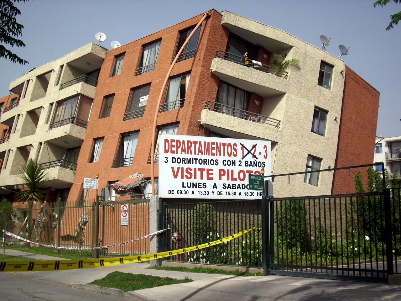

2010 Chile Earthquake
It was 3:34 in the morning on the 27th of February, 2010, and most of central Chile was asleep. Off the coast near the Maule town of Pelluhue, a six-hundred-kilometer length of the seafloor ruptured all at once, two tectonic plates lurching past each other after more than a century of locked, accumulating strain. The shaking lasted roughly three minutes — an eternity when the ground will not stop moving — and it reached eighty percent of the country's population. By the time it ended, 525 people were dead and 25 more would never be found. But the earthquake was only the first blow. The sea was already coming, and the warning that might have saved the coast was about to fail.
Three Minutes in the Dark
A magnitude of 8.8 is difficult to grasp. It was the strongest earthquake to strike Chile since the catastrophic Valdivia event of 1960, and it ranks among the half-dozen most powerful quakes ever recorded — releasing roughly five hundred times the energy of the deadly Haiti earthquake just a month before. The fault slipped nearly ten meters, releasing about a hundred and twenty years of pent-up plate movement in moments. The energy was so vast it left planetary fingerprints: scientists calculated that the quake shortened the length of Earth's day by about 1.26 microseconds and nudged the planet's axis. It shoved the city of Concepción more than three meters to the west and shifted Santiago by nearly a quarter of a meter. In the dark, in the violently moving houses, none of that abstraction mattered. What mattered was getting out, and getting to high ground.
The Warning That Never Came
Along the coast, people did what generations of Chileans are taught to do after a great quake: they feared the sea. But the official system meant to guide them broke down. Chile's naval hydrographic service, the SHOA, failed to issue a clear tsunami warning in the crucial minutes after the shaking stopped. The defense minister later admitted the navy had made a mistake — that an immediate alert could have helped coastal villagers flee sooner. Some lives were saved anyway, by local port captains who sounded alarms on their own initiative, and by ordinary people who trusted their instincts and ran uphill in the dark. But not everyone did, and not everyone could. The head of the SHOA was later dismissed for the organization's failure to warn the country it existed to protect. The waves, meanwhile, were already crossing the shallows toward shore.
The People the Sea Reached
The tsunami came in not as a single wall of water but as a series of surges, and as so often happens, the first was not the worst. In the fishing town of Dichato, of seven thousand residents, it was the third wave that did the most damage. In Curanipe, only eight kilometers from the epicenter, the water swept in and cut the town off from the outside world. A surfer who saw it described a sudden rise of advancing foam, ten or fifteen surges, the last arriving after dawn. Far out in the Pacific, on remote Robinson Crusoe Island, a wave killed four people and left eleven missing — fishing families and islanders who had no chance against water that arrived almost without warning. These were not statistics. They were villagers and children and crews, people who had gone to sleep on an ordinary night in their own homes by their own shore.
The Long Climb Back
When the waters drew back, central Chile faced a country in pieces. The quake had damaged or destroyed roughly 370,000 homes and triggered more than a thousand landslides across the Maule region. A blackout reached ninety-three percent of the population. In the chaos of the first days, with communication severed and aid slow to arrive, parts of Concepción and Talcahuano descended into looting and fear; the government, reluctant at first to put soldiers on the streets, eventually declared a state of catastrophe and sent in the military. The rebuilding took years. Chileans answered with a fierce solidarity — a 24-hour telethon raised tens of millions of dollars for emergency housing, and NGOs threw up tens of thousands of transitional homes. The hardest lesson, though, was not about engineering. It was about warning: that in a country built on a fault, the minutes after the shaking stops are when lives are won or lost, and the system owes its people the truth as fast as the sea can move.
From the Air
The epicenter lay offshore at roughly 36.29°S, 72.78°W in the Pacific, about 3 km off the coast near Pelluhue in Chile's Maule Region — close to the present-day Ñuble coast near Cobquecura, and roughly 100 km from the provincial capitals of Talca, Linares, Chillán, and Concepción. From altitude over this stretch of central Chilean coast, the worst-hit zone runs from the Maule coast south through the Biobío Region. The major regional airport is Carriel Sur International at Concepción (ICAO SCIE); Chillán's field (ICAO SCCH) lies inland. The coastline here was permanently uplifted by the quake — several meters in places south of Cobquecura — subtly reshaping the shore. The open Pacific to the west marks the offshore megathrust where two plates still grind together.
Nearby Stories
- San Carlos, Chile 25 km away
- Ninhue 28 km away
- Parral, Chile 31 km away
- Battle of the Maule 36 km away
- Santa Olga 39 km away
- El Chiflón del Diablo 96 km away
- HMS Monmouth (1901) 124 km away
- 1687 Peru Earthquake 2293 km away