
Battle of the Maule
The Inca Empire stretched for thousands of miles, from the deserts of what is now Ecuador down the spine of the Andes, the largest state the Americas had ever known. And then, somewhere along the Maule River in central Chile, it stopped. According to the chronicler Inca Garcilaso de la Vega, an army sent south to extend the empire met a coalition of peoples who refused to bend, and over three days of fighting neither side could break the other. The river became a frontier. Beyond it lay lands the Inca would survey but never rule.
The Empire Moves South
The campaign had been long. By Garcilaso's account, the Inca general Sinchiruca had spent years subduing the north of Chile - Copiapo, Coquimbo, Aconcagua, and the Maipo Valley around present-day Santiago - building toward an army said to number in the tens of thousands. After securing the Maipo Valley, he sent some twenty thousand men onward to the valley of the Maule. This was how the empire grew: through overwhelming force paired with offers of incorporation, a choice between submission and war. Most peoples, faced with that arithmetic, submitted. The lands south of the Maule were about to answer differently.
Those Who Would Not Submit
The peoples living south of the Maipo Valley refused the empire's terms. When the Inca demand reached them, the Picunche and their southern allies - the Antalli, the Pincu, the Cauqui, and the broader Mapuche world beyond the river - chose to resist. The Inca knew them by a Quechua name, Purumaucas, which the Spanish later softened into Promaucaes; it marked them as those who stood outside the empire's order. The label was the conqueror's, not their own. What it described, in truth, was a confederation of communities who valued their independence enough to take up arms against the most powerful military force on the continent.
Three Days on the River
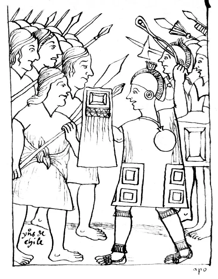
The Inca crossed the Maule and, in keeping with custom, sent envoys demanding submission. The reply, as the chronicle records it, was unbending: the defenders said they had come not to waste time in words but to fight until they won or died. Within days a force of some eighteen to twenty thousand warriors camped opposite the Inca lines. The Inca tried diplomacy once more, promising they came not to seize land but to offer a new way of living. It was refused again. The battle that followed lasted three days. Both armies left their camps each morning and fought until dark, and each evening neither held the advantage - only growing numbers of dead and wounded on the same contested ground.
Why the Empire Stopped
Tradition holds that this stand halted the Inca advance and fixed the Maule as the empire's southern edge. Modern historians have complicated the story. Osvaldo Silva argues the decisive factor was not a single battle but the Inca's own calculation: the Mapuche lived in dispersed, non-urban societies that offered little to govern and much trouble to hold, and the empire simply chose not to pour in the resources that conquest would demand - the kind of effort it had spent grinding down the powerful Chimu in the north. Silva even suggests there may have been two engagements rather than one, with the Inca reaching as far south as the future site of Concepcion before being harried back north. Whichever account is closer to the truth, the outcome is the same on the map: the Maule marked a limit, and the peoples beyond it kept their independence.
A Frontier That Held for Centuries
What makes the Maule remarkable is not a single afternoon of fighting but what it foreshadowed. The Mapuche would prove to be among the most enduring resisters in the Americas. When the Spanish arrived in the sixteenth century and pushed south with steel, horses, and gunpowder, they too were stopped - and then driven back - by the same peoples in the long conflict known as the Arauco War. For generations the Bio Bio River south of here served as a recognized boundary between the colonial world and free Mapuche territory, a frontier the Spanish crown was forced to acknowledge in formal treaties. The defiance the chroniclers recorded at the Maule was not a single act of bravado. It was the first written glimpse of a determination to remain unconquered that would outlast two empires.
From the Air
The traditional battle site lies near the Maule River at approximately 35.57 degrees south, 71.70 degrees west, in central Chile's Maule Region. From the air the Maule is unmistakable - a major river running east to west, draining the Andes across the breadth of the Central Valley toward the Pacific, its banks lined today with vineyards and farmland that would have been open country in the fifteenth century. The nearest airfield is Talca's Panguilemo (ICAO SCTL), a short distance north; Concepcion's Carriel Sur (ICAO SCIE) lies to the southwest, near the limit of the Inca's deepest reported penetration. A viewing altitude of 5,000-7,000 feet follows the river corridor between the coastal hills and the snow-capped Andes. The clearest flying is in the dry summer months (December-February).
Nearby Stories
- Altos de Lircay National Reserve 7.1 km away
- Santa Olga 25 km away
- Battle of Mataquito 31 km away
- LAN-Chile Flight 621 35 km away
- Ninhue 67 km away
- Las Leñas 87 km away
- Reserva Provincial La Payunia 175 km away
- 1687 Peru Earthquake 2269 km away