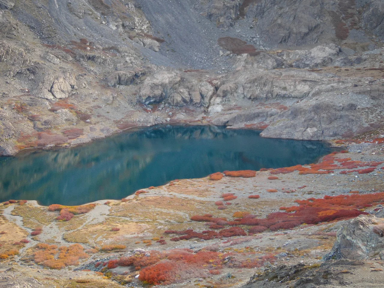

Altos de Lircay National Reserve
Climb long enough above the Lircay River and the forest gives way to one of the strangest floors in the Andes. El Enladrillado is a high, level plateau paved in flat basaltic slabs laid out so squarely, edge to edge, that they look like an enormous brick patio left by something that knew geometry. The orderliness unnerves people. For decades it has drawn UFO watchers convinced no river or frost could be this tidy, making this remote Chilean plain one of the country's odd magnets for believers in visitors from elsewhere.
The Gateway at Vilches
The reserve spreads across 121 square kilometers along the north bank of the Lircay, in the Andean skirts above San Clemente. The path in runs through Vilches, a small mountain community of campgrounds, family-run posadas, and a single grocery store that serves as the gateway. This is famously one of the cheapest places in Chile for serious outdoor time. Locals rent simple, good-quality lodging and guide visitors up the trails on foot or horseback, and the welcome is warm enough that many trekkers remember the village as fondly as the summits. Created in 1996, the reserve has become a beloved entry point into the high cordillera.
Stones of the Cups
Long before hikers came for the views, the Pehuenche people lived in these mountains, and the reserve still holds quiet traces of them. Along the trails you can find the piedras de las tazas, large rocks worn with cup-shaped hollows that the Pehuenche used to grind and prepare food. They are easy to walk past and easy to underestimate, but they are the fingerprints of a people who knew this terrain intimately, generations before any park boundary was drawn. To pause at one of these stones is to stand in a working kitchen many centuries old, in the open air of the Andes.
Forests, Pumas, and Condors
The reserve's forests mix raulí, laurel, cypress, and hualo, and on the long high routes you reach lenga, the southern beech that grows nowhere farther north in Chile. The wildlife is genuinely wild: pumas move through the upper slopes, black woodpeckers hammer the old trunks, and the endangered tricahue parrot brings flashes of color to the canopy. Overhead, Andean condors ride the thermals on wings that can span three meters, scanning the valleys below. Doves, thrushes, eagles, and quail fill in the chorus. This is not a manicured park but a living Andean ecosystem, and it asks to be treated as one.
The Long Climb to the Plateau
Reaching El Enladrillado is a commitment: roughly seven kilometers up and a full day on your feet, with the round trip near twenty kilometers, which is why rangers cap entry to the long trails by mid-morning. The reward is enormous. From the plateau, a great chain of volcanoes unfurls, including Descabezado Grande, Cerro Azul, and Quizapú, whose 1932 eruption was among the largest explosive eruptions of the twentieth century, hurling ash as far as Rio de Janeiro. Other trails reach the Laguna del Alto after a steep climb, or follow native forest to the cool Río Claro and the Valle del Venado. Sixty-six kilometers from Talca, mostly paved, this is the high country the city's flatlanders escape to.
From the Air
Altos de Lircay sits in the Andean foothills of Chile's Maule Region at roughly 35.59°S, 70.94°W, east of San Clemente and the town of Vilches, about 66 km from Talca. From the air the reserve climbs steeply from forested river valleys along the Lircay into high Andean terrain; the standout landmark is El Enladrillado, a broad flat basaltic plateau set against a backdrop of major volcanoes, with Descabezado Grande (3,953 m), Cerro Azul, and Quizapú forming the eastern skyline. Panguilemo Airport (ICAO SCTL, IATA TLX) near Talca is the nearest field to the west; Carriel Sur International (ICAO SCIE) at Concepción serves the wider region. Because terrain rises sharply toward the cordillera, fly this area at 9,000 to 11,000 feet AGL for clearance over peaks and ridgelines. Summer brings clear, stable air; in winter snow closes the upper reserve and can hide the volcanoes, and the final kilometers of road are often impassable.
Nearby Stories
- Yerbas Buenas 26 km away
- Las Leñas 30 km away
- LAN-Chile Flight 621 32 km away
- Battle of Mataquito 38 km away
- Concha y Toro 49 km away
- Witches' Cave 50 km away
- Parral, Chile 53 km away
- Reserva Provincial La Payunia 118 km away