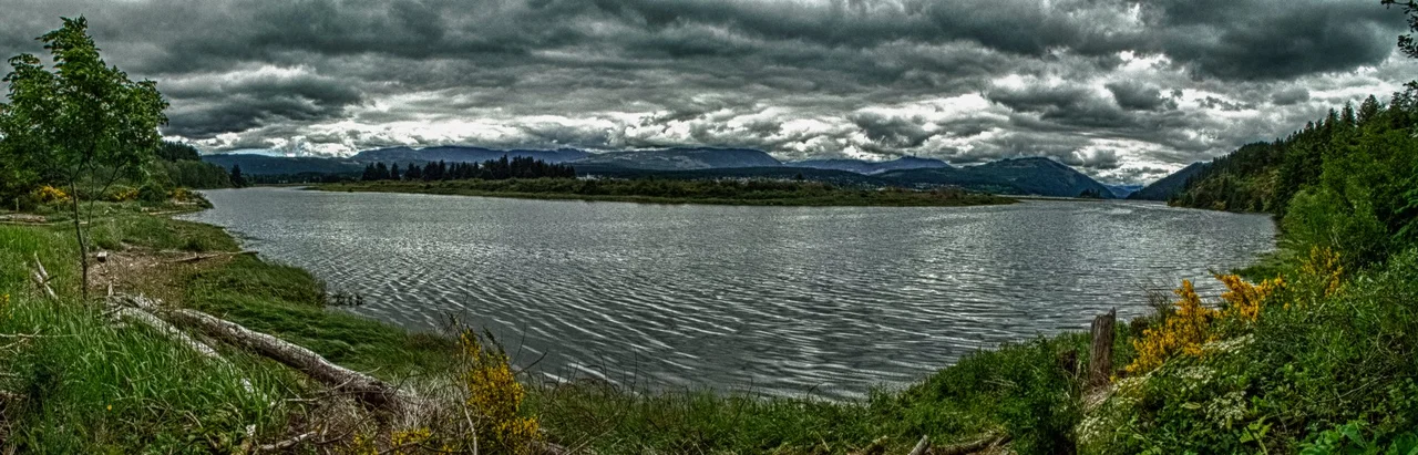

Alberni Inlet
Just after midnight on March 28, 1964, the water in Alberni Inlet began to rise, and it kept rising. The source was 2,000 kilometres north, where a magnitude 9.2 earthquake had torn open the seafloor off Alaska hours earlier. Out in the open Pacific, the wave it launched was almost unnoticeable. But Alberni Inlet is narrow and long and ends in a dead end, and a fjord shaped like that does to a wave what a megaphone does to a voice. The first surge reached Port Alberni at 2.44 metres. An hour later a second one arrived at 3.05 metres. Fifty-eight properties were destroyed outright and another 320 damaged. Nobody in Canada died, largely because residents woke their neighbours and got them uphill before the bigger wave came.
The Long Cut
Alberni Inlet runs 54.3 kilometres from Barkley Sound on the open Pacific to Port Alberni, driving so deep into Vancouver Island that the town at its head sits nearly at the island's centre. It is narrow along its entire length, a green corridor of steep timbered slopes dropping straight into saltwater with almost no shoreline in between. Two basins hold the deep water, separated by shallows: the outer and larger one near the Barkley Sound entrance reaches about 40 metres, while a second near Sproat Narrows bottoms out at 37 metres. The Somass River delivers its freshwater at the top end, and dozens of unnamed creeks come in along both walls. Sailing it feels less like being at sea than being inside something.
A Word Problem
For most of its charted life the waterway was called Alberni Canal, which was accurate in the old sense of the word and badly misleading in the new one. In 1931 someone made the reasonable observation that foreign shipping companies might read a chart, see the word canal, and assume there were locks, tolls, or a man-made ditch waiting at the far end. The recommendation went in to change canal to inlet. Bureaucracy being what it is, the change was not officially approved until 1945. Other Northwest waterways never bothered. Lynn Canal in Alaska, Portland Canal on the Alaska-British Columbia border, and Hood Canal in Washington are all natural saltwater channels that still carry the confusing label, and every one of them still has to explain itself.
Written in Basalt
The trench itself is a fjord, gouged by an outlet glacier that drained the Pleistocene ice caps sitting on Vancouver Island's mountainous interior. When the Last Glacial Maximum ended and sea level climbed, the ocean flooded the valley the ice had carved and made a saltwater arm of a freshwater canyon. The rock it cuts through is older and stranger. This is Wrangellia Terrane, the remains of an island volcanic arc that began building roughly 300 million years ago, capped by seafloor flood basalts laid down around 230 million years ago. Between the lava flows sit layers of sediment, the record of the quiet stretches when nothing erupted. The whole assembly rafted across the Pacific and welded itself to North America, and it has not settled down since. The inlet lies close to where the Juan de Fuca, Explorer, and North American plates meet along the Cascadia subduction zone.
Sarita and the Long Memory
About halfway down the eastern shore, on a low sand beach, stands the Huu-ay-aht village of Sarita. Beaches are good places to live if you fish, land canoes, and want flat ground. They are poor places to be when the inlet focuses a wave. Sarita has been struck by tsunamis repeatedly, which is a dry way of saying that families in this one community have had to rebuild more than once, and that the knowledge of what the water can do here is not theoretical to the Huu-ay-aht. The 1964 event that made headlines in Port Alberni was one entry in a much longer ledger kept along this shoreline. Coastal First Nations on the west side of Vancouver Island carry oral accounts of the sea coming inland, and the geology of the Cascadia subduction zone has since confirmed what those accounts always said.
A Working Corridor
Today the inlet is a highway. Deep-draft vessels run its length to the port at the head, and the Somass estuary funnels returning salmon through some of the most heavily fished water on the island. Fog collects in the corridor and burns off in patches. Wind gets channelled by the walls and accelerates in the afternoon, a reliable enough effect that boaters plan around it. From above, the inlet appears as a single blue stroke laid across a green island, so straight and so deliberate that it looks drawn rather than carved. It was carved. The tool was a kilometre of moving ice, and it took its time.
From the Air
Alberni Inlet lies at roughly 49.083N, 124.817W, running northeast from Barkley Sound on Vancouver Island's Pacific coast to Port Alberni at its head. From altitude it is unmistakable: a narrow, nearly straight blue trench 54 kilometres long, slicing more than halfway across the island between steep forested ridges. Use Barkley Sound and the Broken Group Islands at the seaward end and the Somass River delta plus the mill complexes at Port Alberni at the inland end as your anchors. Alberni Valley Regional Airport (CBS8) sits just north of Port Alberni; Tofino/Long Beach Airport (CYAZ) is roughly 35nm west and Nanaimo Airport (CYCD) about 40nm east. Best viewed between 3,000 and 6,000 feet down the axis of the inlet for the full fjord effect. Expect marine fog pushing in from Barkley Sound in summer mornings, low cloud trapped between the walls, and afternoon channelled winds that can be considerably stronger inside the inlet than outside it.
Nearby Stories
- Della Falls 6.9 km away
- Rogue Wave 7.4 km away
- Bamfield Marine Sciences Centre 12 km away
- Englishman River Falls Provincial Park 15 km away
- Lasqueti Island 16 km away
- Fanny Bay 16 km away
- Youbou, British Columbia 19 km away
- Long Beach 20 km away