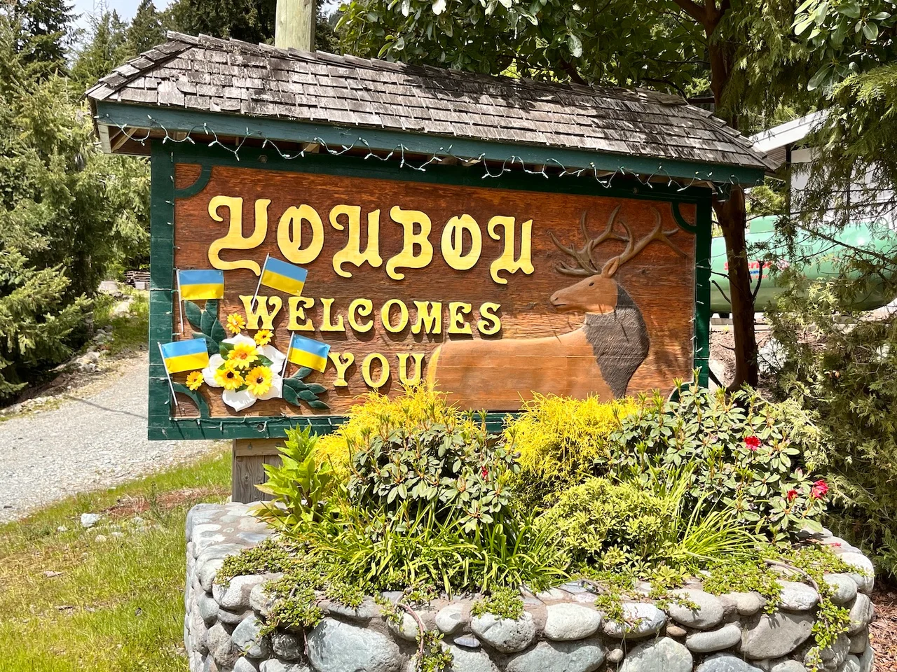

Youbou, British Columbia
The town is named after two men who may never have set foot in it. In 1914 the Empire Lumber Company was securing timber blocks along the north shore of Cowichan Lake, and somebody in the office assembled a place name out of the first syllables of the two officers signing the paperwork — Yount, the general manager, and Bouton, the president. You-bou. It is the kind of name a corporation gives a spot it intends to own, and for the better part of a century that is exactly what Youbou was: a company town on a lake, existing because there was a mill, arranged around the mill, and utterly dependent on it.
The Longest Craneway in the Empire
Before the name, there was Cottonwood. The Esquimalt and Nanaimo Railway reached the site in 1912, logging began the following year, and a small operation known as the Cottonwood or Medina Mill shipped its first load of sawn lumber in 1918 after the First World War delayed everything. The mill that mattered came later. Built in 1927 and running from the following year, it sat directly on fresh water rather than salt — likely the oldest freshwater sawmill in British Columbia — and it once claimed the longest craneway in the British Empire, a superlative that tells you something about both the scale of the timber coming off these slopes and the confidence of the people cutting it. Logs came down the lake in booms. The lumber went out by rail. Everything in Youbou faced the water.
Who Actually Ran the Saws
The Cowichan Valley has a South Asian Canadian community that goes back more than 130 years, overwhelmingly Sikh, and its history is inseparable from the mills. Punjabi workers began arriving in British Columbia in 1903 and built much of the province's lumber industry from the green chain up. A few kilometres away, a man born in 1888 in a Punjabi village called Paldi came looking for timber land and founded his own mill town, eventually naming it after home; by 1919 it had a gurdwara, and the settlement drew workers from South Asia, Japan, China, and Europe into one of Canada's earliest genuinely multi-ethnic industrial communities. Through the 1970s and 1980s the Sikh strongholds around the lake were Honeymoon Bay, Mesachie Lake, and Youbou. The men who made these mills run were not, for most of that period, treated as full citizens of the country they were building. They stayed anyway, and the families are still here.
January 26, 2001
TimberWest shut the Youbou mill on a Friday in late January 2001. Two hundred and twenty people lost their jobs, and seventy-three years of continuous production stopped at once. The company said the mill was unprofitable. Many of the workers did not believe it, and pointed at what happened next: the logging continued at full pace while the logs themselves — unmilled — went onto ships bound for sawmills in the United States and Asia. The building was dismantled and scrapped. In a town that existed for one reason, this was not a layoff so much as the removal of the reason. Anyone who has watched a single-industry community absorb that news knows the particular quiet that follows.
An Unlikely Coalition
A few months before the closure, a Youbou sawmill worker named Ken James and an environmentalist named Ken Wu were put on the same stage in front of an audience of roughly a hundred forestry workers and conservationists. On the coast these two groups had spent two decades treating each other as the enemy. What they discovered in that room was a shared grievance with the same shape — raw logs leaving the province meant fewer mill jobs and faster cutting, and neither side wanted that. After the mill went down, the laid-off workers organized as the Youbou TimberLess Society, and a group of unemployed millwrights became one of the more persistent voices for forest policy reform in British Columbia. It is rare for a town to answer its own closure with an argument rather than an exodus.
What the Lake Kept
Drive thirteen kilometres west from the community of Lake Cowichan and Youbou is still there — smaller, quieter, no longer arranged around a whistle. The mill site is gone, but the shoreline that made it attractive in the first place has not changed: a long, deep lake pinched between forested ridges, a public beach, boats out on the water most summer afternoons, trails running back into second growth. People fish here. People retire here. The name still belongs to two executives from 1914, which nobody seems especially bothered about anymore.
From the Air
Youbou sits at 48.867°N, 124.200°W on the north shore of Cowichan Lake, in the interior of southern Vancouver Island. Best viewed from 2,500 to 5,000 feet on an east–west run along the lake. Cowichan Lake is the navigational anchor and is impossible to miss — a long, narrow body of water roughly 30 kilometres end to end, oriented northwest–southeast and hemmed in by steep second-growth ridges. Youbou is the cluster of roofs on the north shore about a third of the way up from the eastern end; the community of Lake Cowichan sits at the lake's eastern outlet 13 kilometres away, where the Cowichan River begins its run to Duncan and the Strait of Georgia. Victoria International (CYYJ) lies roughly 35 nautical miles southeast, Nanaimo (CYCD) about 30 nautical miles northeast, and Duncan's small strip is the nearest field, down the Cowichan valley to the east. Expect valley fog and low stratus filling the lake basin on calm autumn and winter mornings, mechanical turbulence off the ridges in a strong westerly, and smoke haze in late summer. Terrain rises quickly on both shores — this is a valley to fly along, not across, in marginal conditions.
Nearby Stories
- Sombrio Beach 2.5 km away
- Cowichan Tribes 3 km away
- Leechtown, British Columbia 4.3 km away
- Alberni Inlet 4.6 km away
- Ruxton Island 5.1 km away
- West Coast Trail 13 km away
- Mount Arrowsmith Biosphere Region 16 km away
- SS Pacific (1850) 21 km away