Antelope Valley
The animals that named this place are gone. Pronghorn grazed the valley floor until the 1880s, when hunting eliminated them and the herds dispersed. The Antelope Valley kept the name. It sits at the western tip of the Mojave Desert, bounded by the Tehachapi Mountains to the northwest, the Sierra Pelona Mountains to the west, and the San Gabriel Mountains to the south — a high desert basin at roughly 2,300 feet elevation where the air is clear and the terrain is flat and the ground is hard enough to land almost anything.
The Sound Barrier and What Came After
On October 14, 1947, Captain Charles E. Yeager climbed into a Bell X-1 rocket plane at Muroc Army Air Field — now Edwards Air Force Base — and flew to Mach 1.06. The sound barrier broke, and the age of supersonic aviation began above the Antelope Valley. Edwards continued as the primary test site for the fastest and most dangerous aircraft the United States built through the Cold War decades: the X-15, which reached the edge of space; the U-2 and SR-71 reconnaissance aircraft, developed at Air Force Plant 42 in Palmdale by Lockheed's Skunk Works; the B-2 Spirit stealth bomber, also Palmdale. NASA Space Shuttles landed on Edwards' dry lakebed after orbital missions — the vast flat surface provided the margin for error that concrete runways could not. The aerospace industry shaped the valley's economy so completely that its boom-and-bust cycles became the valley's own.
Two Cities on the Desert Floor
Palmdale and Lancaster are the principal cities of the Antelope Valley, each with populations approaching 200,000, facing each other across a stretch of the Antelope Valley Freeway (State Route 14). The street grid in the Los Angeles County portion of the valley is laid out at one-mile intervals — avenues running east-west, streets running north-south — an agricultural township grid repurposed for suburban development. The cities grew with aerospace employment and with the overflow of Los Angeles County's population expansion, drawing residents willing to trade shorter commutes for the valley's lower housing costs. The world's largest open-pit borax mine operates near Boron, at the valley's eastern edge.
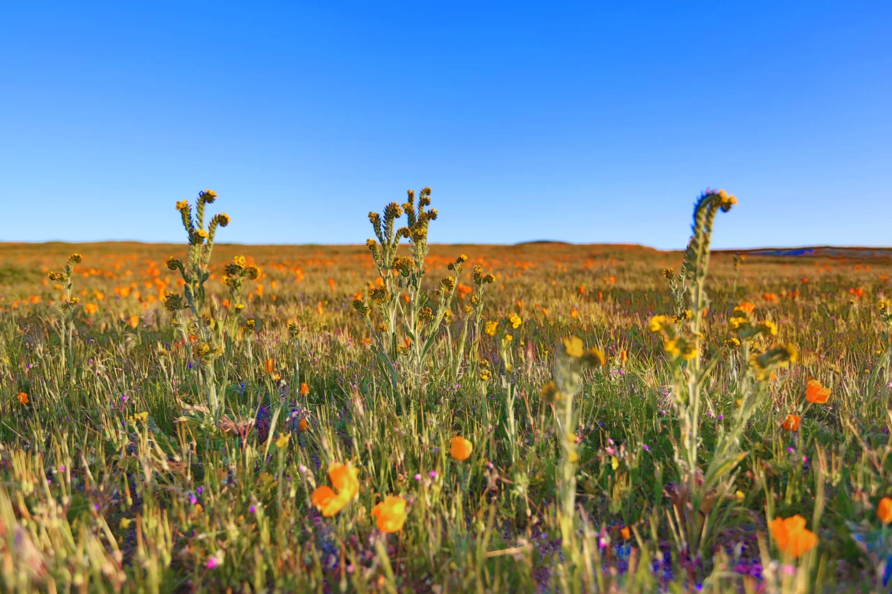
The Desert in All Seasons
The Antelope Valley California Poppy Reserve, 15 miles west of Lancaster, holds the most consistent blooms of the state flower anywhere in California — hillsides that turn orange in spring when the winter rains come correctly. Saddleback Butte State Park and Arthur B. Ripley Desert Woodland State Park preserve desert ecosystems in a valley where agricultural conversion and suburban growth have altered most of the original landscape. The Antelope Valley Indian Museum preserves artifacts from the Kawaiisu and other desert peoples who lived here before European contact. The valley's eastern end opens into the Victor Valley and the broader Mojave — desert continuing east into Nevada, the flat expanse where aircraft land and the horizon is always visible and the sky is always big.
From the Air
The Antelope Valley is centered at approximately 34.75°N, 118.25°W, north of the San Gabriel Mountains in northern Los Angeles County. The valley floor sits at approximately 2,300 feet MSL, with flat desert terrain providing excellent visual references. Palmdale Regional Airport (KPMD) at 34.629°N, 118.085°W is the primary commercial airport. Edwards AFB (KEDW) occupies a large area to the northeast — its Class D airspace and numerous MOAs and restricted areas require careful preflight planning. The San Gabriel Mountains to the south reach above 10,000 feet MSL.
Nearby Stories
- Fillmore and Western Railway 9.7 km away
- Placerita Canyon State Park 16 km away
- The Desert Tortoise Natural Area: Where the Slow Survive 39 km away
- Bakersfield: The Oil Town Where Country Music Got Its Sound 47 km away
- San Bernardino Train Disaster 53 km away
- Amgen 60 km away
- The Trona Pinnacles: California's Most Alien Landscape 80 km away
- Calico: The Ghost Town Walter Knott Saved 87 km away