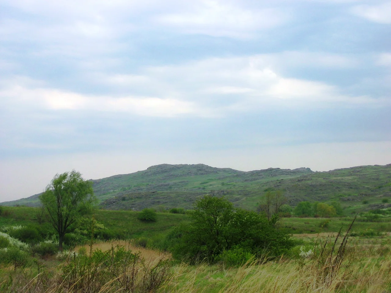

Azov Upland
From the window of a plane, the Azov Upland reads as almost nothing at all: a broad, tawny swell of land tilting gently toward the Sea of Azov, without a single dramatic peak to catch the eye. Look closer, though, and the steppe reveals its punctuation. Scattered across the grass, low and rounded, sit the mohyly - burial mounds raised by peoples who crossed these plains long before the countries below had names. The land is quiet, but it is not empty. It has simply learned to keep its history close to the ground.
A Roof Over the Steppe
Geographers call this a plateau, though it hardly feels like one from the surface. The Azov Upland rises across the Donetsk and Zaporizhzhia regions, a gentle dome bordered by lowlands on nearly every side - the Dnieper Lowland to the north, the Donets Ridge to the northeast, the Black Sea and Azov lowlands to the southwest and south. Its highest point is Mount Belmak-Mohyla, which reaches 327 meters, roughly 1,073 feet, a summit so modest that visitors sometimes fail to notice they have climbed it. Yet on a treeless plain, even a rise of a few hundred meters commands the horizon. From Belmak-Mohyla you can see for many kilometers across grassland the color of old wheat, the earth curving away toward the sea some distance to the south.
The Black Earth Beneath
What the upland lacks in altitude it makes up for underground. The soil here is chernozem - literally "black earth" - the dark, mineral-rich topsoil that made the Ukrainian steppe one of the great breadbaskets of the world. Above it grows a fescue-and-feather-grass steppe, a sea of silvery grasses that ripples in the constant wind and turns silver-white when the feather grass sets seed. The climate is continental and dry, with hot summers and cold, wind-scoured winters. For millennia this was open range: too dry for forest, too fertile to ignore. Nomads pastured horses here; later, farmers turned the black earth with plows. The grass that remains hints at what the whole region once looked like, before the fields arrived.
Graves That Became Landmarks
The mounds are the upland's signature. Known locally as mohyly and elsewhere across the steppe as kurgans, they are earthen burial mounds, some raised more than four thousand years ago by Bronze Age and later Scythian peoples over the graves of their dead. Belmak-Mohyla itself carries the word mohyla - grave - in its name, a hint that its summit may hold ancient burials. Not far away, in the Molochna River valley near the village of Terpinnia, lies the region's most famous stone monument, Kamyana Mohyla, the "Stone Grave": a cluster of sandstone slabs whose sheltered surfaces preserve petroglyphs carved across thousands of years. Together they make the Azov Upland a landscape of memory, where the highest points are often the oldest human marks.
The Watershed of the Plains
Rise a little above the surrounding lowlands and you become a divide. Water that falls on the northern flank of the Azov Upland drains toward the Dnieper basin; water on the southern slope runs down to the Sea of Azov. That quiet arithmetic of elevation shaped where rivers cut, where herds could water, and where routes across the open country naturally ran. For the nomadic peoples who moved through here - Scythians, Sarmatians, and later Turkic steppe riders - the upland was less a barrier than a signpost, its mounds visible for miles and useful as waymarks in a land with few other reference points. Even today, standing on the empty grass with the wind pushing steadily out of the east, it is easy to feel how a low swell of earth could organize an entire landscape around itself, simply by being the one place you could see from anywhere.
From the Air
Centered near 47.33°N, 36.58°E, the Azov Upland is best appreciated from 6,000 to 10,000 feet, where its gentle dome and the scattered dark cones of burial mounds stand out against pale grassland. Mount Belmak-Mohyla marks the high point; the Sea of Azov glints to the south. Nearest major airports include Mariupol (UKCM) to the south and Zaporizhzhia (UKDE) to the northwest.
Nearby Stories
- Battle of the Kalka River 22 km away
- Battle of Dibrivka 42 km away
- Zaporizhzhia 85 km away
- Khortytsia 97 km away
- Klivazh 99 km away
- Byriuchyi Island 138 km away
- Battle of the Tanais River 153 km away
- Henichesk 181 km away