.jpg)
Balladonia, Western Australia
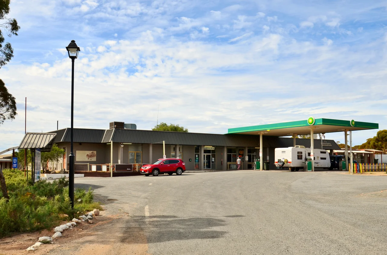
On the night of 11 July 1979, guests at the Balladonia motel watched the sky over the Nullarbor erupt into what looked like a slow, silent fireworks display. They were watching the United States fall to Earth. Skylab, America's 77-tonne space station, was breaking apart on re-entry, and a four percent error in NASA's calculations had carried its debris not into the empty Indian Ocean as planned, but across the scrub of southern Western Australia, right over this tiny roadhouse some 300 kilometres east of the nearest real town.
The Day America Fell on the Nullarbor
NASA had tried to be careful. Engineers tumbled the dying station deliberately, hoping to drop the wreckage into open ocean far from anyone. Instead, the heaviest pieces sailed on and rained down across the Shire of Esperance, with Balladonia near the heart of the debris trail. No one was hurt, scorched chunks of spacecraft simply thudded into the sheep paddocks and saltbush of one of the emptiest places on the planet. The event made this anonymous roadhouse world news overnight, and the moment was sealed in legend when, by widely told account, US President Jimmy Carter telephoned to apologise for the unexpected shower of American hardware from the sky.
A Four-Hundred-Dollar Fine for NASA
The locals answered a falling space station with deadpan Australian humour. The Shire of Esperance issued the United States government a ticket, a fine of 400 dollars, for littering. It was a joke, of course, a mock ceremony with a parks officer solemnly writing up the world's most powerful space agency for dumping rubbish on the outback. NASA, taking the gag in the spirit intended but apparently not the wallet, never paid. The fine sat unsettled for three decades, until in 2009 a California radio host named Scott Barley rallied his listeners to chip in the money and finally clear the books. For squaring America's oldest space debt, he was rewarded with a key to his own city of Barstow, California. Today the Balladonia roadhouse keeps a museum where genuine Skylab fragments sit beside the yellowed newspaper clippings, the unlikely heart of the whole strange story.
The Longest Straight Road
Even without a falling spacecraft, Balladonia would earn its place on the map by sitting at one end of an extraordinary piece of road. Just east of the roadhouse begins the Ninety Mile Straight, a stretch of the Eyre Highway that runs dead level and arrow-straight for 146.6 kilometres without a single bend, one of the longest perfectly straight roads anywhere on Earth. To drive it is to watch the horizon refuse to move for an hour and a half, the white centre line vanishing to a point in a shimmer of heat. At the start of that straight stands the ruined stone shell of an old telegraph station, a marker on the threshold of the long emptiness ahead, though it sits on private land.
Big Rock, Hard Country
Long before the highway or the satellites, this was simply a hard, dry place with a name to match. Balladonia comes from an Aboriginal word meaning big rock by itself, and the country around it has always tested those who crossed it. Europeans settled here in 1879, and from 1897 to 1929 the spot served as a telegraph station on the overland line linking Perth to Adelaide, the wire pushed inland because salt spray off the Southern Ocean kept shorting out an earlier coastal route. Water was the constant problem; the arid climate throttled the town's growth and the few reliable soaks became precious. The roadhouse museum honours that long, harder history too, the Aboriginal heritage of the land, the explorers, the building of the Eyre Highway, and the Royal Flying Doctor Service that still watches over travellers strung out along this immense and lonely road.
From the Air
Balladonia sits at 32.46°S, 123.87°E, on the Eyre Highway at the western end of the Nullarbor crossing, the first stop east of Norseman. From the air, the unmistakable landmark is the Ninety Mile Straight, a ruler-straight 146.6 km line of highway running east toward Caiguna, with the roadhouse marking its western start. The Eyre Highway corridor and occasional emergency airstrips (some sections of the highway itself are gazetted RFDS landing strips) thread the otherwise featureless plain; the nearest sealed airport of note is Esperance (ICAO YESP) to the west. This is remote terrain with vast gaps between services, so plan fuel and reserves carefully. Visibility is generally excellent across the open plain, with summer heat haze, dust, and the occasional Southern Ocean front the main considerations.
Nearby Stories
- Point Culver 31 km away
- Baxter Cliffs 60 km away
- Israelite Bay 102 km away
- Arubiddy Station 144 km away
- Rawlinna Station 185 km away
- The Great Emu War: When Australia Lost a War to Birds 376 km away
- Cosmo Newbery 496 km away
- Marribank 582 km away