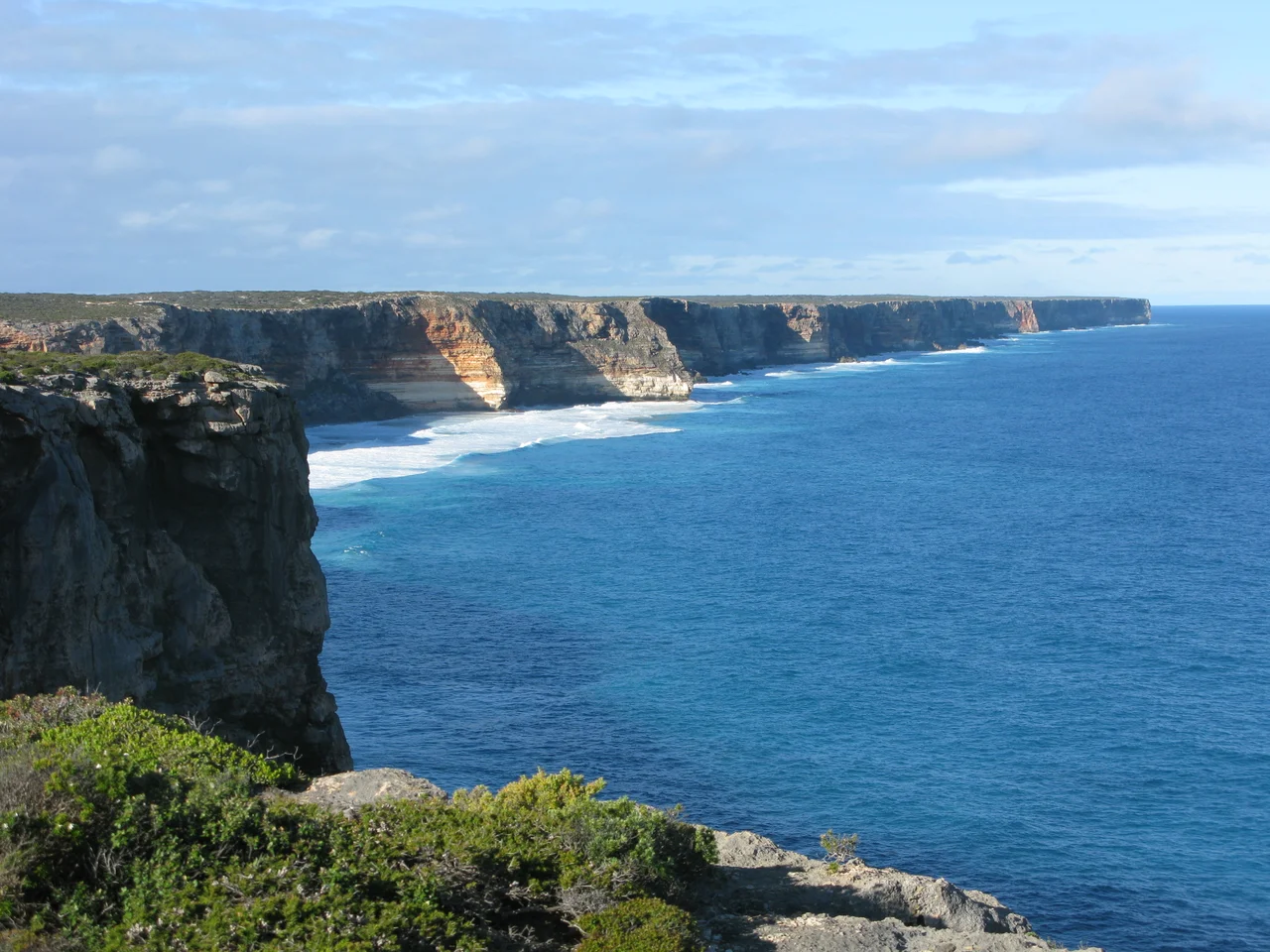

Baxter Cliffs
For almost two hundred kilometres, there is no way down. The Baxter Cliffs rise as a single unbroken wall of pale limestone where the Nullarbor Plain runs out of land and drops, sometimes eighty metres, straight into the Southern Ocean. No harbour, no jetty, no path of descent for most of that length. The plain above is so flat that a traveller can stand a few metres back and never guess the edge is there at all, until the ground simply stops and the swell of the Great Australian Bight booms against the rock below. These are reckoned among the longest sea cliffs on Earth, and they carry the name of a man who never saw their full extent.
The Edge of the Bight
The cliffs run for nearly 200 kilometres, from Point Culver in the west, at the northern end of the Israelite Plain, northeastward to Twilight Cove, where the rampart finally relents and gives way to the lower Roe Plains. They reach up to 80 metres tall. Along that entire span, Toolinna Cove is the only spot where a boat can safely be landed. The Baxter Cliffs form one section of a much longer escarpment carved into the Eucla Basin, a vast sheet of sedimentary rock laid down when this whole region lay beneath a warm shallow sea. Trace the same scarp eastward and it surfaces again as the Hampton Tableland, and again as the Bunda Cliffs across the border in South Australia. The Nullarbor, for all its emptiness, is the floor of an ancient ocean lifted into the sky.
A Name Carried From the Crossing
The cliffs honour John Baxter, overseer to the explorer Edward John Eyre. In 1841 the two men set out to cross the Nullarbor by land from Fowler's Bay in South Australia, accompanied by three young Aboriginal men, among them one named Wylie. The country was merciless: weeks of walking with little water across the waterless plain. On 29 April, two of the Aboriginal men killed Baxter and slipped away into the desert with most of the party's supplies. The ground was solid limestone, and Baxter could not be buried; his body was wrapped in a blanket and left behind. Eyre and Wylie were alone, half-starved, and still hundreds of kilometres from help.
The Two Who Walked On
What followed is one of the great survival stories of Australian exploration, and it belongs as much to Wylie as to Eyre. The two pressed westward for more than a month, sharing what little food they could find, each keeping the other alive. In early June, near Esperance, they sighted a French whaling ship, the Mississippi, anchored offshore under an English captain named Thomas Rossiter. The captain took them aboard, fed them, and replenished their stores. Eyre, stubborn to the last, insisted on finishing the journey overland, and on 7 July 1841 he and Wylie walked into Albany together. The crossing made Eyre famous, but it could not have been completed without the loyalty and bushcraft of the young man who chose to stay.
Reading the Country Today
Visitors rarely reach the clifftop without effort. The escarpment lies within the Nuytsland Nature Reserve, far from the Eyre Highway, down rough station tracks that demand a four-wheel drive and self-sufficiency. There are no railings and no warnings out here, only the long pale line of rock, the wind off the Bight, and the occasional white smudge of a southern right whale moving through the deep water below. To stand at the edge is to feel the strange geometry of the place: an entire continent's edge reduced to a single clean stroke, the same line Eyre and Wylie traced on foot, the same drop that has kept this coast wild and almost untouched.
From the Air
The Baxter Cliffs run along the Great Australian Bight at roughly 32.85°S, 124.86°E, in the Nuytsland Nature Reserve of Western Australia. From the air the feature is unmistakable: a continuous pale escarpment up to 80 m tall separating the dead-flat Nullarbor Plain from the open ocean, stretching nearly 200 km between Point Culver and Twilight Cove. Best viewed from 3,000-6,000 ft AGL on a clear day, when low sun rakes across the cliff face and shadows define its full height. There are no towered airports nearby; the closest sealed strips are Caiguna (YCAG) and Cocklebiddy (YCKY) inland along the Eyre Highway, both small uncontrolled fields. Expect strong, gusty southerly winds off the Southern Ocean and excellent visibility. No fuel or services along this stretch of coast.
Nearby Stories
- Readymix logo geoglyph 49 km away
- Balladonia, Western Australia 56 km away
- Twilight Cove 58 km away
- Israelite Bay 82 km away
- Hampton Tableland 92 km away
- The Great Emu War: When Australia Lost a War to Birds 488 km away
- Marribank 721 km away
- Slade Point 807 km away