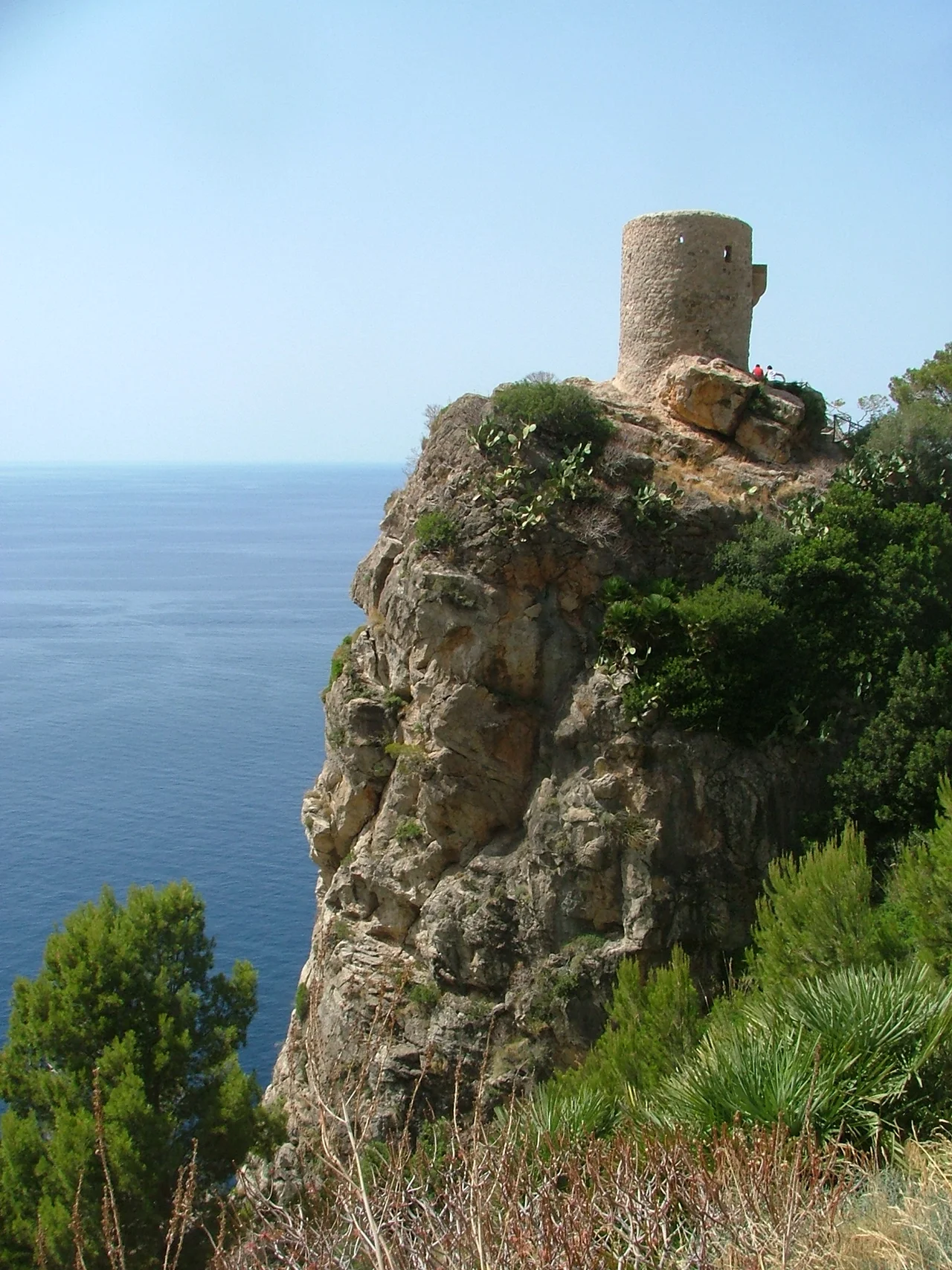

Banyalbufar
The whole village seems to be climbing. From the shoreline, thousands of narrow stone terraces rise up the mountainside in tight green steps, each held in place by a dry-stone wall, each once planted with vines. Banyalbufar clings to the steepest stretch of Mallorca's northwest coast, where the Serra de Tramuntana falls almost straight into the sea, and its people long ago answered the impossible gradient the only way they could — by carving the slope into ledges flat enough to farm. The Arabic name, from a Moorish settlement of the tenth century, is usually read as 'founded by the sea.' What the founders built was not so much a town as a staircase of soil.
A Staircase for Wine
For centuries, everything here bent toward the grape. The terraces — roughly two thousand of them, radiating down from the heights — were devoted above all to Malvasia, a sweet wine so prized that the kings of Aragon coveted it, and the appetite for Banyalbufar's vintages was reckoned among the motives for James I's conquest of the island in 1229. The villagers grew other things too: wheat and barley, olives, flax, hemp, and saffron. But wine was the crown. After a long decline the old Malvasia vines nearly vanished, and only in recent years have growers set about reviving them. Today the terraces more often carry tomatoes and other produce, yet their shape still tells you plainly what they were built to hold. To stand among them is to read a thousand years of labour written into the hillside, wall by wall.
The Genius of Water
None of it would have grown without water, and water on a near-vertical coast is a problem. The solution is one of the finest examples of Moorish engineering on Mallorca. Aqueducts dating largely from the island's Arabic period still carry free-flowing mountain water down to the fields; dry-stone walls, laid by the same builders from the very stones cleared off the land, slow the water's rush down the slope; and a series of catchment basins traps whatever runs to excess. Irrigation and viticulture here are inseparable — one was invented to make the other possible. Ten centuries on, the system still works, a piece of medieval hydraulics quietly doing its job above the sea. Nowhere on the island is the Moorish legacy more legible than in these channels and catchment basins.
Barons and Watchtowers
When the Catalans took Mallorca in 1229, the valley passed to the knights Gilabert de Cruïlles and Ramon sa Clusa, and for the rest of the Middle Ages it was governed almost as a private kingdom. The Barony of Banyalbufar gave its baron both civil and criminal jurisdiction over everyone who lived here — near-absolute power over a village on a cliff. The manor at its heart, La Baronía, still stands and now takes in guests as a hotel. Out on the headland rises the Torre de ses Animes, a watchtower built so villagers could spot the pirates who once raided this coast from the sea. From its platform the view runs for miles, which was, of course, the entire point.
A Village That Nearly Emptied
Life on so steep a slope was never guaranteed. Banyalbufar spreads across just eighteen square kilometres of mountain — the highest peak, Mola de Planícia, tops out at 942 metres — and the rain, when it comes, can come hard: on 10 June 1975 the village recorded 170 litres per square metre in a single day. Its population has always been fragile. It peaked at 894 souls in 1920, then collapsed to barely 200 by 1930 amid political unrest, and stood around 568 in 2005, most of them scattered between the main village and the tiny outlying hamlets of Es Port des Canonge and Son Coll. A well-known walking path winds down through pine woods to the fishing bay of Port des Canonge, which stirs to life only at weekends, when the local boats slip back into the water.
From the Air
Banyalbufar lies at 39.687°N, 2.515°E, on the precipitous northwest coast of Mallorca along the road from Andratx to Valldemossa. From Palma de Mallorca (LEPA), about 28 km to the southeast, cross the Serra de Tramuntana to reach the seaward slope. The clearest visual landmarks are the tiers of green terraces dropping to the sea and the Torre de ses Animes, a lone watchtower on the headland just west of the village. A viewing altitude of 3,000-5,000 ft AGL reveals the full staircase of terraces and the cliffs that frame them. This coast is exposed to the north and west, so expect brisk winds, orographic cloud on the peaks, and turbulence when the Tramuntana wind is blowing.
Nearby Stories
- Cap de Formentor 7.9 km away
- Manacor 8.5 km away
- Bocchoris (city) 38 km away
- Illa de Tagomago 55 km away
- Cala de Sant Vicent 77 km away
- Portinatx 101 km away
- Battle of Ebro River 139 km away
- Shipwreck of Dellys 281 km away