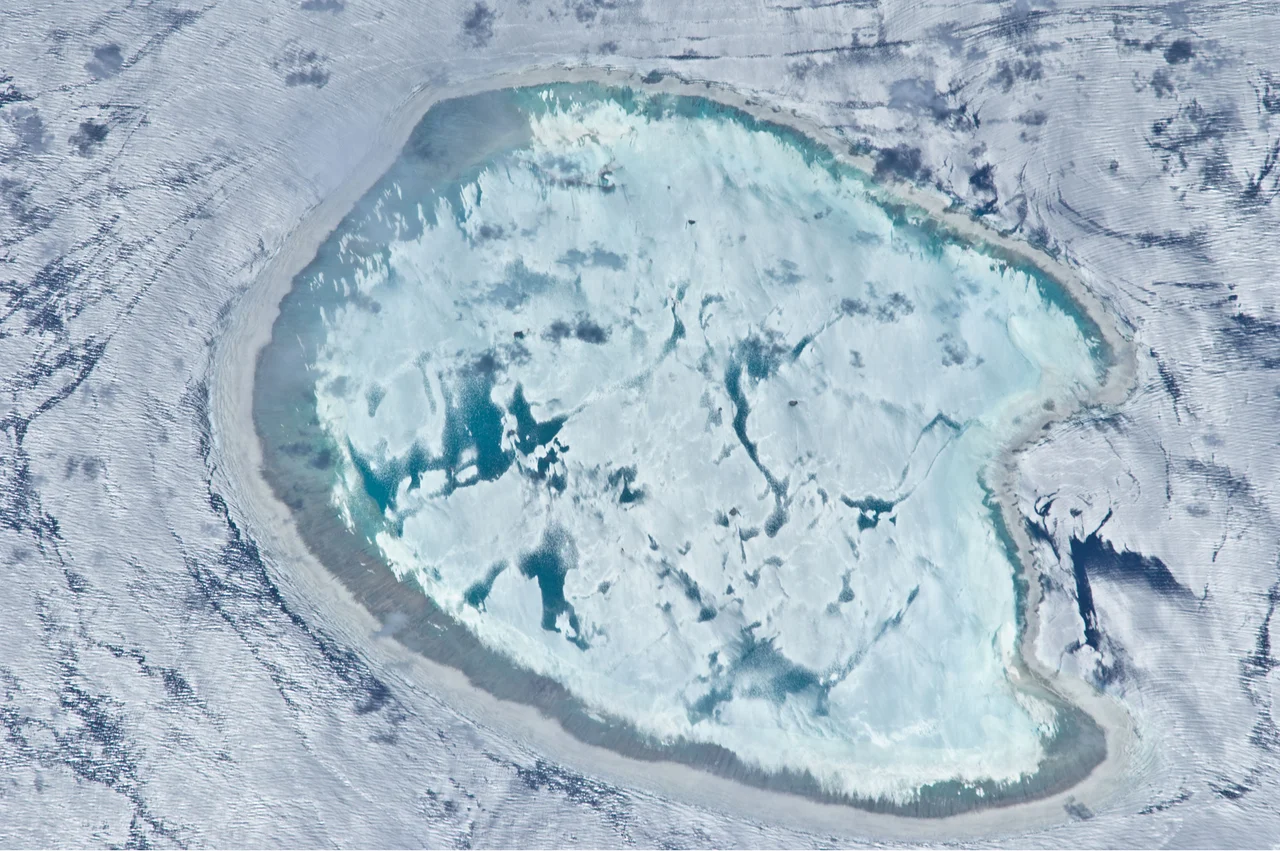

Bassas da India
Twice a day, an entire island disappears. Bassas da India is a ring of coral almost perfectly round, ten kilometers across, rising sheer from a seabed three thousand meters down - and for roughly six hours of every tidal cycle, the sea swallows it whole. From three hours before high tide to three hours after, the reef lies just beneath the surface, invisible, waiting. For five hundred years it has been one of the deadliest traps in the Mozambique Channel, a place sailors learned to fear and treasure hunters learned to covet.
The Vanishing Atoll
Picture a coral wall that encircles a shallow lagoon, its rim averaging just a hundred meters wide, studded with ten barren, vegetation-free rocks no more than a couple of meters high. That is the whole of Bassas da India above water - and only at low tide. The reef plunges almost vertically into the abyss; there is no gentle shelf, no warning shallows for a ship's leadline to catch. A vessel can be in open ocean one moment and grinding across coral the next. France administers this lonely place as one of its Scattered Islands, though Madagascar has claimed it since 1972. Almost no one is allowed to set foot here without a permit.
The Ship That Named It
Portuguese explorers charted the hazard in the early 1500s and called it the Baixo da Judia, the 'Jewess Shoals,' after the ship Judia that struck it in 1506. Over the centuries, mapmakers' transcription errors slowly bent the name into Bassas da India. The most famous victim came in 1585: the carrack Santiago, sailing from Lisbon laden with a fortune - hundreds of thousands of silver pieces of eight - slammed into the reef at full speed in the evening dark, the result of pilot error. The tide rose over the survivors clinging to the wreck and drowned most of them. Around fifty made it ashore near the mouth of the Zambezi River, far to the west.
A Graveyard and a Treasure Vault
The Santiago is only the headline. More than a hundred ships are believed to have died on this reef, their bones scattered along thirty-five kilometers of coral coastline. That deadly history made Bassas da India irresistible to a certain kind of dreamer. In 1977, a Swiss sailor named Ernst Klaar, having read of the Santiago in old maritime archives, sailed out with his teenage son; the boy, snorkeling the reef, spotted cannons on the bottom. The family salvaged cannons, gold jewelry, silver coins, emeralds, religious artifacts, and a rare navigational astrolabe - relics of the lost carrack pulled up from the trap that killed her.
A Sovereignty Dispute Over Nothing
It seems absurd to argue over a reef that is underwater half the time and has no permanent inhabitants, no soil, no fresh water. Yet Bassas da India is contested. France holds it as part of its Scattered Islands in the Indian Ocean and claims an exclusive economic zone of more than 120,000 square kilometers around it - a vast stretch of fish-rich, strategically placed ocean. Madagascar has pressed its own claim since 1972. The stakes are not the rocks but the water and the seabed beneath: fishing rights, potential resources, and control of the super-tanker route through the Channel. When Britain agreed in 2024 to hand the Chagos Islands to Mauritius, the move reignited Madagascar's hopes of reclaiming these specks of French territory.
Life on the Edge
For all its menace, the reef teems with life. The walls dropping into the deep are patrolled by sharks, and in 2003 researchers recorded Galapagos sharks here for the first time anywhere in the Mozambique Channel, suggesting the atoll may serve as a nursery. The isolation that makes Bassas da India so dangerous also makes it a refuge. The French navy patrols these waters hard, seizing illegal fishing and tourism charters that slip out from Mozambique or South Africa. So the ring of coral keeps its solitude, appearing and vanishing with the tide as it has since long before anyone gave it a name.
From the Air
Bassas da India lies at 21.48 degrees S, 39.67 degrees E, in the southern Mozambique Channel roughly midway between Mozambique and Madagascar, about 110 km northwest of Europa Island. From the air it is one of the ocean's strangest sights: a near-perfect pale ring of reef enclosing a turquoise lagoon, set in deep cobalt water - most striking at low tide when the coral rim breaks the surface. There are no airports and no land to speak of; the nearest fields are on Europa Island and in southwest Madagascar (Toliara, ICAO FMST). Cruise high - this is open ocean with cyclone risk in the December-April wet season.
Nearby Stories
- Europa Island 70 km away
- Japanese Submarine I-18 255 km away
- Velondriake 331 km away
- Bazaruto Island 367 km away
- Chibuene 383 km away
- Mikea Forest 406 km away
- Morondava 454 km away
- Quelimane 469 km away