
Battle of Thị Nại Bay
Kublai Khan had already seen Vietnam resist Mongol power by the time he turned his attention to Champa. An earlier overland campaign in 1257 — authorized by Möngke Khan and executed by general Uriyangkhadai, before Kublai's own reign — had sacked Thăng Long but ultimately withdrawn under scorched-earth pressure. But Champa, the Hindu maritime kingdom controlling the coast of what is now south-central Vietnam, had refused to submit to Mongol authority — and in Kublai's empire, refusal had consequences. In summer 1282, he sent Sogetu of the Jalairs, the governor of Guangzhou, south with 5,000 men, 100 ships, and 250 landing craft. They were headed for the harbor now called Qui Nhơn. What waited for them was a fortified wooden fortress, 10,000 Cham warriors, several war elephants, and around 100 Muslim-operated trebuchets.
The Grievance and the Fleet
The expedition had a stated rationale. Kublai declared that the elderly Cham king, Indravarman V, was blameless — the resistance came from his son Harijit and a Southern Chinese ally. Whether the distinction mattered to the men loading landing crafts in late 1282 is unclear. What mattered was the destination: Vijaya, the Cham capital at the bay the Vietnamese called Thị Nại, on the coast of central Vietnam. The Yuan fleet made the passage in late 1282 and arrived at the coast near modern-day Qui Nhơn in February 1283. The Cham defenders had not been idle. They had built a fortified wooden fortress on the west shore of the bay — exactly where any seaborne invader would have to make landfall.
The Night Landing and Morning Battle
Sogetu's forces landed at midnight on 13 February 1283. The assault came from three directions simultaneously: 300 soldiers under Cheng Pin and Chao Ta approached from the east; 1,600 troops under Chen Chung-ta, Li Ch'uan, and Su Ch'uan moved in from the north; and the main force of 3,000, led by Sogetu himself, attacked from the south in three columns. At 05:00 AM, the Cham responded. The south gate opened, and 10,000 warriors marched to the beach — war elephants moving among the columns, drums beating, banners raised. The trebuchets, operated by Muslim engineers who had likely come to Champa through the maritime trade network, opened fire. The fighting lasted through the night and into the following day. By 01:00 AM on 14 February, Yuan forces from the north and east had breached the fort. Thousands of Cham defenders died in the assault, drowned, or were killed inside the walls.
The King Who Would Not Submit
Yuan forces reached Vijaya on 17 February 1283 and completed its capture approximately two days later. But victory at the bay was not the same as victory in Champa. Indravarman V did not surrender. Before evacuating into the western highlands, he executed two Mongol envoys — Yu Yongxian and Yilan — and burned his own warehouses to deny the invaders their supplies. He then disappeared into the mountains, where the Cham kingdom knew the terrain and the Yuan forces did not. The guerrilla campaign that followed proved far more costly to the Mongols than the beach assault had been. Yuan troops captured Vijaya, held it briefly, then withdrew outside the city to set up camps — a sign that controlling the coast was not the same as controlling the country. The occupation never consolidated.
A Bay That Carries the Memory
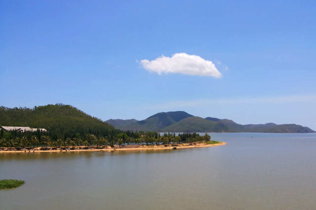
Thị Nại Bay is now the harbor of Qui Nhơn, the capital of Bình Định Province and a modern port city on Vietnam's South Central Coast. The wooden fortress is long gone. The trebuchets and war elephants exist only in Chinese military chronicles and Vietnamese historical records. But the bay's shape hasn't changed: the same sheltered water where Mongol landing crafts grounded in the dark of 13 February 1283 is where fishing vessels and container ships now move. This shoreline saw Champa's last significant military engagement before Mongol pressure and, later, Vietnamese expansion erased the kingdom from the map entirely. The Battle of Thị Nại Bay is one of the places where that story touched ground.
From the Air
The battle site lies at approximately 13.767°N, 109.233°E, centered on Thị Nại Bay near modern Qui Nhơn. The bay is immediately visible from the air: a broad indentation in the coast, sheltered by the Phương Mai Peninsula to the east, with the city of Qui Nhơn on its western and southern shores. Phù Cát Airport (UIH) is approximately 25 km to the northwest, making this one of the most accessible historical sites from the air in the region. From 2,000–3,000 feet, the bay's strategic logic is clear — it is the natural harbor for the entire central Vietnamese coast, the obvious landing point for any fleet arriving from the South China Sea. The Cham fortress would have stood on the western shore, now occupied by the urban waterfront of Qui Nhơn.
Nearby Stories
- Sông Cầu 11 km away
- Operation Crazy Horse 36 km away
- Kon Ka Kinh National Park 42 km away
- Central Highlands (Vietnam) 42 km away
- Chư Yang Sin National Park 76 km away
- Battle of the Paracel Islands 342 km away
- South-East Asian Theatre of World War II 395 km away
- Kashmir Princess 411 km away