
Sông Cầu
Sông Cầu translates roughly as 'river bridge,' and the name fits: this town on Vietnam's South Central Coast has long been a crossing point — between provinces, between administrative eras, between what the country was and what it was becoming. Phú Yên Province's northernmost coastal town sits at 13.45°N, where the coast curves and the South China Sea stretches unbroken to the east. It is the kind of place that rarely makes the history books in its own right, but whose steady persistence through decades of reorganization says something about the durability of coastal communities.
A Coast That Faces East
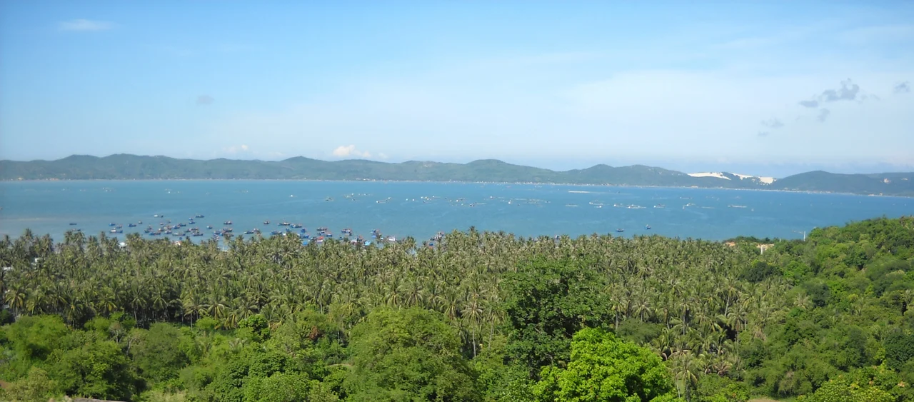
Sông Cầu occupies the northern end of Phú Yên Province, on a stretch of South Central Coast where the mountains press close to the sea and the coastal plain narrows to a thin strip. The town's orientation is oceanic: the four wards and ten communes of Sông Cầu are mostly arranged along estuaries, lagoons, and the bays that indent this part of the Vietnamese coast. Xuân Đài Bay in particular is known for its sheltered waters and aquaculture, especially lobster farming — a livelihood that has shaped the coastal communes more than any administrative redrawing. The fishing boats and lobster cages in the bay's calm water represent a continuity that outlasted the political upheavals that repeatedly redrew the map around them.
Reorganized, Again and Again
After the Vietnam War ended, Sông Cầu was absorbed into Đồng Xuân District in 1976 as part of the new unified government's consolidation of the south. Within a year, Đồng Xuân merged with Tuy An District to form the short-lived Xuân An District — which was itself split apart again in September 1978, less than eighteen months after it was created. Sông Cầu Township served as the administrative seat throughout these reorganizations, a stable center for an unstable structure. On 27 June 1985, Sông Cầu District was finally carved out as its own administrative unit from Đồng Xuân. The upgrades kept coming: on 28 August 2009, the district was elevated to town (*thị xã*) status, formalizing what the coast had always been — a place substantial enough to organize around.
The Town Today
Sông Cầu's 2009 upgrade to town status came with a population of 101,521 people spread across four wards and ten communes. The town's administrative offices are located in Xuân Phú Ward. The Xuân names multiply across the subdivisions — Xuân Yên, Xuân Phú, Xuân Thành, Xuân Đài among the wards, and Xuân Thọ, Xuân Lâm, Xuân Phương, Xuân Thịnh, Xuân Cảnh, Xuân Hoà, Xuân Bình, Xuân Lộc, and Xuân Hải among the communes — a naming pattern that reflects the aspirational language of spring and renewal common in Vietnamese place names. The town is connected south to the Phú Yên provincial capital of Tuy Hòa by the coastal highway, and north toward Bình Định Province and its larger city, Qui Nhơn.
Between Two Provinces
Sông Cầu's position at the northern edge of Phú Yên places it in perpetual conversation with the Bình Định Province to its north — a relationship of proximity rather than belonging. The coastline here is quieter than the resort beaches further south, and the town's economy has long been grounded in fishing and aquaculture rather than tourism. That may be changing: the calm waters of Xuân Đài Bay have drawn increasing attention, and the region's relative obscurity is itself a draw for visitors seeking the less-trafficked Vietnamese coast. But for the fishermen who have worked this stretch of water through every administrative reorganization since 1976, the bay is simply where they have always been.
From the Air
Sông Cầu sits at 13.454°N, 109.221°E on the northern coast of Phú Yên Province. Approaching from the air, the town is visible where a series of shallow bays and estuaries indent the coastline — Xuân Đài Bay in particular is identifiable as a broad sheltered indentation north of the main town area. The nearest airport is Tuy Hòa Airport (TBB) in the provincial capital, roughly 60 km to the south. Phù Cát Airport (UIH) near Qui Nhơn is approximately 80 km to the north. Flying along the coast at 2,000–3,000 feet, the compressed coastal plain — mountains close on the left, the South China Sea stretching right — gives this section of Vietnam its characteristic dramatic narrowness.
Nearby Stories
- Operation Nathan Hale 2.1 km away
- Quy Nhon 10 km away
- Chư Yang Sin National Park 40 km away
- Central Highlands (Vietnam) 42 km away
- Gia Lai province 53 km away
- South-East Asian Theatre of World War II 356 km away
- Battle of the Paracel Islands 374 km away
- Kashmir Princess 394 km away