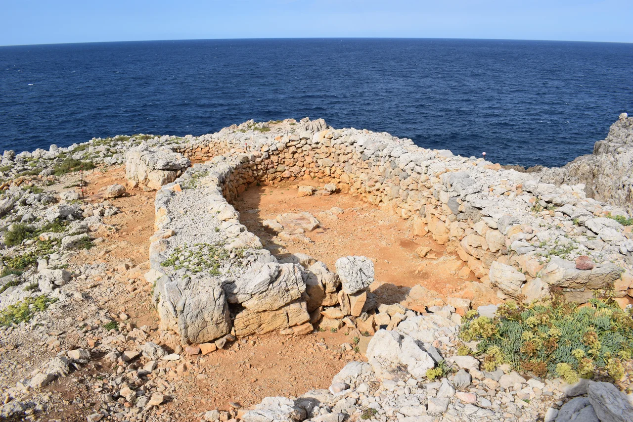

Cala Morell Settlement
The people who lived on this clifftop, thirty-five meters above the Mediterranean, appear never to have eaten the sea. Excavators sifting through the Bronze Age settlement of Cala Morell found bones of goats, sheep, pigs, and above all cattle, along with pottery, grinding stones, and bone tools. What they did not find was fish. Not a single fishbone, no mussel shells, no crab claws, nothing at all from the water crashing at the foot of their headland. It is one of the small mysteries of Menorcan prehistory, and it turns out to be true of every ancient site on the island, not just this one.
A People Who Never Ate the Sea
The complete absence of marine remains is genuinely startling. These were islanders, perched on a coastal headland with the water in constant view, and yet the evidence says they fed themselves entirely from the land. Their diet came from the herds they raised, cattle most of all, supported by cereal they ground on stone. It seems almost willful, a community that turned its back on the obvious larder below. Whatever the reason, whether taboo, tradition, or a way of life carried over from the mainland farmers who first settled the island, the pattern holds across all of Menorca's prehistoric sites. The sea was their horizon and their defense, but apparently not their dinner.
A Fortress by Nature and by Hand
Cala Morell sits on a promontory that closes off the northeast side of its bay, and the site is built to be defended. On the landward side, where the headland joins solid ground, the inhabitants raised a dry-stone wall to seal off approach. On the seaward side they built nothing at all, because they did not need to; the cliffs there are high and sheer enough to form a natural rampart. Archaeologists working the site suspect this defensive posture was no accident but a response to social conflict, a hint that life on Bronze Age Menorca could be dangerous enough to justify walling your village onto a cliff. Two hollows cut into the bedrock near the center may have caught precious rainwater.
Twelve Stone Homes
Scattered across the headland are around a dozen dwelling navetas, the distinctive Bronze Age houses found on Menorca and Mallorca, plus an enigmatic circular structure of large stone slabs raised on the highest point. Excavation of two of the houses, numbered 11 and 12, has begun to reveal daily life here. Both face south and lean against the settlement's outer wall, and inside each runs a bench encircling a hearth, the warm heart of the home. Outside house 11, a grinding-stone base and a clay structure point to food preparation, most likely the grinding of cereal into flour. House 12 lacks those features but has two short wall stretches narrowing its entrance. These were real homes, lived in, cooked in, and repaired.
Between Islands
Cala Morell is still giving up its secrets. After a first survey by the Museum of Menorca in 1996, archaeologists partnered the Municipal Museum of Ciutadella with the History Museum of Manacor on Mallorca to launch a project called Entre Illes, Between Islands. It studies two fortified coastal headlands with the same methods, Sa Ferradura near Porto Cristo on Mallorca and Cala Morell on Menorca, comparing how the two islands' Bronze Age peoples solved the same problems. Radiocarbon dating places the settlement's life between roughly 1600 and 1200 BC. Cala Morell is one of the component sites of Talayotic Menorca, the remarkable ensemble of prehistoric monuments that UNESCO inscribed on the World Heritage List in 2023.
From the Air
The Cala Morell settlement sits at 40.0575 N, 3.8828 E on Menorca's northwest coast, on the headland closing the northeast side of Cala Morell's small bay near Ciutadella. Recommended viewing altitude is 2,000 to 3,500 feet to trace the promontory and the cove it guards, with Ciutadella's long harbour inlet a short distance to the south. Menorca airport (LEMH) is roughly 50 km east near Maó; Palma de Mallorca (LEPA) lies west across open water. This is the exposed north coast, where the tramuntana wind blows hard and often, so pick a settled, clear day for the best low-level look at the cliffs and the ancient headland.
Nearby Stories
- Castle of Capdepera 7.5 km away
- Cap de Formentor 26 km away
- Ses Païsses 59 km away
- Llobregat Delta 165 km away
- Somorrostro 200 km away
- Porto Flavia 332 km away
- Cosquer Cave 336 km away
- Nuraghe Seruci 340 km away