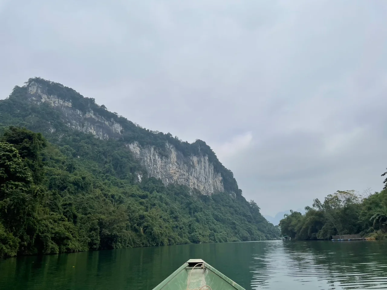

Con Cuông
Look for Con Cuông district on a current map of Vietnam and you will not find it. On 1 July 2025 the country carried out the most drastic administrative reform in decades, folding 63 provinces and cities into 34 and abolishing the district tier outright, so that government now runs from province straight to commune. Nghệ An kept its name and its borders; its districts did not survive. Con Cuông — 1,680 square kilometres of mountain forest in the province's west, about 130 kilometres from Vinh, with 61 kilometres of border facing Laos — was reorganised out of existence, and a new Con Cuông commune assembled in its place. The name persists. It has outlasted several previous attempts to retire it.
Ten Thousand Years Under a Ceiling of Rock
About four kilometres east of Trà Lân town lies Tam Hối cave, a site bearing the marks of the stone-age Hòa Bình culture. Excavations in 1967 and again in 1972 — conducted, it is worth noting, while the air war was under way over this province — brought up stone tools, animal bones, mollusc shells, human remains and grave goods. Radiocarbon dating puts the occupation at roughly ten thousand years old. Those were burials, not merely debris: people here were placing objects with their dead before the invention of agriculture reached the valley. Later the district lay within Âu Lạc, and a Đông Sơn bronze drum found locally links these hills to the bronze-casting civilisation of the Red River delta. Continuity, in other words, is the local speciality.
Words Cut Into a Cliff
In the winter of 1335, an inscription was carved directly into the rock face of Mount Thanh Nam. The Ma Nhai merit-record stele commemorates a victory by the Trần emperor Trần Minh Tông over invaders from Ai Lao, present-day Laos, and its text was composed by the scholar-official Nguyễn Trung Ngạn. A century later this frontier changed hands again. During the Ming occupation of 1407 to 1427, the fortress of Trà Lân stood in what is now Bồng Khê, held by a local commander named Cầm Bành who had thrown in with the occupiers; it could hold several thousand troops behind the Lam River, the surrounding mountains, deep trenches and bamboo palisades. Lê Lợi's Lam Sơn uprising besieged it and forced Cầm Bành's surrender. When Lê Lợi drove out the Ming and founded the Later Lê dynasty, the district took the name Trà Lân — the name given back to the local town in December 2024, six hundred years later, when Con Cuông township merged with Bồng Khê and part of Chi Khê.
Looms, Leaf Yeast and the Giăng River
The 2019 count recorded 77,830 people here, drawn from more than twenty-five ethnic groups. Thai communities make up the great majority — 52,803 people, just over seventy percent — alongside 18,059 Kinh and 3,750 Đan Lai. Thai women weave brocade on handlooms in geometric patterns for clothing, scarves and household textiles; artisans in Diềm village in Châu Khê work bamboo and rattan into baskets and storage jars; households ferment rượu cần and rượu men lá from sticky rice and leaf yeast, burying the jars in the earth to age. Since around 2012, when the province began promoting community tourism, between 300,000 and 400,000 visitors a year have come to sleep in stilt houses in Nưa, Khe Rạn and Xiềng, take boats up the Giăng River, and stand at the foot of Khe Kèm waterfall, which drops 150 metres inside Pù Mát National Park. In Thai it is called Bo Bo, or Boc Bo — white silk ribbon. Nearby, Mọc Spring is the Fairy Spring, where the Jade Emperor's celestial maidens are said to have bathed before descending to the human world.
The Stilt House at Môn Sơn
In the early 1930s, the French colonial administration broke the Nghệ-Tĩnh Soviets with considerable violence, and the revolutionary movement in the lowlands had nowhere left to stand. The response was to go uphill. Lê Xuân Đào and Nguyễn Hữu Bình were sent into Con Cuông to organise young people and support peasants against landowners, and by mid-April 1931 a party branch had been formally established at the stilt house of Vi Văn Khang in Môn Sơn commune, with Khang as its first secretary — the first such branch in the western uplands of Nghệ An, founded by and among Thai villagers rather than delivered to them. Meetings were held in that house; weapons were stored there; leaflets were printed there. Suppression through the rest of the decade drove the work underground without ending it, and in the August Revolution of 1945 local people seized food and stores from landlords and officials and shared them out. The house still stands, and every April the commune holds a ceremony there.
The Forest That Pays the Bills
Nearly 95 percent of the land is farm or forest, and the mountains that hem the district in are also its economy. There is timber under a canopy that closes over seventy percent of the ground, and quarry stone including a marble deposit at Làng Pha reckoned at 170 million cubic metres. The greater asset is the forest itself. Con Cuông sits at the core of the Western Nghệ An Biosphere Reserve, with Pù Mát National Park at its centre, and twenty-four local communities now share in payments for keeping that forest standing. Cửa Rọ valley, ringed by mountains, was a natural stronghold when Lê Lợi ambushed Ming troops there; during the American war, families sheltered in it from the bombing. The valley has now been quiet for fifty years. It is the longest run of peace this frontier has had in a very long time.
From the Air
Con Cuông lies at approximately 19.05°N, 104.88°E in western Nghệ An, Vietnam, roughly 130 km west-northwest of Vinh, with terrain running from about 50 m in the Lam River valley to 1,841 m at Pu Mat on the Lao frontier. Fly at 5,000–8,000 ft AGL to hold both the river corridor and the forested ridge line in view. Navigate on the Lam River and National Highway 7A, which run together through the settled valley floor, with the Giăng River joining from the south and the unbroken canopy of Pù Mát National Park filling the ground southwest of town. Nearest airport is Vinh (VVVH), about 130 km east; Thọ Xuân (VVTX) lies to the north and Vientiane–Wattay (VLVT) across the border to the west. Summers are hot, running to the mid-30s Celsius with dry westerly winds off Laos; the wet season is May to October, peaking in September, and dry-season mornings can bring near-freezing temperatures and heavy valley fog.
Nearby Stories
- Diễn Châu 12 km away
- Kim Liên Museum 18 km away
- Ho Chi Minh Trail 18 km away
- Bến En National Park 32 km away
- Ban Nahin 67 km away
- Nghi Sơn Refinery 90 km away
- Viengxay Caves 120 km away
- Battle of Lima Site 85 169 km away