
Concepción
Once a week, a boat called the Aquidabán pulls away from the dock at Concepción and disappears upriver into one of South America's last great wildernesses. It is a living relic - a creaking cargo ferry that stops at nearly every settlement on the Paraguay River as it crawls north toward Bahía Negra, hauling fuel, supplies, and the occasional backpacker into country where roads simply give up. For the people scattered along that water, the Aquidabán is not a curiosity. It is the lifeline.
Pearl of the North
Concepción earned its nickname - La Perla del Norte - the way river ports often did: through money. At the turn of the twentieth century, yerba mate and timber from across northern Paraguay and the Brazilian state of Mato Grosso poured into the city, were loaded onto boats, and floated downriver to Argentine ports for shipment to Europe and Asia. The trade brought Italian, Spanish, and Arab immigrants, and they left their fortunes in stone. Walk the compact grid of streets today and you pass the Mansión Otaño, the Villa Ida, and a procession of aristocratic Italianate manors, their decorated facades a memory of when this sleepy town of 83,000 was one of the busiest commercial hubs in the country.
A Frontier Fort
The city began not as a pearl but as a shield. Governor Agustín Fernando de Pinedo founded the Villa Real de la Concepción on 25 May 1773 to guard Spanish territory against two threats: the Mbayá peoples of the region and the Portuguese, who pressed constantly westward from Brazil. For nearly forty years it stayed a pure military outpost, no civilians permitted, until 1812 finally opened it to settlers. War never strayed far. In late 1864 Mariscal Francisco Solano López sent a river expedition of some 3,000 soldiers upriver from this port to attack Brazil's Mato Grosso - the opening blow of the catastrophic War of the Triple Alliance. Years later, after López met his death at Cerro Corá to the east, his wake was held in this same city.
The River Defines Everything
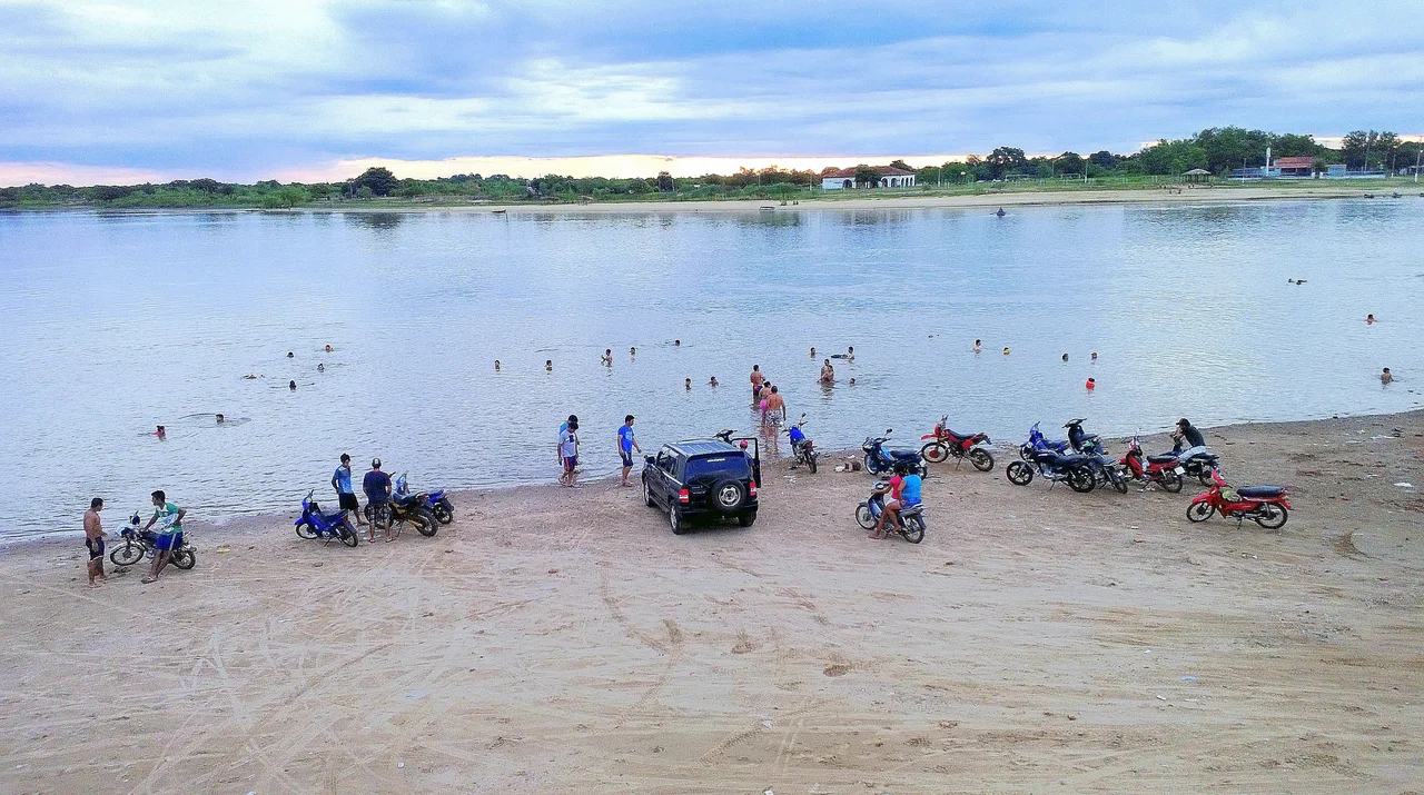
Life in Concepción still bends toward the water. There is a public beach beside the port where families gather on weekends to swim and fish, and the sunsets over the Paraguay River draw quiet crowds. Across the channel lies the island of Chaco'í, home to a handful of families who row to the mainland each morning to work, their dirt lanes lined with farm animals and crops and a single small church. North of the city, the Aquidabán River unrolls some of the country's finest beaches - broad stretches of yellow sand - while the Tagatiyá stream runs so clear it has become locally famous for its colored little fish.
An Art Town in Disguise
For a remote cattle port, Concepción carries a surprising cultural weight, much of it owed to one man. The painter Carlos Colombino, born here in 1937, became one of Paraguay's most important artists and a fierce critic of the Stroessner dictatorship. He pioneered a technique he called xilopintura - carving and painting thin sheets of wood into large, otherworldly panels - and gave his work titles like El Torturado, the tortured one. Colombino helped found museums across the country, including Concepción's own Museo de Arte Contemporáneo. The city keeps three museums in all, each tied to a different era: the trading boom, the war years, and the present.
Gateway to the Wild North
Most travelers come to Concepción for what lies beyond it. This is the staging point for the Pantanal - the vast wetland straddling Paraguay, Bolivia, and Brazil - reached by sailing the Aquidabán north toward Fuerte Olimpo and Bahía Negra. It is also a base for the touristic estancias of the surrounding ranchland, for sport fishing on the river, and for the limestone cave country around Vallemí. During holidays the city fills with anglers from Pedro Juan Caballero and Brazilians from across the border, drawn to a place that has quietly traded its commercial grandeur for something rarer: a foothold at the edge of the map.
From the Air
Concepción sits at 23.40°S, 57.43°W on the east bank of the Paraguay River in northern Paraguay, about 460 km north of Asunción. The city has its own airport on the southern edge of town, near the Nanawa bridge, served by a weekly domestic flight; the nearest international gateway is Silvio Pettirossi International Airport (ICAO: SGAS) at Asunción, roughly 300 nautical miles south. From the air the city is unmistakable: a tight grid of streets pressed against a wide silver bend of the Paraguay River, with the flat green expanse of the Chaco stretching west and cattle country rolling east. Best viewed in clear morning light before river haze builds. Recommended viewing altitude FL250-FL350 en route, lower for a look at the port, the public beach, and the island of Chaco'í across the channel.
Nearby Stories
- Nueva Germania 33 km away
- Tevego 53 km away
- Laguna Blanca (Paraguay) 77 km away
- Battle of Cerro Cora 113 km away
- Río Pilcomayo National Park 149 km away
- Villa Hayes 152 km away
- First Battle of Nanawa 175 km away
- Paraguayan Chaco 177 km away