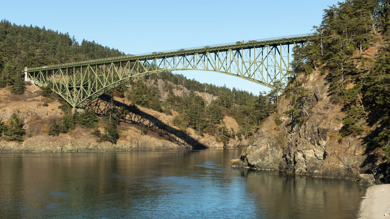

Deception Pass Bridge
To cross before the bridge, you banged on a saw. There was no schedule and no ticket office at the Fidalgo Island landing in the horse-and-buggy years - just a saw hung where travellers could reach it and a mallet to hit it with, and then you waited for someone on the far shore to come and get you. Below that crossing, the water moved through a rock gap at up to nine or ten knots, reversing twice a day, boiling into standing waves and whirlpools. It is a strange thing to stand on the Deception Pass Bridge now, 180 feet above all that, and think about the people who used to signal across it with a hand tool.
A Channel Mistaken for a Bay
The name is an accusation. Spanish charts had marked this notch in the coastline as a small bay, and on 2 June 1792 Joseph Whidbey - master of HMS Discovery and George Vancouver's chief navigator - proved otherwise. It was not a bay at all but a deep, violent channel linking the Strait of Juan de Fuca with Saratoga Passage, which meant the long body of land the British had been calling a peninsula was in fact two islands, Fidalgo and Whidbey. Vancouver named the pass for the deception and the larger island for the man who caught it. The water has been intimidating mariners ever since. Thomas Coupe, a sea captain who founded Coupeville down the island, is recorded as the only person ever to take a full-rigged ship through the strait - a feat nobody appears to have felt the need to repeat.
Depression Steel
Construction began in August 1934, at the bottom of the Depression, and the money came from the Public Works Administration topped up with county funds: $482,000 in total. It is not one bridge but two. The northern span crosses Canoe Pass on a single steel arch of 511 feet; the southern crosses Deception Pass itself with a pair of 175-foot cantilever arms carrying a 200-foot suspended span between them; Pass Island sits in the middle, holding them apart. The Wallace Bridge and Structural Company of Seattle supplied the steel - 460 tons for the Canoe Pass side, 1,130 tons for Deception Pass. Young men from the Civilian Conservation Corps built parts of the project, the same New Deal labour force that was cutting trails and raising shelters across the rest of the Northwest. End to end the structure runs 1,487 feet, better than a quarter of a mile. It was dedicated at noon on 31 July 1935, eleven months after the first work began.
What the Bridge Made Possible
A bridge changes the arithmetic of a place. Whidbey Island stopped being a ferry-dependent backwater the day the span opened, and the fact that it was now reachable by road weighed on the Navy's decision to establish Naval Air Station Whidbey Island a few years later. Oak Harbor, the town nearest the base, grew from that decision and has not stopped. Today around twenty thousand vehicles cross the pass daily. They do it on a deck twenty-eight feet wide, in two eleven-foot lanes, one each way - dimensions set in 1934 for a country that had far fewer cars and much narrower ones. The sidewalks are three feet. People walk them anyway, in large numbers, because the view from the middle is one of the best in Washington and because standing above that current is genuinely thrilling in a way a photograph never conveys.
Evergreen Green
In 1982 the bridge was added to the National Register of Historic Places, and the timing was not sentimental: a major repainting was coming, and it would end up costing more than the entire original construction. Steel over salt water is a permanent maintenance obligation, not a finished object. A second repainting followed in 1997, this time in lead-free paint, with corroded members cut out and replaced - and with the colour held exactly where it was. The shade has a name, Evergreen Green, and changing it was never really on the table. The bridge has passed into the region's visual vocabulary that thoroughly. It has even been exported: the designers of the 2004 video game Half-Life 2 took the structure as the model for the under-bridge sequence in its Highway 17 chapter, so that a generation of players who have never been to Washington have crawled along its girders anyway, in a different country, with the same drop underneath.
From the Air
Located at 48.406 N, 122.645 W, carrying Washington State Route 20 between Fidalgo Island (Skagit County) and Whidbey Island (Island County). It is one of the most recognizable structures in Puget Sound from the air: two green steel spans totalling 1,487 ft, separated by Pass Island, crossing a narrow rock-walled channel about 180 ft below. Deception Pass State Park surrounds it, so the approach on both sides is dark conifer forest meeting steep cliffs and pale beaches. The Strait of Juan de Fuca opens west, Skagit Bay and the Cascade foothills lie east, and Mount Baker stands prominently to the northeast in clear weather. Tidal flow through the gap runs up to 9 knots in Deception Pass and 10 in Canoe Pass, and is often visible from altitude as rips and standing waves. Recommended viewing altitude is 1,500-3,000 ft MSL. NAS Whidbey Island (KNUW) is roughly 10 km south with associated restricted and special-use airspace - check NOTAMs and stay clear of active military operations. Skagit Regional (KBVS) is about 20 km east and Anacortes (74S) about 12 km northwest. Expect marine layer mornings, funnelled westerly wind through the pass, and strong mechanical turbulence close to the cliffs.
Nearby Stories
- Saratoga Passage 1.9 km away
- Glacial Erratic Boulders of the Puget Sound Region 3.1 km away
- San Juan Island 12 km away
- Saturna Island 13 km away
- Mount Baker 16 km away
- Hurricane Ridge 35 km away
- Snoqualmie Valley 54 km away
- North Cascades National Park 80 km away