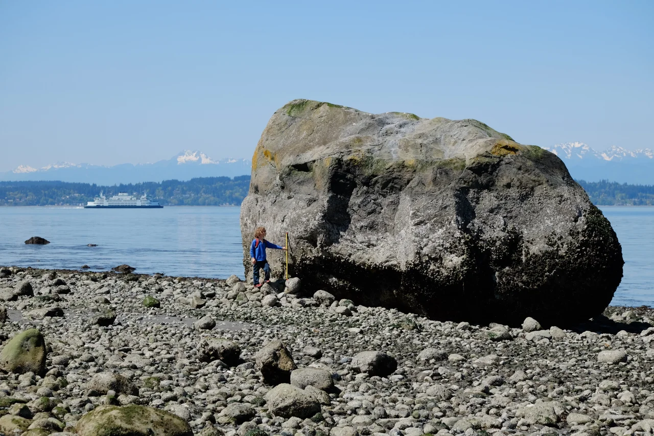

Glacial Erratic Boulders of the Puget Sound Region
On a quiet residential street in northeast Seattle there is a rock roughly nineteen feet tall and weighing something on the order of seven hundred tons. Houses stand on either side of it. It is gneiss, and its mineral signature matches Mount Erie on Fidalgo Island, about 89 kilometres to the north - which is to say that this boulder did not roll there, did not wash there, and was not put there by anyone. It was carried, frozen into the base of an ice sheet, and set down roughly 14,000 years ago when the ice let go. Then a neighbourhood grew up around it.
Canadian Rocks in the American Lowland
During the Pleistocene, a tongue of the Cordilleran ice sheet called the Puget Lobe pushed south out of British Columbia and down this basin, reaching its maximum extent near present-day Yelm. It carved Puget Sound itself along with most of the region's recognizable landforms, and when it retreated it left behind everything it had been carrying. As Nick Zentner of Central Washington University's geology department puts it, "Canadian rocks [are] strewn all over the Puget lowland, stretching from the Olympic Peninsula clear over to the Cascade Range." A glacial erratic is simply a rock that does not belong to the bedrock beneath it. Each one is a shipping label, and with enough petrology you can read the origin address.
A City Built on Debris
Seattle sits on the evidence. Roughly eighty per cent of the city's soil is glacial drift, most of it Vashon till laid down during the last major glaciation, and nearly every one of its famous hills is a landform the ice made. Beacon Hill, First Hill, Capitol Hill, and Queen Anne Hill are drumlins - elongated mounds streamlined beneath moving ice. Magnolia and West Seattle are drift uplands. Residents climbing those hills on foot or in low gear are climbing glacial sediment, shaped and left in place while the ice was still on top of it. Within that till, genuinely large boulders are the exception. Anything more than three metres across counts as rare, which is part of why the biggest erratics have become local landmarks rather than simply large rocks.
The Rock in Wedgwood
The Seattle boulder has a neighbourhood named around it - Wedgwood Rock, in the Wedgwood district, one of a small handful of truly large erratics in the Puget Sound area. Nineteen feet at its tallest and hundreds of tons in mass, it is the kind of object that seems to violate the rules of the street it sits on. Its gneiss matches the rock of Mount Erie on Fidalgo Island, 55 miles north, which means the ice moved it that distance at minimum and possibly carried it from much farther before that. Standing next to it, the arithmetic is difficult to process: the thing beside you is heavier than the houses on the block combined, and something once carried it like grit in a boot.
The One Hiding in the Trees
The largest erratics are not all in cities. On Whidbey Island, in the second-growth forest of Saratoga Woods Park, the Waterman erratic stands about thirty-eight feet high with a circumference of roughly 135 feet - a greenschist monolith with chlorite and epidote in its mineralogy, marking it as low-grade metamorphic rock formed under pressure a long way from here. There is no plaza around it and no plaque on the street. You walk in through the trees and it is simply there, mossed over, considerably larger than anything in the forest around it, doing nothing at all and having done nothing at all for fourteen millennia.
Why Geologists Chase Them
Erratics are more than curiosities. Match a boulder's rock type to its source outcrop and you have a data point on where the ice came from and how it flowed; plot enough of them and the flow lines of a vanished ice sheet start to appear on the map. That is the premise behind the Washington glacial erratics project at the University of Washington's Department of Earth and Space Sciences, which catalogues these boulders across the region. They are scattered from the Olympic Peninsula to the Cascade foothills, some in parks, some in yards, some in the middle of nowhere. Every one is a piece of somewhere else, delivered by an ice sheet that has been gone since before anyone built a road here.
From the Air
The reference point for this region's erratics is 48.6983°N, 122.4793°W, in the northern Puget lowland near Samish Bay south of Bellingham, but the boulders themselves are scattered across the entire basin - from the Olympic Peninsula east to the Cascade foothills and south to the Yelm area, where the Puget Lobe stopped. What is visible from the air is not the rocks but the machinery that delivered them: the long north-south grain of the Puget lowland, the parallel ridges and troughs scoured by ice moving south, Whidbey and Fidalgo islands, and the drumlin-streaked terrain under Seattle. Recommended viewing altitude is 6,000-10,000 ft MSL to read the glacial fabric of the landscape, with 3,000 ft appropriate for individual parks and shoreline exposures. Bellingham International (KBLI) is roughly 10 nm north of the reference point; Naval Air Station Whidbey Island (KNUW) lies about 20 nm southwest, Paine Field (KPAE) about 35 nm south, and Seattle-Tacoma International (KSEA) roughly 65 nm south. Note military airspace around Whidbey. The lowland is prone to winter fog and low stratus; clear winter days after a front passes give the sharpest relief.
Nearby Stories
- Naval Radio Section Aldergrove 5.2 km away
- Anacortes 6.8 km away
- Saturna Island 7.4 km away
- George Massey Tunnel 9 km away
- Mount Baker 13 km away
- Discovery Island (British Columbia) 17 km away
- North Cascades National Park 80 km away
- Manning Provincial Park 88 km away