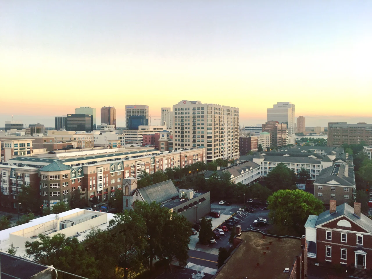

Downtown Norfolk, Virginia
The skyline of downtown Norfolk in 1982 and the skyline of downtown Norfolk today share almost no buildings. A visitor who flew out in the early 1980s and never came back would not recognize the waterfront they remember. The piers that once handled noxious cargo, the decaying warehouses, the pedestrianized Granby Street with its empty storefronts and rising crime - all gone. In their place: Town Point Park, the Waterside Festival Marketplace, the Nauticus science center with the battleship Wisconsin moored at its door, the Half Moone Cruise Terminal, the Wells Fargo and Dominion Enterprises towers, and an upscale shopping mall named for a five-star general whose tomb sits across the street. The transformation took forty years and a lot of federal money. It is not a finished project. Most of it works.
How Granby Street Died
Through the first half of the twentieth century, Granby Street was the commercial heart of southeastern Virginia. Smith and Welton, Rices Nachmans, Ames and Brownley - the city's department stores ran a century or longer. The street had fine hotels, the NorVa Theater, Loew's State, the Wells Theatre, the Monticello Arcade. Then suburbia happened. Pembroke Mall opened in Virginia Beach as the region's first climate-controlled shopping mall. JANAF Shopping Center opened in Norfolk's Military Circle area. The Granby Street stores could not match free parking at the door and air conditioning. City leaders tried to fight back by turning Granby Street into a pedestrian mall, repaving it, adding planters and benches. The Granby Mall, they called it. It made things worse. Closing the street to cars reduced foot traffic, increased the sense of abandonment, and pushed the spiral lower.
Urban Renewal at the Waterfront
While Granby died slowly, city leaders looked at the waterfront and made a different bet. The Housing Act of 1949 had created federal funds for the demolition of urban blight, and Norfolk took them. The piers and warehouses came down. Some of what came down with them, in retrospect, did not need to: the City Market, the Monticello Hotel, Norfolk Terminal Station, and most of the East Main Street historic district. The replacement was Waterside Drive, the Town Point Park esplanade, the Waterside Festival Marketplace built in 1983 by the Enterprise Development Company - founded by James Rouse after he left The Rouse Company - on the model of Baltimore's Harborplace, and the Norfolk Omni Hotel. The waterfront revival worked almost immediately. Office towers followed - Town Point Park created a place people wanted to be near, and developers built tall to be near it.
The General's Mall
By the mid-1990s the waterfront was solid, and city leaders went back to Granby Street. The piece of urban-renewal land one block east had been sitting empty for years. The strategy was an upscale enclosed shopping mall - the same form that had nearly killed Granby Street in the first place - and the bet was that climate-controlled retail might save what climate-controlled retail had broken. The city pursued Nordstrom for years, finally landed a commitment in late 1997, and named the mall MacArthur Center for the five-star general whose tomb stands across the street at the old Norfolk City Hall. The mall opened in March 1999 with Nordstrom, Dillard's, an eighteen-screen Regal Cinemas, and a tenant mix that brought brands the region had never seen. Granby Street did not die again; it filled up with restaurants and bars feeding off the shoppers walking the block from the mall.
The Retail Apocalypse Arrives
MacArthur Center peaked early. The retail apocalypse hit it the way it hit American malls everywhere. Nordstrom closed in April 2019. Dillard's followed in September 2023. By 2024 the mall was only 56 percent occupied; Regal Cinemas had become the largest tenant by a long way. The city of Norfolk bought the property in 2023 with the intention of redeveloping it as a mixed-use complex anchored by a convention or conference center and a headquarters hotel. The Waterside Festival Marketplace had already gone through a similar cycle - it lost most of its tenants by 2012 and was reborn in 2017 as Waterside District, a smaller entertainment venue. Cities renew themselves over and over, and Norfolk has done it twice in fifty years.
The Map Today
Walk through downtown Norfolk today and the layers are visible. The Walter E. Hoffman federal courthouse from the early 1930s and the Pickett Custom House from 1852 anchor the historic district. The Wells Fargo Center from 2010, twenty-three stories, sits a block away. Tidewater Community College runs its central campus along Granby Street, with the library housed in the painstakingly renovated Smith and Welton department store building - the place where, eighty years earlier, Norfolk women bought their hats. Nauticus and the battleship Wisconsin draw two million visitors. The Ghent neighborhood just northwest is the densest residential district in the Hampton Roads region. Norfolk has spent decades figuring out what a downtown is for after containerized shipping took away its first reason to exist. The answer it has built is part museum, part residential, part cruise terminal, part civic center - and still arguing with itself about the next chapter.
From the Air
Downtown Norfolk centers at 36.847N, 76.285W on the north bank of the Elizabeth River. From the air the downtown is identifiable by its cluster of high-rises, the curving waterfront with the battleship Wisconsin visible at Nauticus, and Town Point Park. Norfolk International (KORF) is 6 nm east-northeast; Naval Station Norfolk (KNGU) is 4 nm to the north. Recommended viewing altitude 1,500-3,000 feet AGL for waterfront identification.
Nearby Stories
- James River Reserve Fleet 3.5 km away
- Coastal Virginia Offshore Wind 11 km away
- Cape Charles Air Force Station 15 km away
- Dismal Swamp Canal 24 km away
- Blackwater River (Virginia) 25 km away
- Bacon's Castle 32 km away
- SS Monroe (1902) 66 km away
- Bodie Island Lighthouse 83 km away