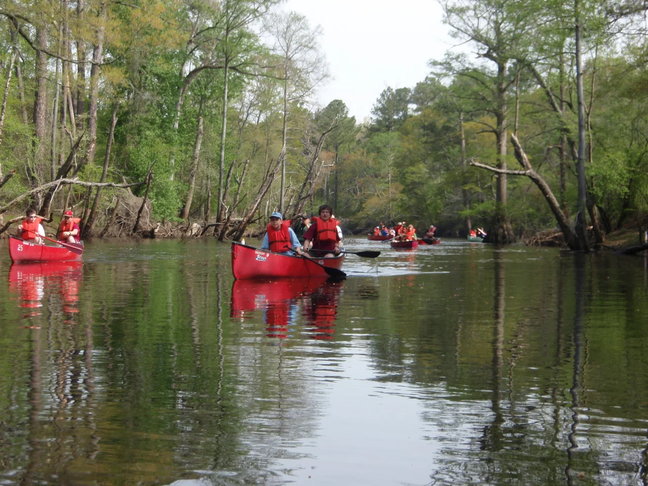

Blackwater River (Virginia)
Most of Virginia's rivers obey the Chesapeake. They flow east or southeast, dumping into the bay where colonial governors could see them, tax them, regulate them. The Blackwater would not cooperate. It rises in swamps near Petersburg, slides 105 miles through the coastal plain of southeastern Virginia, and runs south into North Carolina - away from Chesapeake authority, toward the lawless Albemarle. That geographic stubbornness shaped four centuries of human story: it drew settlers into a region the colony tried to keep closed, it became a colonial-era boundary the Powhatan Confederation negotiated for, and during the Civil War, it became a thin, badly defended line that thousands of enslaved people crossed into freedom.
Water the Color of Tea
Step into the Blackwater and the water is clear, but it looks black. Tannins leaching out of fallen leaves and cypress knees turn it the color of strong tea, slightly acidic, low in nutrients - a true blackwater river. The flood plain is mostly forested swamp, dotted with pocosins, those bog-like wetlands that perch on the higher ground between drainages. The Blackwater River Preserve protects one of the oldest bald cypress and tupelo stands in the South, with trees up to 800 years old. For decades the largest known water tupelo in the United States stood here in Isle of Wight County, ninety-five feet tall with a trunk measuring 406 inches around. Virginia's Blackwater watershed still holds some of the largest specimens anywhere; a record-breaking water tupelo in nearby Greensville County has since taken the national title at 108 feet and 463 inches of girth. These are trees that were already old when Jamestown was founded.
A Line Drawn in 1646
After two years of war between the Virginia colony and the Powhatan Confederation, Governor William Berkeley and Chief Necotowance signed a peace treaty in 1646. The agreement drew a hard frontier: the lower Blackwater River became the boundary between English Virginia and Native lands to the south and west. Native people could only cross at Fort Henry on the Appomattox, where Petersburg now stands, and they had to display a special badge. Without it, they could be killed on the spot - and after 1662, arrested. The line held legally until 1706. In practice, it leaked. Settlers slipped south, planted tobacco on Appomattoc and Nottoway ground, and the colonial government issued increasingly desperate orders for them to come back. The Blackwater's geography made the leak inevitable. Its headwaters lay within three miles of the James River settlements; once you found the watershed, the river itself carried you south.
South Quay and the Pull Toward Carolina
By 1713, a place called South Quay, six and a half miles downriver from Franklin, was becoming a serious port. Warehouses filled with tobacco, salt pork, and lumber waited for ships that came up from the Atlantic by way of Albemarle Sound and the Chowan. By 1777 South Quay was the leading interior port serving the Tidewater. Its shipyard built two vessels, the Caswell and the Washington, that helped defend the coast from the British in 1777-78. The Royal Navy noticed. On July 16, 1781, Lieutenant Colonel Dundas was dispatched by Cornwallis to destroy South Quay - and did. What is now called Old South Quay never came back as a port. The Blackwater settlements had been drawn away from Virginia's Chesapeake center of gravity for decades by then; the war just put a violent punctuation mark on the divergence.
The Boundary That Leaked Both Ways
In the Civil War the Blackwater became a frontier again. For a stretch of the conflict it marked the dividing line between Union-held territory to the east and Confederate Virginia to the west. The Confederate forces did not have enough men to defend it properly. Thousands of people who had been enslaved in Southampton County - the same county where Nat Turner had launched his 1831 rebellion - slipped across the river and walked into Union lines. The word the Federal army used for them was contraband, a legal fiction that let northern commanders refuse to return them while the war still raged. The word was not adequate. They were people who had used the same river that had once been a colonial cage as a corridor out, exactly as their geography promised it could be.
The River Today
Modern Blackwater is a paddler's river. From Franklin, where the head of navigation sits and the new River Walk park puts a canoe launch by the bridge, kayakers slip into the same braided channels of cypress and tupelo. Red-cockaded woodpeckers - the species reaches its northern limit here - work the longleaf pine flatwoods east of the river. More than thirty species of amphibians breed in the floodplain. In spring the dark water hosts runs of striped bass, river herring, American and hickory shad. The bowfin and gar in the lower stem will bend a rod. Hurricane Floyd in 1999 and an unnamed October 2006 nor'easter both put Franklin underwater - the river, for once, refusing to behave like the placid blackwater swamp it usually is.
From the Air
Confluence with the Nottoway at the Virginia-North Carolina line near 36.54 N, 76.92 W, forming the Chowan River. The Blackwater runs roughly southeast from Petersburg through Surry, Isle of Wight, and Southampton counties. Best viewing 2,000-4,000 feet AGL to read the dark serpentine channel against pine and swamp. Nearest airports: Franklin Regional (KFKN) on the river itself, Suffolk Executive (KSFQ) 20 nm east, Wakefield Municipal (KAKQ) 15 nm northwest. Norfolk approach (KORF) handles traffic 30 nm east. Summer fog can hang over the swamp at dawn.
Nearby Stories
- Chesapeake, Virginia 3.2 km away
- Suffolk, Virginia 18 km away
- Hope Plantation 19 km away
- Elizabeth City 21 km away
- Albemarle Sound 26 km away
- Halifax County, North Carolina 37 km away
- Tarboro, North Carolina 39 km away
- Battle of Vaughan Road 45 km away